I included most of Pittston but cut out the Upper Pittston north of Parsonage St as its lower-density and has a lot of newer development. In 1853, Pittston broke away from Pittston Township and officially became a borough. Pittson quickly grew to 3K by 1860 and quadrupled to 12K by 1900. Pittston became a vital center for coal mining in the 19th century, part of the larger Anthracite Coal Region of Pennsylvania. This era attracted a large influx of immigrants, mainly from Ireland, Italy, and Eastern Europe. By the mid 19th century the demand for anthracite coal declined and Pittston began to decline like many other rust belt towns in the area. Yet Pittston’s population had already peaked in 1920 at 18,500 souls. Even with the decline in coal mining Pittston’s economy remained strong from 1930 to the 1980s, as the town emerged as a national center for clothing manufacturing. But this dried up by the late 20th century as well and the town was faced with continued population decline, increased poverty, and vacancy. Yet civic leaders never gave up and in 2008, under the leadership of Mayor Joseph P. Keating, the City invested heavily in its Downtown area with a complete streetscape refresh. new street art through numerous sculpture pieces and colorful brick pavers, creation of a new riverfront park, and investment of many of its historic buildings and even in-fill urban development. Pittston now promotes itself as “The Quality Tomato Capital of the World.” as the region is a major tomatoes producing area especially for New York’s insatiable appetite for tomato imports. Fortunately Pittston population decline has slowed since 2000 and the City now sits at 7,600 residents.
The next stage for urban renewal is the revitalization of its residential areas. Much blight and disinvestment still exist in Pittston’s residential areas and there is a need for more economic diversity as nearly 30% of the town lives in poverty. I’d also like to see more bike infrastructure, immigration, rental housing variety and investment in Main Street outside of Dwtn (esp. north as this is a major blighted area in town).

Click here to view my Pittston album on Flickr
URBAN STRENGTHS:
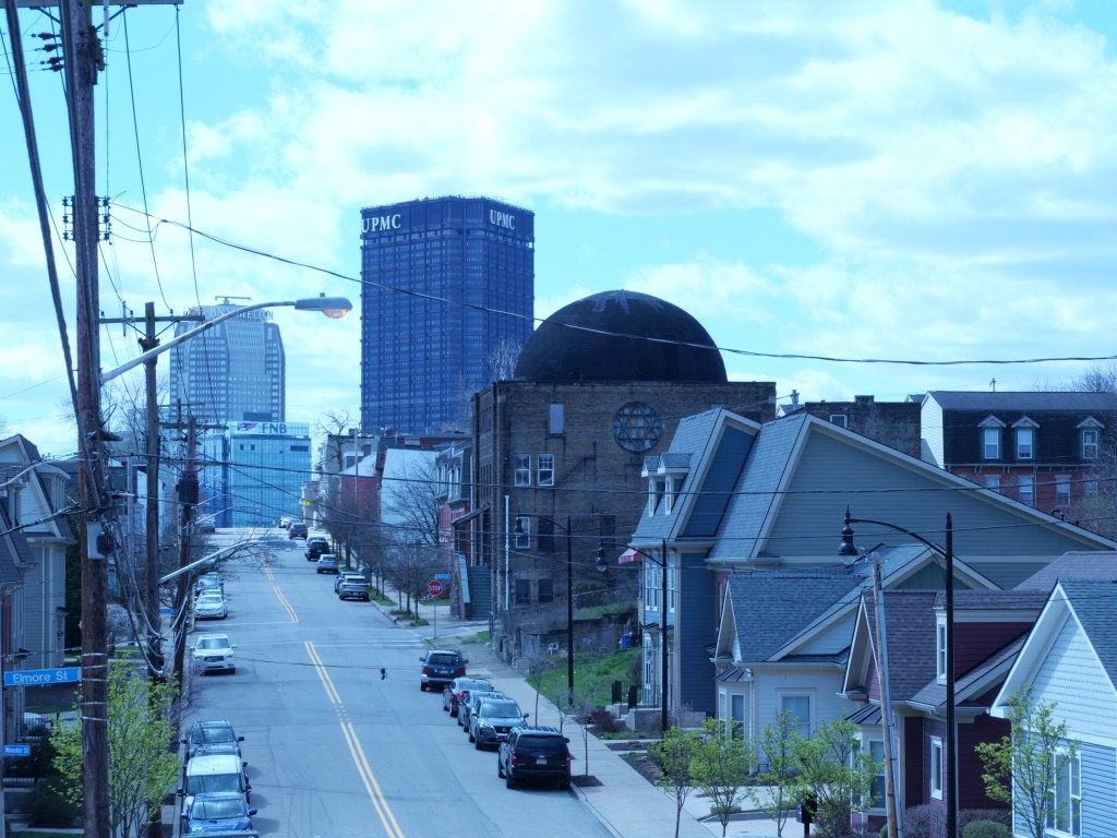
* Decent Dwtn access as Pittston is located btwn Scranton & Wilkes-Barre; 20 min drive to each. But 1 Hr bus ride to Scranton and only 25 mins to Wilkes-Barre.
* Nice recreational trail running along the Susquehanna River on the southern half of Dwtn.
* Pretty good generational diversity as the medium age here is 35 (much lower than the state of PA). Also a good pct of families w/ children.
*Good array of elementary and middle schoos in Pittston and pretty good rating. The high school, however, isn’t walkable to most residents sitting on the edge of town.
* For sale housing is generally pretty affordable but some good medium range options too. 2-beds sell btwn 70K-350K. 3 & 4 beds sell btwn 50K-350K.
* Decent # of affordable rentals provided by the Pittston Housing Authority.
* Great Riverfront park located right next to the main street. Completement by a couple nice medium sized parks and a couple of smaller parklettes dwtn.
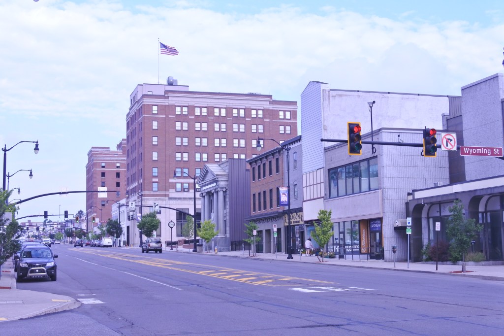
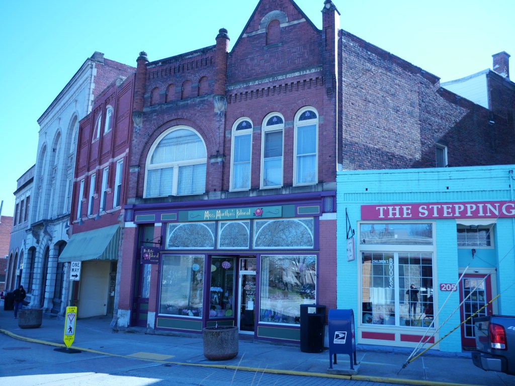
* Highly in-tact and attractive dwtn main street. Several excellent historic churches near the main street as well.
* Excellent urban form in the heart of Dwtn which runs about 5 blocks. Excellent streetscaping project along Main St Dwtn and running to the souther border. Urban form and streetscaping along Main street north of Dwtn is pretty poor.
* Good cultural amenities several restaurants & bars, a distillery, several cafes, a couple art galleries and lots of public street art including an intential sculpture campaign, and several night clubs.
* Also good retail amenities including a couple dollar & drug stores, several boutiques, clothing stores, and gift stores, plenty of banks, a dwtn public library & post office, a music store, a couple dessert shops, a YMCA and a couple gyms, several churches and a couple doctor’s offices.
URBAN WEAKNESSES:
- Other than the river trail, there is no bike infrastructure here.
- Sidewalk infrastructure is generally good but sometimes missing on the residential streets which almost never have up to date ADA curbs. Core of Main Street is solid.
- So so public transit
- Some economic diversity but poverty is high here, 27%.
- 80% White population but the Hispanic population appears to be growing.
- Crime seems to be higher than average in Pittston and the town has a good amount of grit and blight. But it doesn’t feel unsafe walking the Main Street.
- Decent # of rentals but not much variety as they are all pretty affordable. 1-beds lease around 1K. 2-beds btwn low 1Ks and a handful of 3-beds leasing for a bit more.
- Historic residential housing is pretty gritty thanks to the working class styling.
- Some decent in-fill bldg dwtn but a fair amount of autocentric crud on the southern end of Pittston.”