Oleander-Sunset- an urban district just south of Downtown Bakersfield

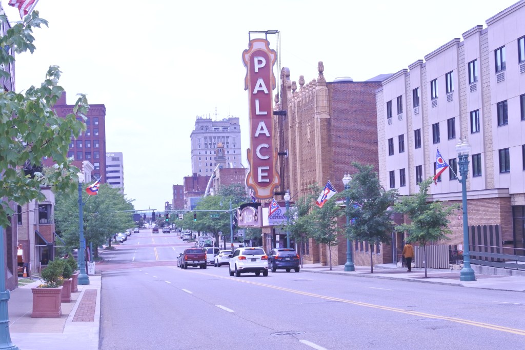
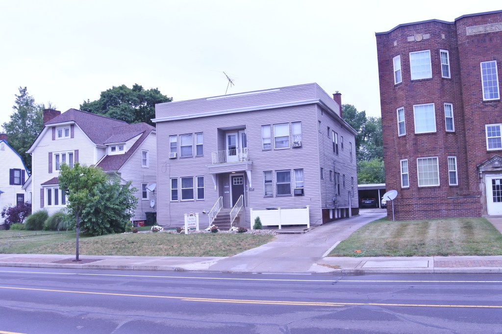
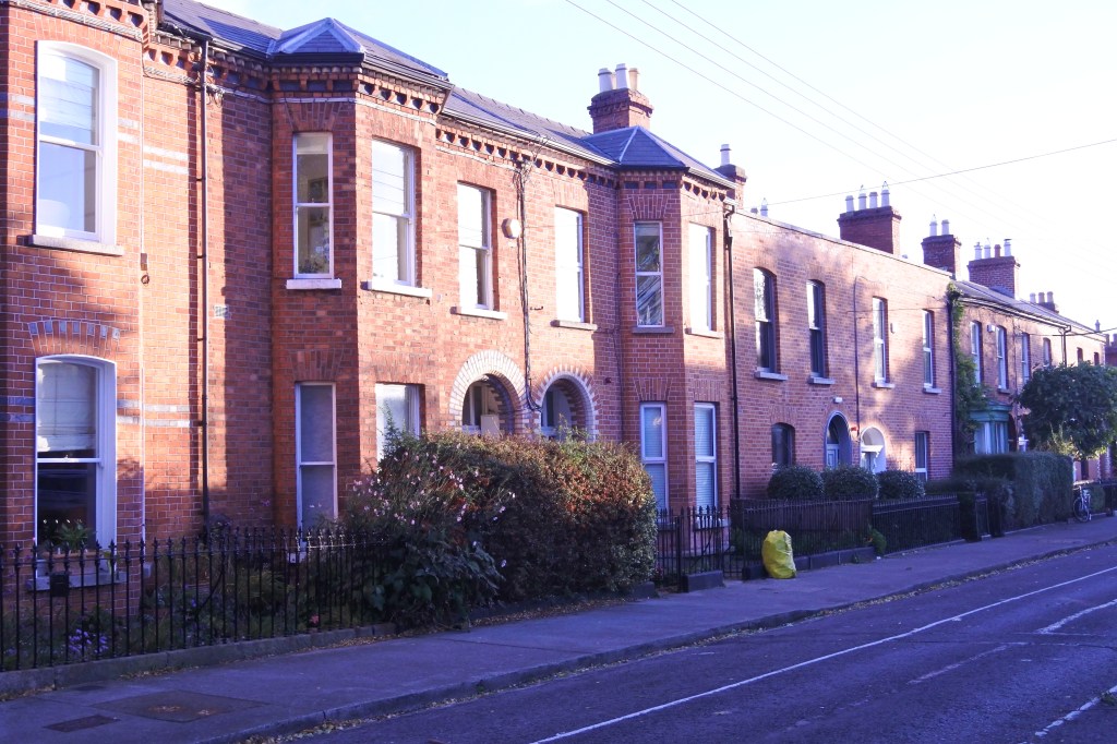
Oleander-Sunset is one of Bakersfield’s most urban, diverse, and eclectic neighborhoods. Homes began to fill in during the late 19th century especially east of A Street. Oleander Avenue contains some of Bakersfield nicest historic mansions and was once the City’s most coveted address. The Eastern half of the district has a higher poverty rates but better urbanity (more dense, access to some walkable commercial, and consistent sidewalks).

Oleander/Sunset has good bones and great access to Downtown Bakersfield with pretty good public transit and bike infrastructure. There is the potential for it to be a quality urban neighborhood but several improvements are needed (i.e. better urban form along Chester & Union, improved sidewalks, quality schools, more walkable amenities, and improved safety outcomes). 

Click here to view my Oleander-Sunset Album on Flickr

URBAN STRENGTHS:

* Excellent access to Dwtn being on the southern edge of the central district.
* Great connectivity thanks to the districts highly gridded street network.
* Several dedicated bike lanes in Oleander.
* Solid income diversity and lots of family households here.
* Sale prices are very reasonable esp. for California. 1-beds sell anywhere btwn 100K-300K. 2-beds btwn 150K-300K and 3 & 4 beds btwn 200K-500K. Some 5-beds sell for more.
* Good # of rentals and pretty affordable. 1-beds lease for around 1K and 2-beds 1K to high 1Ks. Plenty of 3 beds that lease btwn the mid 1Ks-2K.
* Decent parks including a pair a attractive mid-sized parks (i.e. Beale & Lowell Park) and lots of ball fields by the high school.
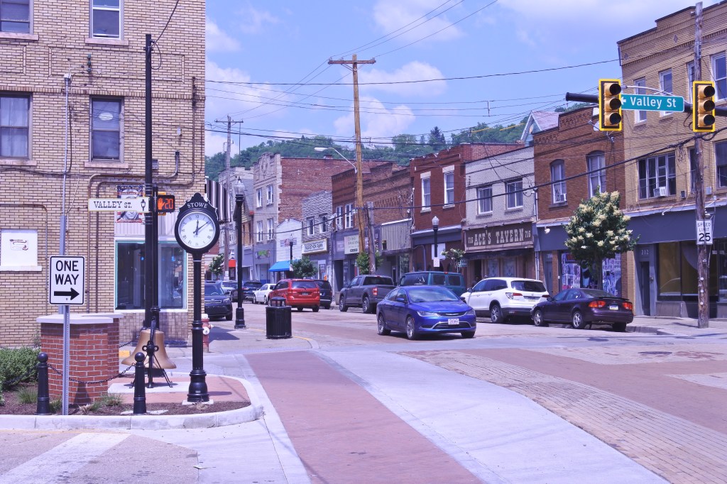
* Decent amenities include lots of small grocerias, a couple drug stores, several boutiques, a bookstore, several dessert joints, plenty of salons & barber shops, several florists, lots of churches, and a couple doctor’s offices.

URBAN WEAKNESSES:

* Sidewalks and ADA curbs are spotty in places
* Okay density.
* Ok transit.
* Residential streets are way to wide.
* Not great diversity as 70% of the neighborhood is Hispanic.
* Several public schools in the neighborhood but poorly rated.
* Moderate level of crime and certainly some blight.
* Tree canopy is spitting and generally better in the western half of the district.
* Some cultural activities including plenty of restaurants, a couple night clubs, and good access to Dwtn amenities.
* Lots of autocentric and uninspiring modern commercial along the main commercial districts (Chester & Union Ave).

Downtown Canton, OH

I loosely define Downtown Canton to be between McKinley to the west, Cherry to east and between north and south 6th Streets. One could argue that the North Market district running from North 6th to 12th street is also part of Downtown as it includes the main library and Canton’s Art Center.

Downtown Canton’s also contains a couple notable subdistricts: 1) The Canton Arts District/Music block centered in the core of Dwtn along Cleveland Street where many 2-4 story historic mixed-use buildings still remain and are filled with retail and food & beverage/theater uses. This is where Canton’s historic building concentration is strongest. 2) The Warehouse District which runs between Market and Cherry Avenues where a scattering of historic warehouse remain standing yet most are underutilized. 3) Saxton Quarter is located south of Tuscarawas St. This is named after the Saxton McKinley House and feels like a marketing attempt to uplift a largely dead part of Downtown. Market Street is the main spine through Dwtn and contains its best architecture and the well designed and active Centennial Plaza. Tuscarawas  is the second main street Dwtn and runs east to west.

All in all for a midsized Midwestern Dwtn, Canton does pretty good thanks to the targeted investment in its core along Cleveland and Market Avenues north of Tuscarawas. Dwtn includes a decent # of local retail, solid cultural amenities, a well designed central plaza and even a semi-pedestrian street along the Court Street alleyway. To move to the next urban level, Canton needs a lot of Dwtn apartments and condos and new development south of Tuscarawas and on its edges to liven these dead areas. Targeted redevelopment of the warehouse district is probably the best place to start.

Click here to view my Dwtn Canton Album on Flickr

URBAN STRENGTHS:

* Good efforts have been made to stabilize dwtn with the focus on the arts, revitalization efforts along Cleveland and Market Avenues, an extensive semi-pedestrian alley along Court Street line with many businesses, and the well designed Centennial Plaza.
* Also decent mixed-use activity along N 6th Street and some along N. 2, 3, 4, and 5th Streets.
* Good cultural offerings including plenty of bars, restaurants, and cafes, a historic theater, several live music venues, many museums and historic sites, and a major cultural arts center.
* Generally good sidewalk and ADA curbs especially in the more invested parts of Dwtn.
* Good historic architecture and much of it is still preserved.
* Decent number of street trees.
* Decent retail amenities but no supermarket.

URBAN WEAKNESSES:

* Lots of dead spaces outside of the core of Dwtn especially the southern half south of Market.
* Tinken Steel’s career Campus on the western edge of Dwtn feels like a suburban community college artificially placed Dwtn.
* Only a handful of rentals and condos Dwtn.
* Only a couple of schools located dwtn and a small Stark County Community College presence.
* So so modern infill

Vassar Park- A Stable Pre-War II Neighborhood on Canton’s Northside

Vassar Park is one of Canton’s more stable and attractive districts with generally stable housing developed between the 1920s-1940s. Some post WWII housing mixed-in making this a newer district than neighboring West Park. Vassar Park also has some retail amenities mixed-in, very affordable housing, a decent amount of rentals, solid racial and economic diversity, and very convenient access to Dwtn.

What Vassar Park needs to be a quality urban district is more parks and retail amenities, improved public transit access, and better ADA infrastructure.

Click here to view my Vassar Park Album on Flickr

URBAN STRENGTHS:

* Housing stock in generally in stock with a mix of modest and larger homes.
* Solid tree cover.
* For sale housing is very affordable ranging from 35K-250K.
* Decent # of rentals and very affordable.
* Solid racial and economic diversity.
* Generally a very family oriented neighborhood.
* Very convenient access to Dwtn Canton, only 1.5 miles away.

URBAN WEAKNESSES:

* ADA curb cuts are limited. Generally good sidewalks.
* Some retail but not supermarket.
* So so public transit access.
* Access to a dedicated bike lane on the southeastern edge but that’s it.
* A handful of schools in Vassar Park and nearby.
* Not much diversity in price point for housing.
* Only a handful of parks although Vassar Park is a very nice centrally located community park.

Canton’s West Park Neighborhood- a relatively intact early 20th century urban district along McKinley Memorial Park

West Park is located between 12th and 30th Street and between Cleveland and McKinley Memorial Park. The district was developed mostly in the early 20th century with a mixture of grand Victorian and Turn-of-the Century houses and elegant apartment buildings along with smaller houses middle class homes. The neighborhood was pretty stable until the 1980s and 1990s when blight and vacancy crept into the district thanks to low real estate prices. Some effort has been made to stabilize the neighborhood and this has prevented widespread abandonment and a mixture of stable and less stable streets. West Park does have some commercial amenities that are pretty walkable along Fulton and Cleveland Avenue but many retail amenities like a supermarket are missing.

To advance West Park to what I would consider a quality urban district it needs more commercial amenities along Fulton & Cleveland, more higher end residential diversity, more stability, and better public transit access. Thankfully since the neighborhood is mostly intact this seems doable. 

Click here to view my West Park Album on Flickr

URBAN STRENGTHS:

* Generally a stable early 20th century middle class district but decent amount of blight mixed in. Very street by street.
* Decent amount of rentals mixed in.
* Generally good tree canopy, but depending on the socioeconomics of your particular street.
* Good sidewalk infrastructure. ADA curbs are good along the main streets but hit or miss on the residential streets.
* Several schools in the neighborhood but mixed ratings.
* For sale housing is very affordable ranging from 50K-250.
* Decent number of rentals and generally very affordable.
* Good racial diversity.
* Excellent access to Dwtn only 1 mile away.
* Decent access to two dedicated bike lanes.
* Great park access with McKinley Memorial park running down its western border and lots of neighborhood parks.

URBAN WEAKNESSES:

* Some retail along Fulton and more so Cleveland but missing a lot of important neighborhood services starting with a supermarket.
* Cleveland Ave is generally ugly and rather autocentric.
* About 1/3 of the West Park neighborhood lives in poverty and medium of income at 30K.
* Public transit access is so . 

The Ridgewood Historic District- Canton, Ohio’s Premiere Residential Neighborhood

Ridgewood  consists of well preserved American Revival Mansions built mostly from the 1920s -1940s. Its homes are architect-designed for the most part and demonstrate the enormous variations of shape, skin, and sensibility that characterize the European Revival styles favored in this period.  The district also boasts of a highly aestetically pleasing envrionment with large shade trees, original brick streets, and locally produced street lighting standards. Due to its historic architectural significance, the Ridgewood was added to the U.S. National Register of Historic Places in 1982 and has remained one of Canton’s most stable communities.

From an urbanist standpoint Ridgewood is really a suburban-urban hybrid. Yes it has consistent sidewalks, mature trees, and some public transit access. But most trips needs to be made by car as the nearest commercial district is rather amenity poor and not a plesant walk. Bike infrastructure is non-existant and rental housing options are limited.

Click here to view my Ridgewood Album on Flickr

URBAN STRENGTHS:

* Canton’s premiere pre WWII mansion district.
* Excellent tree canopy and brick streets. Beautif aesthetic.
* Good sidewalk infrasturcture.
* These mansions are a great value with most costs between 250K-400K. These homes would costs close a 1 M in the equivalent Cleveland neighborhood.
* Very convenient access to Dwtn Canton only 2 miles away. A 7 minute drive and 15 minute bus ride. 

URBAN WEAKNESSES:

* Curbcuts exist but ADA ramp are not up to modern standards.
* Very little mixed use in the district. The nearest commercial district is 0.7 miles away on Cleveland Ave, a pretty sad semi-autocentric commercial district.
* Transit access is pretty limited.
* No dedicated bike infrastructure.
* Rentals are limited but some product availabe on the edges of the district.
* Few walkable schools in the area.

Somerset, PA- On the edge of the Laurel Highlands

In this review I included only the cohesive pre-WII part of Somerset. This account for about 60% of the Borough boundaries. Grand houses are concentrated along Main Street west and east of the center city.

Somerset is one of Western PA’s oldest communities and was a central stage for the Whiskey Rebellion of 1794. The Borough grew quickly in its early days reaching 500 by 1810, 1,000 by 1860, and 2,000 by 1900. Population peaked at 6,700 in 2000 thanks to the Borough incorporating much of the new suburban development.  Yet Somerset has lost population since due to an aging population and lack of immigrant. It now has just under 6K residents.

Downtown Somerset is centered at the cross roads of Main and Center Streets  but mixed use fabric expands a couple blocks from here. Somerset also hosts the county seat, which has likely kept the Borough from declining further. Grand homes line Main Street, both west and east of Downtown. Residential stock off of Main Street is more working class. and uninspiring. Much of the urban fabric in Downtown has been preserved but the commercial streets have become increasing auto centric a couple blocks from the cross roads of Main and Center Streets, especially at the interchange.

Somerset still has a decent amount of local retail, good connectivity, decent schools, inexpensive housing, and is a generally safe community. But nothing reality inspires me about Somerset from an urban point of view. Many of its downtown storefronts are vacant or underutilized, there are not bike paths, public transit is limited, parks are few, and there is really no new development occurring other than strip malls by the interchange. The community could really use a boast from immigration it help it stabilize its population and increase racial diversity.

Click here to view my Somerset Album on Flickr

URBAN STRENGTHS:

* Generally solid street connectivity.
* Consistant sidewalk infrastructure throughout Somerset but ADA curb cuts can mostly concentrated dwtn and along Main Street.
* Decent economic diversity. Decent # of households with children but Somerset like most older PA towns is aging overall.
* Good schools here but only the Catholic elementary and public high school are within walking distance of the center of Somerset.
* For sale housing is generally inexpensive but some diversity. Only a handful of 1-beds that sell for around 100K, 2-beds sell btwn 50K-150, 3 & 4 beds sell btwn 75K=350K but a handful of homes around 500K.
* Somerset is generally safe with not too much crime north is blight widespread.
* Pretty good retail amenities including a couple groceries (Giant Eagle on the outskirts), several drug stores and family dollars, a couple boutiques/gift stores, a hardware store, several clothing and consignment stores, many banks, several boutiques, several dessert joints , a couple gyms, lots of doctor offices and churches, a public library and local post office.
* Decent historic architecture esp. along Main Street and dwtn.
* Decent Tree canopy here.

URBAN WEAKNESSES:

* Poor Density for an urban area.
* Public transit is very limited here.
* Poor access to Dwtn Pittsburgh and job centers. Over a 1 hour drive.
* limited racial diversity, this a very White community.
* No bike infrastructure to speak of.
* Very few rentals listed on the open market. What is available is affordable.
* Many of Somerset’s park amenities are located on the outskirts where it isn’t walkable. Within the center city there is a couple of plazas and cemeteries.
* Okay cultural amenities including several restaurants & bars, a couple cafes & art galleries, the Guild of American Paper cutters Museum.
* Very little in fill to speak of except crummy commercial infill near the highway interchange.
* Good urban massing in the core of Dwtn Somerset but becomes more autocentric as the Center Ave and Pa-31 leave town especially near the highway interchange.

Stowe Township, a rare urban township on Pittsburgh’s Westside

I only evaluated the portion of Stowe Township between Benwood Ave/McCoy Rd town to the Twp’s southern border mostly abutting McKees Rocks.

Stowe Township is a rarity as it is one of the few Townships in Pennsylvania with a historic main street and extensive pre WWII residential areas. The historic part of Stowe is very tied to the fate of McKees Rock its neighbor to the east and south. Both municipalities share a school district and the blight of McKees Rock has certainly spread to Stowe Township. But Stowe is more intact and has lost less population. Its business district along Broadway is surprisingly still in tact and hosts a good array of restaurants, bars and even a Historic Movie Theater and Brewery.  The Business District along Broadway got a major facelift in 1983 with a comprehensive streetscaping redo but little has changed since.

Stowe Township’s best chance for revitalization and an active Business District is immigration. Already there are signs of this occurring with a new African restaurant and grocery store open along Broadway. Immigration would help fill up the vacant homes and retail spaces before too much vacancy brings the community down and tips the community into a death spiral of blight. Given its convenient access to Dwtn Pittsburgh (12 minutes by car and 20 by bus), I’m hopefully that Stowe Township will stabilize and improve.

Click here to view my Stowe Township Album on Flickr

URBAN STRENGTHS:

* Solid urban density. 
* Great access to Dwtn as it is a 12 min drive and 20 minute bus ride. The frequency of service, however, is so so.
* Generally good connectivity with a strong street grid but this gets broken up at times with the hills and hollers.
* Decent racial diversity with a large Black population of about 20% -30% of the population.
* Good amount of families here.
* Decent cultural amenities including a brewery, several restaurants, a local movie theater, and a handful of bars.
* Historic Commercial District is relatively in tact. Gets a bit spotty along Broadway closer to McKeesport.
* Streetscaping was redone in the early 80s. Feels dated but still largely holding up.

URBAN WEAKNESSES:

* Decent sidewalk coverage but ADA ramps are pretty spotty. Some newer or hiller streets without sidewalks.
* No bike infrastructure to speak of.
* Economically Stowe is mostly low-moderate income. It has a very working class feel.
* Schools are limited to  a poorly rated public high school and a Catholic grad school.
 * Not a lot of housing diversity and housing is very affordable. A handful of 1-beds that sell around 70K. 2-beds sell anywhere btwn 50K-150. 3 & 4 beds sell btwn 70K-200K.
* Parks are limited to Norwood Park (a small park with a playground and ballcourt) and a Jewish cemetery just over the line in McKees Rocks.
* Tree canopy is limited in most of the evaluation area but lots of trees on the edges on the hillsides.
* Missing important retail amenities such as supermarkets, drug stores, banks,  boutiques, a public library & post office, and any medical offices. Retail amenities that do exist include a bakery, a couple clothing stores and gift stores, a couple salons and several churches.
* Historic Commercial Architecture is ok but historic residential while plentiful is pretty low quality.
* Modern in-fill largely doesn’t existing in Stowe.

North City Centre- Home to Dublin’s Bustling Shopping District and a Highly Walkable Ecletic Mixed-Use District

The North City Centre likely began seeing major development in the mid-17th Century with the development of the Smithfield Marketplace. The 1700s was a boom for North City as many members of the affluent Protestant Ascendancy class built Georgian flats in the district creating “Georgian Dublin”. The best remaining concentrations of this architecture is located along O’Connell St east to approximately Gariner Street Lower, surrounding Mount Joy Square Park. Even a pocket remains along Henrietta St. The wealthy, however, began to leave the North City in the early 19th century moving to new districts around St. Stephan’s Green and Merrion Square to the south. Many of the regal Georgian flats were converted into poor tenant housing. This trend deepened in the 19th century as Dublin as a whole became more impoverished thanks to the British Unification, which moved Dublin political power to Westminster and led to tariffs and other limits on Dublin’s wool linen trade. North City became even more impoverished and dense in the 19th century with a large influx of potatoes famine refugees from the country side in the mid-century. Even up to this day the North City  is viewed as Dublin’s ‘rough’ and rundown part of town compared to the upscale southeast side.

North City Center is a pretty loose neighborhood name for several subdistricts and loosely defined neighborhoods. The more defined subdistricts include: Smithfield, Liberty Corner, Mountjoy, and Summerhill.  I view the boundaries of North City Center to be Constitution Hill and Dorset Street (N 1) running northeast to the Grand Canal as the northern border, Stoneybatter to the west, and the Docklands/Grand Canal forming the eastern border. North City holds a very eclectic array of architecture styles and time periods ranging from the 1600s to the present day. There is so much texture and variety, great parks and landmarks to the North City that I find it an even more interesting urban district than Center City. Much of North City was redeveloped in the mid century with large school social housing schemes perceived as the answer to this district’s poverty and poorly built housing. Fortunately much of the old city fabric remains and the new and the old mix quite nicely without major scares to the urban fabric. The Smithfield market was completed made over in the 2000s replacing a historic market with a well designed urban plaza and shopping area.

O’Connell Street Lower is the heart of North City, a bustling mixed-use historic blvd/streetcar hosting the massive Spire, Parnell Statue, and the start of Easter Bombing in 1916 with the bombing of the several bldgs on the street. Henry/Earl/Talbout/Mary street is a narrow bustling pedestrian shopping street that cuts through east to west blocks in the North City.  Several pedestrian or semi-pedestrian block streets filled with retail businesses run perpendicular to Henry/Earl/Talbout/Mary street and three large shopping malls all feed into the main pedestrian street. Capel St is a wonderful historic mixed-use street running north to south. Other solid urban biz districts Parnell St, Dorset/Bolton/King, Smithfield St, Middle and Abbey/ Abbey St. Lower.

Click here to view my North City Centre Album and here to view my Smithfield Album on Flickr

URBAN STRENGTHS:

* Great mixed-use fabric throughout most of the North City supplemented by several great urban business districts and pedestrian shopping streets.
* Excellent cultural and retail amenities rivaling and sometimes beating these amenities in the Center City. Tons of restaurants, bars, live music venues, theaters, and several theaters. North City also hosts the best concentration of clothing and department stores centered along or near the Henry/Earl/Talbout/Mary Pedestrian Mall. Three of Dublin’s five city centre shopping centers are located here (i.e. Jervis Centre, the Ilac Shopping Centre / Moore Street Mall, & the Irish Life Shopping Mall).
* Northside hosts Ireland’s largest cinman (i.e. The Cineworld) and the Savoy Cinema one of Ireland’s oldest cinemas.
* Very eclectic and interesting mixed of architectural styles, development periods, and uses mixing in close proximity of each other.
* Very dense population which helps support all the retail districts.
* Great proximity to Center City sitting just south across the Liffey River.
* Great system of bike lanes (often projected) and the City’s best access to streetcar lines with better service than Center city.

URBAN WEAKNESSES:

* North City can be gritty at times and much of the mid-century in-fill is unattractive. Generally mid- century infill still has better urban design than its American counterpart.
* Much of the modern in-fill, while not always aesthetically attractive, is well designed from an urban form and design perspective.

Stoneybatter- a Historic Dublin Thorofare now a Hip and Gentrifying District close to the Center City

Long before Dublin extended much beyond Center City Stoneybatter was nothing more than a country road and served as a great thoroughfare to Dublin from the districts lying west and north-west of the city. The name Stoneybatter is the “English” equivalent of “the road of the stones”. In recent years the neighborhood has experienced pretty intense gentrification thanks to its increase in popularity and proximity to the Center City. It is often referred to as Dublin’s “hipster quarter”.

The northern half of the neighborhood is mostly 1-2 story stripped down worker housing similar to the Liberties district but a slight cut above. New mid-century rowhouses fil the south western quadrant of the district and the couple blocks closest to the river are a hodgepodge of turn of the 18th century, mixed-use fabric and institutional uses like the Collins Barracks, Criminal Courts of Justice, and Croppies Acres Memorial Park. Blackhall Place/Manor St. is an excellent business district  running along its eastern edge filled with many restaurants, bars, live music venues, and trendy shops. Also a decent commercial node along Benburg/Parkgate near the Liffey River. Very nice terrace housing along Circular Rd, which forms Stoneybatter’s eastern boundary.

Overall Stoneybatter is an attractive compact urban district with most retail and cultural amenities within a 10 minute walk. The neighborhood also has decent streetcar access (along its southern border), several dedicated bike lanes fill the main thorofares, and great park access thanks to Dublin’s largest park Phoenix park sitting on Stoneybatter’s western border. Stoneybatter’s biggest urban challenges is poor connectivity in spots thanks to the impenetrable Arbor Hill Cemetery and other likewise institutions, mediocre tree canopy, and middle of the road historic architecture.

Click here to view my Stoneybatter album on my Flickr Page

URBAN STRENGTHS:

* Generally pretty compact development and good walkable access to solid retail and food & beverage amenities and several museums (Arbor Hill Cemetery, Collins Barrack, Nat. Museum of Ireland Decorative Art, and several others).
* Dedicated bike lanes surround the district along the main thoroughfares.
* Great park amenities thanks to the Arbor Hill Cemetery, Croppies Acre Memorial Park, O’ Devany Gardens, and Dublin’s largest park (Phoenix Park) on its western border.
* Access to one streetcar line on the Stoney batter’s southern border.
* Good access to Center City but about a 20-30 minute walk. The Liberties and North City are adjacent to Stoneybatter, which are great neighborhoods themselves.
* Much less tourism here than the Center City. Most tourist in the district don’t venture beyond the Collins Barrack.

URBAN WEAKNESSES:

* Connectivity isn’t great especially with the impenetrable Arbor Hill Cemetery boundaries and the newer development in the SW part of the district.
* Limited urban infill.
* Some nice historic terraces along the Circular Rd (the western border) but most architecture is more stripped down late 19th century housing.
* Tree canopy isn’t great.

Portobello- Historic 19th century district home to many Middle Class Families and Dublin’s largest Jewish Communit

Portobello came into existence as a small suburb south of the City in the 18th century, centered on Richmond Street (R 114). During the 19th century Portobello was filled in with development transforming an area of private estates and farmland into solid Victorian red-bricked living quarters for the middle classes on the larger streets, and terraced housing generally closer to the canal for the working classes. The vast majority of development came in the  latter half of the 19th century. Portobello became the perfect transition neighborhood of the working class poor living in “the Liberties” to the west and the regal well off Georgian district to the east. Many mobile middle class families historically settled here. Portobello also became a major Ashkenazi Jewish community, fleeing widespread violence against Jews in Russia and Eastern Europe. This led to Portobello being known as Dublin’s “Little Jerusalem”.

Portobello is one of my favorite Dublin neighborhoods as it hosts a very comfortable and walkable urban district on the edge of the Center City. The architecture is an attractive mix of more regal upper middle class housing and worker rowhouses with just enough ornamentation to make them attractive. The R137 and Richmond Street commercial districts sandwich the neighborhood on the western and eastern sides providing excelling retail and cultural amenities (i.e. restaurants, bars, and live music). Portobello is also a 10-20 minute walk from most sites in the Center City but removed enough to not be overrun by tourists. Not much to complain about here from an urban perspective. The district has better tree canopy than most inner city Portobello districts and hosts a nice canal front walking path along the Grand Canal. The district could use more park and plazas spaces but not sure where they could squeeze this in as the neighborhood is very compact.

Click here to view my Portobello album on my Flickr page

URBAN STRENGTHS:

* Very well preserved historic stock mixing in more ornate with mostly stripped done rowhouses but with some minor ornamentation.
* Served by two vibrant commercial districts on the western and eastern edges ( R 137 and Richmond St),. Richmond Street (R 114) has excellent historic commercial architecture.
* Good tree canopy for Dublin standards and much better than the neighboring Liberties District.
* Excellent retail and solid cultural amenities, especially restaurants, bars, and live music. Very close to all the cultural amenities in Center City as it surrounds Portobello on two sides.
* District isn’t swarming with tourists.
* Urban modern in-fill, while limited is of a good quality.
* Good bike lanes network and close to a street ca line.

URBAN WEAKNESSES:

* Park space is limited to two  small squares and the recreational trail along the Grand Canal.