“The Liberties”- Dublin’s Historically Revolutionary Neighborhood and Home of the Guinness Blockhouse.

The name “Liberties” derives from jurisdictions dating from the arrival of the Anglo-Normans in the 12th century. They were lands united to the Dublin, but still preserving various rights and directly rule. This autonomy lasted all the way to 1840.  Settlement in mass started In the late 1600s where French Huguenots weavers settled. The neighborhood was actually pretty prosperous for a time but this came to a halt thanks to the neighborhood’s strong participation in the Irish rebellions of 1798 and 1803 and the ensuing Act of Union, which let to major tariffs on any silk products produced in the Liberties. From this time on, the fate of the Liberties was sealed and the district quickly became poverty-stricken with many urban ills. But the Liberties continued to be a hot bed of revolutionary activity.

Many parts of the Liberties have been torn down and redeveloped as part of mid-century slum clearance efforts by the government. But much of  the neighborhood remains in tact helping one imagine the working class grid that underpinned the district. But for the most part the Liberties is no longer a neighborhood for the destitute but has actually seen quite a lot of revitalization and even recent in-fill development. Many new crafting distilling and breweries companies have opened building on the neighborhood’s rich history with the Guinness Blockhouse. 

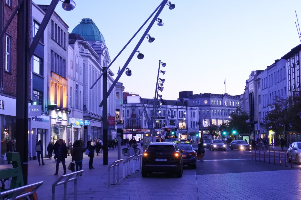
The Liberties also supports a pretty high level of urbanity with compact rowhouse development mixing with many mixed-use streets. Urban commercial districts in the Liberties include , R110, Meath St, Francis St,  R 137, and R 810 running along the entire length of the north edge of the district serving as the main route for Guinness visitors traveling to the Center City. The district also boosts one of Dublin’s longest running markets (Liberty Market), which feels more like a large flee market.  I’d certainly like to see more greenery and trees in the district but not sure where they would good. Same issue with inserting a quality waterfront park, the space simply doesn’t exist without a major redesign of the river.

Click here to view my Liberties album on Flickr

URBAN STRENGTHS:

* Highly walkable compact urban fabric.
* Excellent business district running across the Northern edge of the district on route R 810. Wonderful historic bldgs and eclectic businesses here.  Several other business districts as well, especially on the edge touching Center City.
* Lots of solid urban infill especially at the north and southern boundaries of the neighborhood and along the R110 business district.
* Thanks to all this mixed-use fabric, excellent retail and cultural amenities throughout the district, especially the eastern half.
* Great access to the Center City.
* With the exception of the Guinness Tours, not a neighborhood crawling with tourist.
* Good access to a rail line and solid bike infrastructure.

URBAN WEAKNESSES:

* Definitively one of Dublin’s gritter districts given its historic working class and slum history. But the neighborhood has received significant investment over the past several decades and by most measures is a good place to reside.
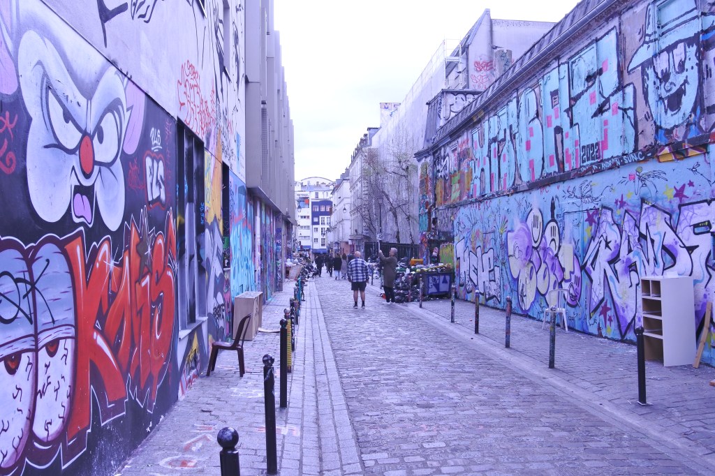
* Historic architecture is general plain and unadorned but at times interesting (especially the 1-2 story wide but shallow rowhouses).
* Very few trees
* Park space a bit limited but seems to be getting better with Bridgefoot Street Park. No real waterfront park or rec trail along the Liffey. Just a sidewalk.
* Some industrial uses still exist along the river.

Center City Dublin

Center City is really characterized by three separate subdistricts: Temple Bar running along the Liffey River, Georgian Dublin south of Trinity College spreading south and east to the canals, Trinity College, and the more “unlabeled” part of Center City between Temple Bar and Portobello.

Temple Bar is characterized by excellent narrow streets running between the river and R 137, an excellent mixed-use historic street. Temple Bar is the most touristy part of Dublin filled with bars, restaurants, live music and plenty of tourist traps. But it is quiet charming with its coble stone streets and 18th century and 19th century buildings.

Georgian Dublin:  This occupies a large part of Central Dublin extending south from Trinity College all the way south and east to the canal and westward to Aungier St. The district contains some of the best urban fabric of all of Dublin with consistent 3-5 story early 19th century flat Georgian architecture. The premiere park in the district is Stephen’s Square. But there are several other lovely squares (i.e. Merrion Square Park, Fitzwilliam Sq, Wilton Park, and Iveagh Gardens).  The most regal Georgian flats surround the squares or are along Harcourt St. Several excellent business districts cut through the district including Leeson Street Lower, Bagget Street Lower, Camden Street, R138, Pembrooke St, and Dawson St.

Trinity College/Center City: Trinity College is located just east of Temple Bar and is a gorgeous campus with many historic gothic buildings from the late 18th to 19th century.  North of here is a non-descript district mixing historic Georgian architecture and a lot of mixed-use in-fill spilling over from the Docklands. The area between Temple Bar south to Kevin Street and west to Patrick Street is the core of Center City Dublin. This includes some of the most important Dublin landmarks (i.e. St. Patrick’s Cathedral, Christ Cathedral, Dublin Castle, St. Audoen’s Church, Dublin Linn Garden, George’s Street Arcade, and Stephen Green’s Shopping Centre). The City’s best pedestrian mall/shopping district is also here along Kings Street/Clarendon Row/Grafton St/Wicklow Street. William/St. Andrea’s Street is a wonderful semi-pedestrian street nearby. R 137 is a solid business district that forms the Center City’s northern and western border with Temple Bar and the Liberties, respectively. Augier St is a wonderful business district with tons of gorgeous mixed-use architecture running north-south through the district and hosting George’s Arcade.

Click to the right to view several of my Center City Dublin Albums on Flickr: Center City, Temple Bar, and Georgian Dublin

URBAN STRENGTHS:

* Great dedicated bike lane system, many of them being separated.
* Highly walkable, mixed-use fabric with many business districts, landmarks, squares, and pedestrian street with excellent shopping options.
* Excellent cultural amenities including tons of restaurants, bars, numerous art galleries, plenty of museums and historic sites, tons of live music venues in Temple Bar, and several performing art and movie theaters.
* Lot of gorgeous historic architecture especially in the Temple Bar and Georgian subdistricts. Wonderful historic commercial buildings along Kings Street, Clarendon, Grafton, William St, Dame St, and Augier St.
* Several excellent urban plazas and squares.

URBAN WEAKNESSES:

* Fair amount of ugly post WWII buildings in Center City between Temple Bar and Portobello.
* Tree Canopy is limited to the squares and plazas.
* Connectivity and imaginability are a bit challenging with all the winding and dead-end streets.
* Disappointing access to the river in Center City. Just a simple sidewalk runs along the riverside.

Dublin’s East Wall District, a Traditionally Blue-Collar Neighborhood on the Edge of the Historic Dublin Port

East Wall was built on reclaimed ground starting in the mid-late 19th Century district. Mostly blue collar housing was built due to the neighborhood’s close proximity to the Dublin Port.  In the economic boom years starting in the late 1990s onwards, the area developed rapidly, with the notable addition of the East Point Business Park on reclaimed land extending East Wall northwards. The district has also seen a lot of new apartments and mixed-use development primarily along East Wall Rd and East Rd leading to a population increase. Estimates say there are about 5,000 people living in the East Wall neighborhood.

East Wall has solid urban fabric with lots of medium density rowhouse streets and Mixed-Use Development mixed-in. While being only a 20-30 minute walk to the Docklands/Center City it still feels isolated given all the railroads and industrial development along its perimeter. Some retail amenities exist here but certainly room for improvement. Cultural amenities are limited to restaurants and bars.

Click here to view my East Wall Neighborhood on my Flickr Page

URBAN STRENGTHS:

* Convenient access to Center City. Walkable to the Docklands District.
* Solid rowhouse urban fabric with medium density.
* Tight community. Seems to be many long time families living here.
* Lots of new mixed-use development occurring in the district

URBAN WEAKNESSES:

* Nothing special about the architecture. Rowhouse are traditional working class and pretty plain.
* Some retail amenities (mostly concentrated on East Wall Rd) but not a ton. More mixed-use Development is coming to East Wall Rd so that could help bring more retail.
* Lots of industrial remanence and rail lines along the edges of the district. This also disconnects East Wall from surrounding neighborhoods and limits connecting paths.
* Connectivity is so so.
* Ok tree canopy.

Dublin’s Docklands Neighborhood- the City’s International Finance Centre set in a Quality Urban Environment

The Docklands/North Wall started to take shape in the 1990s and has continued to grow and expand since.  The Docklands is a revitalization of Dublin’s historic port and has become the City’s premiere business hub and International Financial Services Centre. I like the urban and public realm design of the South Strand are better than the North Wall district. Developers seem to have built the North Wall with limited thought to the pedestrian experience and creating quality public places. The Docklands neighborhood in general has done a good job creating quality waterfront trails and recreational spaces on both sides of the Liffey along the Hanover Quay and canals. The Roya Canal Linear Park is the best designed public park.

The Docklands also hosts many neighborhood amenities including  several grocery stores & drugstores and other essential stores. Plenty of entertainment options here as well (i.e. theaters, live music, cineplex, bars, restaurants, and nightclubs). Docklands, however, lacks the boutique stores more common in the Center City and hosts few museums or art galleries. This is a place designed well for the young professional and perhaps some empty nesters looking to feel young but certainly not a very family friendly neighborhood.

Click here to view my Docklands Album on Flickr

URBAN STRENGTHS:

* Great waterfront parks and recreational trails here along Liffey, Hanover Quay and the canal).
* Decent public plaza space (i.e. Royal Canal Linear Park, Pearse Square, Elizabeth O’Farrell Park, Central Square).
* Some of the cities most cutting edge modern architecture is located here. Also some stunning bridges crossing the Liffey.
* Infill generally is designed to a high urban form.
* Excellent dedicated bike lanes along the waterfront and on the bridges.
* Comfortable pedestrian environment with wide sidewalks and well designed streetscaping. Also well served by two streetcar lines.
* Solid retail amenities including plenty of groceries, drug stores, banks and other basic neighborhood amenities.
* Several theaters, a cineplex and plenty of restaurants and bars. Also several live music venues as well.
* Hosts the Dublin Convention Center.

URBAN WEAKNESSES:

* Almost all of the historic docklands fabric has been erased. What does remain is in the western edge of the district but this is quickly be replaced.
* Some of the earlier in-fill (90s and 2000s) is rather bland.
* Tree canopy is a bit limited.
* Lacks boutiques, bookstores, clothing stores, and gift shops. Those are located further west in the Center City.
* Really no museums or art galleries here.

Center Cork, Ireland

Centered City is located in the middle of the River Lee and is the location of the City’s original trading post settlement. Centre City really is a delight with many comfortable pedestrian streets lined with shops, restaurants, and bars, extensive mixed-use fabric and several great landmarks and gathering places. The most vibrant part of Centre City is between S Mall and Saint Patrick Street where Oliver Plunket bisects. Oliver Plunket St is the longest pedestrian street that cuts through the Heart of Centre City. Several narrow streets run perpendicular to Oliver Plunket St and are at least partially pedestrian. Saint Patrick Street/Grand Parade hold excellent retail amenities, wide, plaza wide sidewalks and the excellent English Market and Bishop Lucey Park.  Cornmarket Centre Shopping Mall is another great hub surrounded with lots of shops and the activity Main Street business St a block away.

Its hard for a mid-city to beat Center City from an urbanist perspective but there are some areas where it can improve including better tree canopy, more park and plaza space, and more recreational space along the riverfront. This is a very tight and built up Center City, so creating new park spaces is a challenge but they did find a way to install a great separate bike lane system in Center City. One would think they could find a way to add more parks and plazas.

Click here to view my Center City Cork Album on Flickr

URBAN STRENGTHS:

* Excellent historic architecture throughout
* Very vibrant and mixed-use. Center City packs in a lot!
* Great shopping options still in Center City especially along St. Patrick St. & Grand Parade. Wonderful wide sidewalk and new streetscaping along these streets as well.
* English Market is a top notch historic market supported by many businesses.
* Extensive pedestrian street running down Oliver Plunket St (car free at least most of the time). Many pedestrian or limited traffic roads running perpendicular to Oliver street connecting to St Patrick St to the north and less so to S Mall to the south. Maylor St is prob the 2nd longest mostly pedestrian St. and hosts many shops.
* Also nice Commercial districts along Washington, Sheares St., Main St., S Mall, and Cornmarket St which hosts the Cornmarket Centre shopping Mall.
* Several well planned and designed separated bike lanes. Impressed they could create these considering how limited roadway space is in the Center City.
* Several wonderful historic churches dwtn (i.e. St. Augustine’s, St. Peter & Paul’s, St. Francis, Holy Trinity.
* Excellent cultural amenities including tons of bars & restaurants, a movie theater, tons of performing arts theaters, and many live music venues.

URBAN WEAKNESSES:

* While Center City bike lane network is great it doesn’t connect well to the inner City neighborhoods and Cork as a whole.
* Limited tree canopy Dwtn.
* No real park space or recreational trail along the waterfronts.
* Limited Park and plaza space in Center City.

Center City Rouen, France

The urban quality of Center City Rouen is as good as any American neighborhood/downtown hosting a very walkable mixed-use environment with lots of historic landmarks and destinations.. Rouen also preserves an incredible number of half-timber structures, probably one of the highest concentrations in all of France. It somehow managed to save much of its historic fabric even after extensive bombing during WWII. And what had to be rebuilt during the mid 20th century is still great urban form. The most notable landmark is the Rouen Cathedral, which also miraculously survived the bombing. The Cathedral’s gothic façade (completed in the 16th century) was made famous in a series paintings by Claude Monet. One these paintings is housed in the Rouen Museum of Fine Arts only a 1/4 mile from the cathedral.  This landmark is joined by several other notable churches that mark the skyline  (i.e. St. Maclou Catholic Church, Saint-Ouen Abbey Church, and  Hôtel de ville de Rouen).  Other famous sites in Center City including The Gros Horloge (an astronomical clock dating back to the 14th century) and the St Joan of Arc modernist church where Joan of Arc was burned at the sake.

Center City flows very nicely comprised of several well designed plazas, markets, squares, theaters, and landmarks all located with a 1/4 of mile of each other. This is exactly the type of urban environment that urbanist Jane Jacobs loved. Plenty of pedestrian streets or low traffic alleyways also fill Center City creating a very comfortable walkable environment. Center City also hosts a great array of retail and nightlife amenities all well connected by a couple light rail lines and a subway. One area in which Center City could see improvement is cleaning up its waterfront along the Seine. The area is choked by roadways and an abandonded rail line that should be converted into a recreational path. Tree canopy is also lacking here.

Click here to view my Rouen, France album on Flickr

URBAN STRENGTHS:

* Some incredible landmarks including the Cathedral of Rouen, St. Maclou Catholic Church, Saint-Ouen Abbey Church, Hôtel de ville de Rouen, Le Gros-Horloge, Rouen Museum of Fine Arts, Donjon de Rouen
 Castle, St Joan of Arc’s Church and countless half-timber buildings.
* Lots of pedestrians ways, most notably the Rue du Gros Horloge
* Great historic architecture even with the bombing. Incredible what was able to be saved. Modern mid-century infill built after the war is generally quality urban form. Most architecture spans from the  16th-20th centuries. Lots of variety.
* Several nice plazas including Marche Saint Marc, Parc del’Hôtel-de-Ville Garden, Fontaine Sainte Marie, Place de Vieux Marche, Square Verdrel
* Extensive compact mixed-use area in Center City.
* A gentle rise on the northern edge of Center City creating some interesting elevation changes.
* Lots of narrow alleyways creating many interesting passageways and urban spaces.
* Great cultural amenities in Center  including many restaurants, several theaters, a cinema, lots of night clubs & bars, a couple live music venues, and tons of art galleries and museums.
* Good transit access dwtn; a mix of subways and streetcars

URBAN WEAKNESSES:

* Some blander modern architecture on the eastern edge of Center City but still good urban form.
* Tree canopy isn’t great.
* Limited dedicated bike lanes but plenty of low traffic alleyways to transverse.
* Poor waterfront access along the Seine. There is even an abandonded rail line that could easily be converted to a waterfront trail.

Center City Le Mans, Francae

Center City Le Mans would be a great downtown by American standards but for a mid-sized French City its pretty middle of the road. Center City hosts an excellent Old Town District clustered around its La Grande Rue, where dozens of medieval half-timbered houses and grand Renaissance mansions line dense cobblestone medieval streets. This comprises about 1/3 of the Center City in its northwest quadrant.

The Place de la republique is the flat part of Center City centered on Place de la République. This is a lively district with mostly historic 18th & 19th century architecture set on dense mix-use blocks and frequent pedestrian only streets.  I find the eastern half of this district to be the most lively and healthy from an urban perspective with modern office buildings mixed in with historic blocks where lots of attractive small plazas, fountains, and pedestrian streets can be found. Pretty intense mid-century buildings in this area along General de Gaulle and  François Mitterrand but a high quality urban form is still retained even if its pretty ugly from an aesthetic standpoint. The southern edge of Place de la republique is still good urbanity but is more residential in character and hosts some ugly modern buildings with poor urban design. Also some bad surface parking decisions were made here.

Click here to view my Le Mans album on Flickr

URBAN STRENGTHS:

* Excellent half timber district (Old Town) on the bluff center on Grande Rue. Lots of attractive 18th and 19th century architecture in the flat part of Center City. (Republique)
* Beautiful historic Gothic Cathedral (Cathedral of Saint Julian of Le Mans) located in Old Town.
*Place de la republique is a lively plazas hosting regular outdoor markets lots of outdoor seating
* Pretty consistent vibrant mixed-use blocks throughout dwtn. Very walkable and active.
* The two streetcar lines runs through Center City providing dwtn excellent public access to the rest of the City.

URBAN WEAKNESSES:

* Some bad connectivity given the hillsides and medieval nature of the street grid.
* River front park is a bid underwhelming. While there is a nice walkway, lots of surface parking concentrated here. Still some cool park spaces running along ancient walls going up to the Old Town district.
* ADA infrastructure is spotty especially in the Old Town District.
* Filled a plaza (Rue d’Alger) with surface parking. A very American thing to do!
* The southern edge of Center City can be pretty gritty with some poor urban design decisions.

Ft. Myers Beach, FL

I included the most urban portion of Ft. Myers Beach from the northern tip, southwards to Connecticut Avenue. This evaluation occurred after Hurricane Ian severely damaged the City. My approach to the evaluation is to assume the City will be rebuilt in more or less the urban form it was in pre-hurricane. Given Florida’s rapid post hurricane recovery this seems to be largely accurate although many of the low lying single family homes will likely be replaced with larger/more expensive single family homes on stilts or large apartment bldgs more resilient to hurricanes.

Present day Ft. Myers Beach was first settled by people of European decent in the mid 1700s by Cuban fishermen. The Homestead Act of 1862 brought American settlements to Estero Island. The island remained sparsely populated until 1911 when developer William Case built the first subdivision and cottage rental industry. Development on Ft. Myers Beach (then called Crescent Beach) was slow until the 1920s as Florida gained national attention as a vacation destination. The land boom ended with the hurricanes of 1921 and 1926 that challenged the paradise appeal of southwest Florida. But development slowly increased and by the 1950s, Crescent Beach began to boom and modernize. By 1960 Crescent Beach hosted 2,500 residents and its population peaked at 9,000 in 1990. Crescent City officially changed its name to Ft. Myers Beach in 1995 Since then the City has actually lost full-time residents shifting to snowbirds and tourist. The City now hosts just under 6,000 souls.

Old San Carlos is the main commercial street, which hosts decent urban form and walkability but still plenty of surface parking lots along it. Estero is the main beachside Thorofare through Ft. Myers and is most urban where it intersects with Old San Carlos and here is a block long pedestrian street a block from the beachfront. The further south down Estero the urban fabric  becomes less and less urban and mixed-use but still hosts sidewalks, ADA curbs, and some restaurants bars sprinkled in. 

Click here to view my Ft. Myers Beach album on Flickr.

URBAN STRENGTHS:

* Decent grid but lots of dead end streets due to the skinny nature of the island and also plenty of cul-de-sacs.
* Dedicated bike path along most of Estero Blvd provide a good bike connection to post of Ft. Myers Beach included in this evaluation.
* Lots for sale product available including plenty of 1-bed condos that range anywhere from 200K-850K. Wide range of prices of 2-beds starting at 200K to 2 M with some product even more expensive. 3 & 4 beds sell anywhere between 400K- around 3 M with some mansions costing even more.
* Quality park space including a public Beach running along the entire Gulf coast, an expansive nature preserve, the quality Bodwitch point park at the top of the island, and an expansive ballfield park.
* Decent cultural amenities including lots of bars & restaurants, a couple cafes, night clubs, a local theater, a couple art galleries, lots of places that host live music, and a local art center.
* Ok retail amenities. The supermarket is several blocks south of this evaluation area, plenty of gift shops, souvenir stores, and boutiques. Also a couple banks, lots of dessert joints, a couple gyms, a local public library & post office, and a couple churches.
* A very safe community.
* Decent street scaping.
* Good tree canopy but this has been significantly reduced since Hurricane Ian.

URBAN WEAKNESSES:

* Very low density for an urban area.
* Pretty poor public transit access.
* ADA curbs and sidewalks really along exist along Old San Carlos and Estero Blvd. Side streets generally don’t have sidewalks.
* Poor diversity ratings across all measures. This is a very white, elderly (median age is 68), and generous prosperous community.
* Only one school in Ft. Myers beach, a well rated elementary school of only 100 students.
* 30 minute drive to dwtn Ft. Myers and no viable public transit option. Important to keep in mind that there are a lot of service industry jobs in Ft. Myers Beach.
* Very limited rental product and what does exist is mostly 2 & 3 bedrooms.
* Missing a lot of retail amenities including a drug store,.
* Historic architecture is limited especially after Hurricane Ian. Modern architecture isn’t very impressive either. Generally cheap with semi-urban design.
* Plenty of surface parking lots and strip malls.

The 20th Arrondissement: Home to Paris’s most Historically Radical Neighborhood (Belleville)

The 20th Arrondissement is generally conceived as Paris’ most radical and working class arrondissement. In many ways this is true but the 20th Arrondissement is much more than that as it also hosts many middle class districts. Les Amandiers/Menilmontant and Belleville are the stereotypical working class and historically radical neighborhoods within the 20th Arrondissement.  By the 1830s Menilmontant and Belleville were already urbanized, heavily working-class, and socialist. The districts played a major role in the Paris Commune of 1871 and was the most difficult area for the Versailles Army to reconquer Paris in May of 1871. By the 1950s/1960s  many artists, musicians, students, and hippies moved into the area, giving it a distinctively bohemian, left-wing and counterculture identity. But by this time much of the neighborhood was in disrepair and the City targeted the area for urban renewal. Fortunately Paris’ version of urban renewal was much more targeted and sensible than its counterpart in American. Hillsides were converted to parks and buildings surgically replaced with modernist buildings that still retained a decent urban design. Current day Belleville remains somewhat gritty but is witnessing a significant amount of revitalization. Belleville also hosts Parc de Belleville where one is given some of the best great views of the City. The remaining parts of the 20th Arronissement, which comprise the majority of the district, are middle class areas hosting an eclectic mix of historic and modern architecture with generally quality urbanity.

The 20th Arrondissement hosts several great commercial districts but has limited consistant mixed-use areas as is the case closer to the center of Paris. Major commercial districts in the arrondissement include:  Rue d’Avron,  Rue Saint-Blaise (intimate cobble stone street), Rue de Bagnolet, Av. Gambetta/Rue Belgrand, Rue des Pyrénées, Rue de Belleville, Rue de Ménilmontant, Bd de Belleville.

Click here to view my 20th Arrondissement Album on Flickr

URBAN STRENGTHS:

* Solid density at around 83K per square mile.
* Hosts the infamous Père Lachaise Cemetery where many famous people are buried (i.e. Edith Piaf, Jim Morrison, Chopin, Oscar Wild) and countless Parisian families.
* Largest immigrant populations here.
* Limited amount of tourism.
* Hosts Parc de Belleville a wonderful hilltop park with great views of the City. Decent # of other small to medium sized parks but less green spaces than most parts of Paris.
* Nice Promenade in the middle of Bd Belleville.
* Quality modern in fill in the eastern and southern parts of the arrondissement.
* Interesting maze of stairways and roadways in the hillier parts of the district.
* Good subway access throughout the district. 

URBAN WEAKNESSES:

* Still lots of grit and some crime in the Menilmontant and Belleville areas but this is changing as the districts are gentrying.
* Tree canopy is lacking in the more historically working class areas.
* The Menilmontant and Belleville areas hosts a large concentration of unattractive mid century buildings. Still better urban form than their counterpart in American but often ugly buildings.

Paris’ 19th Arrondissement- An Authentic Parisian District Mixing Classic Bohemism with New Diverse France

The 19th arrondissement is a great mix of architecture styles and walks of life mixing Old French bohemianism and the new highly diverse Parisian cosmopolitanism. This sector is home to many immigrants especially from North and Sub-Sahara Africa. Generally the south western edge of the district is the oldest populated with a mix of Haussmannian architecture along the Boulevards but also plenty of more plain historic styles common to its neighbor Belleville to the south. As one moves to the north and east thru the neighborhood architecture becomes more and more modern but plenty overall the district is very eclectic architecturally.

Quartier de la Mouzaïa in the eastern central portion of the district is the most affluent and attractive neighborhood of the 19th Arrondissement hosting many semi-private and village esh streets. The Quartier is surrounded by two excellent hilltop parks (i.e. Parc des Buttes-Chaumont and Parc de la Buttee-du-Chapeau-Rouge), which take advantage of the 19th’s hilly terrain. Just north of here is the LaVilette, Paris’ largest cultural park, a treasurer for Parisian families where one can enjoy a host of museums and performing arts venues or simply take a stroll thru the well designed plazas and canal side promenades along the Canal Saint-Denis and Cala de l’Ourcq. Much of the 19th Arrondissement has a strong immigrant/working class presence but it is most pronounced  in the Northwestern sector outlined by the two aforementioned canals. This subdistrict is mostly post WWII construction yet still maintains a high level of urbanity.

The 19th’s main commercial districts include  Av. Jean Jaurès,  Rue de Belleville, Simon Bolivar, Rue Eugène Jumin (a block long pedestrian st surrounded by gorgeous 1910s flats), Av. de Flandre (Pedestrian Promenade in the middle), and Rue de Crimée.

Click here to view my 19th Arrondissement Album on my Flickr Page

URBAN STRENGTHS:

* The 19th Arrondissement is marked by some of Paris’ greatest parks and ones that are off the beaten track of most tourist (i.e. the hilltop parks of Parc des Buttes-Chaumont (designed by Baron Haussmann for the World’s Exposition in the 1860s) and Parc de la Butte-du-Chapeau-Rouge, Le Bassin de la Villette and surrounding canal promenades, and the expansive La Villete filled with numerous museums and arts and cultural amenities, it is Paris’s largest cultural park), and Jardins d’Eole. Plenty of others smaller plazas and parkettes and the lengthy where Canal Saint-Denis and the Canal de l’Ourcq meet creating some wonderful waterfront trails.
* Great diversity here with more middle and upper middle class districts in the southern and eastern quadrants and more immigrant work class areas in the western and northern sectors.
* Solid public transit access.
* Only of Paris’ most hilly districts.
* Nice mix of architecture covering anywhere between the mid 1800s to the present age. Older parts of the district are in the Southwestern portions of the neighborhood.
* Solid urban density at 68K per sq mile pretty average for Paris. Neighborhood is actually at its peak population.
* Low amounts of Tourism here give one a very authentic Parisian experience.

URBAN WEAKNESSES:

* Some churches but much less than other Parisian districts.
* Decent amount of grid in the more working class areas.
* Decent number unattractive modern buildings with not the best urban form.