Downtown Jackson, MS

There are no hard boundaries for Dwtn but my sense is that its western border is the railroad to the west, Court St to the south, Jefferson St to the east, and High/Monument St to the North with a couple additional blocks north of the Statehouse.

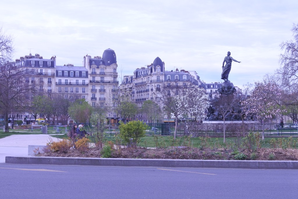
Capitol Street is by far Dwtn Jackson’s best street with decent urban form as a lot of historic buildings remains, great streetscaping and even some business, hotels, and office bldgs. Decent cohesion and sense of place surround State Capitol Building, Smith Park,  and the governor’s Mansion. The block west of here to Lamar street holds a decent array of modern and historic bldgs but not great urban form. Some efforts have been made to revitalize the historic African American Business District (Farish St) evidenced by several blocks of new streetscaping and a handful of renovated businesses. A nice block on State St also sits across from the old Capitol Building.

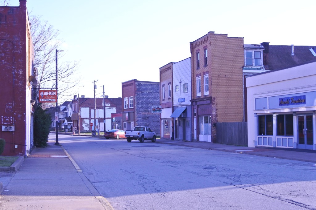
But outside of these aforementioned nodes Downtown Jackson is a mixture of sterile and dead office blocks, parking lots, and blight and vacancy lacking a sense of place and urban cohesion. One particularly poor urban design decision was made at the intersection of Amite and Farish Street where a large mid century parking garage literally dumps two massive car ramps onto where sidewalks should be. Jackson is sadly the worse major American City Downtown I have evaluated to date from an urban perspective. But there is even still hope here. Downtown can continue to invest and urbanize the nodes I mentioned before, especially Capitol Street, where revitalization could spill northward towards the Capitol Building and State Street and eventually westward to Farish Street. There could conceivably be a quality tight Downtown core framed by State, Capitol, Farish and High Streets. But this would require significant amount of political will, intentionality, and investment.

Click here to view my Dwtn Jackson Album on Flickr

URBAN STRENGTHS:

* Dwtn’s Street Connectivity is pretty decent with a good grid and few very wide 1-way streets. The Innerbelt is set pretty far to the east and south of Dwtn and didn’t result in major Dwtn urban renewal. The wide Court St blvd on Dwtn’s southern edge is pretty bad.
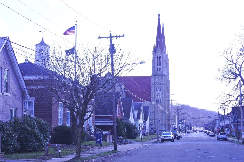
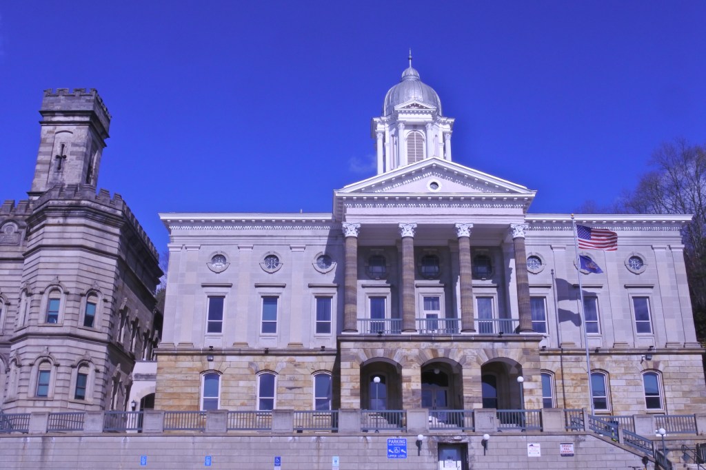
* Jackson was blessed with some quality historic architecture and it was quite extensive. While much of it has been demolished much remains especially along Capitol St and many Capitol bldgs.
* Good racial diversity Dwtn.
* ADA and sidewalk infrastructure is a really mixed bag in Dwtn Jackson. Some great streetscaping along Capitol St, parts of Farish, and the core of Dwtn but the more distressed areas of Dwtn have terrible ADA/sidewalk infrastructure.
* Decent cultural amenities including some restaurants & bars, several night clubs and live music options, a couple art galleries, a good collections of museums, and plenty of historic sites. Regional amenities include two  convention centers and the Jackson Volcano site that includes the State fair grounds and an arena.
* Dwtn hosts a lot of government offices and courthouses along with the main public library.
* Dwtn Jackson has a safety ambassador’s program.
* Solid # of employees in Dwtn at 22K. This is decent given Jackson’s metro size just shy of 600K.
* Some good City Beautiful planning with both statehouses terminating at the end of Congress and Capitol  Streets but much of Dwtn’s originally cohesion has been lost.

URBAN WEAKNESSES:

* Low density even for a Dwtn area.
* Public transit access is quite bad throughout Jackson and mediocre at best in its pre-war II area. Dwtn has better public transit than other neighborhoods just about the worst Dwtn public transit access of any major US City.
* Modern in-fill is generally not very exciting. Either bland mid century towers with poor urban form or auto centric low rise buildings.
* Bike infrastructure doesn’t existing in Dwtn Jackson and practically doesn’t exist in the entire Jackson metro with the one exception of the Natchez Trace Pkwy rec trail running a couple miles north of the city.
* Overall Dwtn’s population is pretty poor but some economic diversity.
* Mostly a younger population Dwtn and few activities for kids.
* Dwtn Jackson isn’t particularly dangerous its just dead and often blighted in places.
* No schools within Dwtn Jackson but some well rated elementary schools in adjacent neighborhoods.
* Hsg is limited dwtn but affordable. 1-bed apts lease for 800K- the low 1Ks. and 2-beds in the 1Ks.
* For sale hsg is practically non-existent Dwtn.
* About 500 students attend college in Dwtn Jackson but Jackson State (10K enrollment) is 1 mile SW of Dwtn.
* Not a ton of verticality nor cohesion to the Jackson skyline but some attractive boutique skyscrapers augmented by the two capitol buildings.
* Very limited pedestrian activity dwtn.
* Only two sizable parks Dwtn: the Statehouse lawn and Smith Park, Jackson’s best Civic plazas. A handful of other plazas dwtn but not much.
* Retail is limited to a couple boutiques & banks, a florist, a couple gift shops & music/book store, a bakery, a gym, a small post office and several churches.

Downtown Baton Rouge and Historic Spanish Town, LA

Most of my evaluation area for dwtn Baton Rouge is btwn North Avenue Blvd and the Capital Access Rd to the north. I included a small segment btwn North Ave and Government St. west of St. Louis St. This includes the historic Spanish Town district.

Spanish Town was commissioned in 1805 and is the oldest neighborhood in Baton Rouge. I believe Spanish town developed before most of Dwtn except along the waterfront. Baton Rouge only had a population of about 500 in 1810 even though the City was established as a fort and trading post in 1755 by the French. The creation of Spanish town allowed Baton Rouge to diversify beyond just a mainly Anglo and minority French City brining new Spanish citizens to the City. The American Civil War brought destruction to the area and left only a few homes and buildings standing in the Spanish town. At this time only 5,000 residents lived in Baton Rouge primarily in the Downtown, Spanish town and Beuregard Town.  After the Civil War, Spanish Town was mostly populated by African Americans. I believe the Downtown area began to take shape after the Civic War.

I view Downtown in 4 segments:


– Spanish town is between 5th Avenue east to the highway and north of North St.
– Capitol Area is between N 5th Ave and the River and South to North St.
– Heart of Downtown is south of North St to North Blvd/Federal St. There is where the majority of high rises are located, Arts activity, Dwtn’s historic street along 3rd Avenue and major civic plazas.
– Underutilized Dwtn- is east of N 5th Ave between North Avenue and North St. This is a mixture of historic low rise buildings, some mixed-use activity but lots of surface parking and dead spaces.

Dwtn desperately needs more residential and neighborhood amenities which can be achieved through significant mixed-use infill development especially east of N. 5th Ave.

Click here to view my Dwtn Flickr Album and here to view my Spanish Town Album

URBAN STRENGTHS:

* Very gridded and easy to navigate Dwtn street network
* Good dedicated bike sharing system Dwtn and spilling into Beuregard Town.
* Decent age diversity among adults living Dwtn.
* Solid park amenities including the Mississippi River front park, Galvez Plaza and North Blvd Town Square, the Downtown Greenway Blvd park, and the Capitol Gardens and Veteran’s Memorial Park surrounding the Capitol Complex. Several smaller plazas and parkettes too.
* North Blvd Town Square and Galvez Plaza and interconnected and form and solid Civic Plaza with lots of public events.
* Crime is pretty average for American Dwtn’s. Generally a safe place.
* Pretty good imageability with a distinct state house area, the Historic Spanish Town, Historic commercial district along 3rd St and well designed Dwtn plaza spaces. Put also plenty of soulless areas in the eastern half of Dwtn.
* Good architecture (both historic and infill) around Galvez Plaza and North Blvd Town Square. Great historic architecture in Spanish town.
* No hard data on Dwtn employment but assuming with all the State workers here its a decent # (40K-50K). COVID has certainly decreased this amount.
* Solid cultural amenities including plenty of restaurants, bars, & cafes. Decent # of live music venues, a handful of art galleries & performing arts theaters, and lots of museums.
* Major regional amenities including plenty of courthouses and gov’t bldg, a convention center, and Dwtn post office & library.

URBAN WEAKNESSES:

* Population density is low even for an American Dwtn.
* Decent public transit access Dwtn and decent access to the more historic neighborhoods east of Dwtn and to a less extend south of Dwtn. Outside of these areas public transit access drops off pretty quickly but at least some level of access within the City of Baton Rouge. Very limited public transit access outside of the City.
* Plenty of 2-3 lane one way roads. While this isn’t terrible egregious its pretty unnecessary given Dwtn Baton Rouge’s size and more of these roads should be made 1 way.
*Effectively no dedicated bike lanes within Dwtn. Very limited dedicated loans outside of Dwtn. Nice 2 mile dedicated lane running east of Dwtn along Government St and a waterfront line going south of Dwtn.
* No a very children’s friendly dwtn. No major sports area’s Dwtn. Along truly kids friendly museum is the Science Museum. Few kids living Dwtn.
* Greater Science focused high school Dwtn and a couple smaller schools. A handful of smaller schools on the edge of Dwtn.
* For sale options are limited to the Spanish town area. A handful of 1-bed options selling btwn 100K-200K, 2-beds sell btwn the high 100Ks to the low 300Ks, 3 & 4 beds btwn 200K-500K.
* Okay # of rentals with 1 beds ranging anywhere in the 1Ks, similar # of 2-beds and similar lease amount. Very limited 3-bed options.
* Poor ADA curb cuts in Spanish town and some missing sidewalks too. Eastern town generally has curb cuts but often outdated. Western Dwtn has good sidewalks and pretty consistant curb cuts.
* No University presence Dwtn. The closest college location is Baton Rouge Community .
* Other than the spectacular Art Deco tower not much to speak of with the Baton Rouge skyline other than a couple mid century 20-30 story towers and smaller gov’t bldgs.
* Lots of bland office towers throughout and auto centric infill in the eastern half of Dwtn.
* So so retail amenities including a pharmacy, a small market, a couple boutiques & gift stores, many banks, a couple gyms, and lots of churches.

Paris’ 17th Arrondissement- A Wonderfully Tourist Free District just beyond the Arc de Triompe

The 17th Arrondissement is divided into four administrative districts: Ternes and Monceau in the southwestern part (two upper-class districts which are more Haussmannian in style); in the middle is the tightly packed Batignolles district, a hip area experiencing significant gentrification; and in the northeastern part, the Épinettes district a former industrial district redeveloped residential with a mixture of middle class and working class immigrant families.

Other than the small area around the Arc de Triomphe, the 17th Arrondissement is largely a tourist free area as it lacks major destinations. This gives it a very authentic Parisian vibe where one can enjoy the district for  an excellent representative slice of Parisian life. The Parc Clichy-Batignolles/Martin Luther King Park is a wonderful redevelopment sight with an expansive and well designed modern park with excellent edgy modern apartment buildings rising around it similar to New York’s Highline. Yet the area is very much off the tourist path. Other highlights include the excellent Boulevard des Batignolles pedestrian promenade, the highly urban and mixed-use area between Ave de la Grande Armee and Rue de Courcelles, and the stunning Haussmannian architecture on the western half of the district and surrounding the excellent Parc Monceau.

The more working class eastern third of the 17th Arrondissement also hosts some wonderful urbanity mixing late 19th century architecture with modern mid century buildings. My only real critique of the neighborhood is that some of the mid-century neighborhoods are a bit gritty with uninspiring buildings and the Bd Peripherique (a highway) runs along the outer edge of the neighborhood. One hopes that the gentrification process never becomes total and complete in the eastern half of the district.

Click here to view my 17th Arrondissement on my Flickr Page

URBAN STRENGTHS:

* Boulevard Pereire is a really nice park/promenade boulevard with fancy Parisian housing surrounding it.
* Several excellent business districts including: Ave des Ternes- Very high end street and fashionable commercial street; Rue de Courcelles- Incredible ornate and consistent beau arts architecture; Rue des Dames- alleyway biz district
* Parc Clichy-Batignolles/ Martin Luther-King: Very modern park but super interesting with very innovative park design and modern buildings surrounding it.
* Excellent mixed use area between Ave de la Grande Armee and Rue de Courcelles. High level of urbanity here with incredible Haussman architecture.
Batignolles-  subdistrict that surrounds both sides of the railroad tracks is home to narrow streets packed with shops, wine bars and eateries.
* Excellent pedestrian prominent within Boulevard des Batignolles. Greater node where it hits Place De Clichy.
* Ave de Clichy Av. de Saint-Ouen are solid biz districts along the Eastern edge of the district.
* Solid population density with 76K per square mile.
* Parc Monceau is on the southern border an excellent medium sized park. Some incredible architecture around the park.
* Good mix of high end neighborhoods on the western half and middle class/working class districts in the eastern half of the district.
* Several nice small-medium sized parks in the eastern half (i.e. Square des Batignolles, Square Ernest-Gouin, Square Jean Leclaire, & Square des Epinettes.
* Other than the immediate area surrounding the Arc de Triomphe, tourism is low.

URBAN WEAKNESSES:

* Northeast sections of the district (i.e. Porte de Clichy, Porte de Saint-Ouen, and Epinettes) is pretty gritty with lots of uglier mid century buildings.
*  Highway runs along the outer edge of the neighborhood.

Paris’ 11th Arrondissement- Great Density and home to the Place de la Bastille and Place de la Nation

The 11th Arrondissement is one of Paris’ most dense neighborhoods siting at just over 100K per square mile with a total population of 150K. The neighborhood actually peaked in 1911 with a total population of 250K! The 11th Arrondissement is less known to tourist than other more centrally located portions of Paris but has some well known landmarks such as the Place de la Bastille, Opera Bastille, Place de la Republic, and the popular Oberkampf district where the 2015 terrorist attacks occurred. Generally the western half of the 11th Arrondissement is more mixed-use with great cultural assets, cool arcades and passageways, and gorgeous Haussmannian architecture largely hosting single adults. The eastern half is more laid back and more family-oriented. The area hosts less ornate and more modern architecture but still  boast high quality urbanism.

Other areas to highlight in the 11th Arrondissement are the Rue du Faubourg Saint-Antoine, an active commercial district  full of fashionable cafés, restaurants, and nightlife, running along the district’s southern border; Rue de Charonne, a less known but quality business district that cuts through the middle of the neighborhood west to east; and the impressive Place de la Nation holding down the southeastern corner of the neighborhood .

Click here to view my 11th Arrondissement album on Flickr

URBAN STRENGTHS:

* Great subway coverage here.
* One of Paris’ most dense districts at over 100K per square mile.
* Great concentration of arcades and small passage ways off the main street line with small shops. Much less touristy than passages of the 2nd and 9th Arrondissements. These are closed to Place de la Bastille.
* Largest open air market (Marche Bastille) set up along  Richard-Lenoir. Richard-Lenoirs becomes a great blvd park further north, the filled in remains of the old Canal Saint-Martin.
* Both famous plazas (Place de la Republique and Place de la Bastille) are in the 11th Arrondissement along the Western Edge. A lesser know but still great square (Place de la Nation) is along the Eastern Edge.
* Several nice gardens and parkettes (jardin Émile-Gallé, Jardin Damia, Square des Jardiniers, Square Maurice Gardette.
* Sizable middle class  family areas esp. in the eastern half away from the trendy parts of the district.

URBAN WEAKNESSES:

* Architectural style is less spectacular as the buildings move to the mid century in the eastern half of the neighborhood but still very urban and decent styling.
* Some of the more mid-century buildings are tired and without green adornment and street trees.
* Less cultural opportunity in the southeastern portion of the neighborhood.

Paris’ 3rd Arrondissement- Known for its hôtels particuliers, gardens, elegance, and historic diverse communities

Development began in the 3rd Arrondissement in the 14th century when King Charles V drained the marshlands  “the Marsais”  included this area inside the new walls that protected the city. Charles V  also relocated the Royal Court to Hôtel Saint Paul in Le Marais (4th Arrondissement). This relocation prompted many important and wealthy people wishing to be near the King to built beautiful private mansions (hôtels particuliers) nearby, which explains the plethora of hotels particulars in Marsais. Several centuries later, the third arrondissement became home to 3 ethnic communities: Auvergne (from the French region of Auvergne), Jewish and Wenzhou Chinese community, the first Chinese community to arrive in Paris

The 3rd Arrondissement of Paris is divided into 4 neighborhoods: Quartier des Arts-et-Métiers, Quartier des Enfants Rouges, Quartier des Archives and Quartier Sainte-Avoye. the Temple Quarter.
– The name “Temple” comes from the Knights of Templar, the religious and military order who by the 14th century owned this area.
– Arts et Métiers Museum stands as a silent witness of this arts & crafts past in medieval times.
– Quartier des Enfants Rouge:  This district takes its name from the Hospice des Enfants-Rouges founded in 1536. In memory of this hospital-orphanage, the neighboring market of the Marais du Temple became the Marché des Enfants-Rouges.

Evidence of the historic Jewish quartier are still present in the 3rd Arrondissement by landmarks such as the Musée d’Art et d’Histoire du Judaïsme and Jardin Anne-Frank. But the heart of the quarter is just to the south along the Rue de Rosiers in the 4th Arrondissement. 

Click here to view my Album on Flickr

URBAN STRENGTHS:

* Lovely array of 17th hotels [mansions:  hôtels de Soubise, Hotel Sale, Musée Cognac-Jay, Musée Carnavalet, Hôtel de Saint-Aignan] often turned into boutique museums and small and mediums plazas [Les jardins des Archives nationales, Parc de l’Hôtel Salé, Square du Temple, Square Émile-Chautemps, Square du General Morin, Square Georges-Cain, Square Léopold-Achille, Jardin Arnaud Beltrame typically the remanence of walled hotel yards.
* Wonderful architecture through the district mixing architecture from the 16th-19th centuries. Oldest than most Parisian districts.
* District contains half of the famous Plaza de la Republique.
* Much of “Le Marsais” district is contained in the 3rd one of Paris’ most elegant and preserved districts.
* Contains the city’s oldest market “Marché couvert des Enfants Rouges:
* One of Paris’ most dense districts with 75K per square mile.
* More unique district in Paris as its missing the large Haussmannian boulevards.
* Great night life amenities as well. Most of the district is mix use providing residents excellent access to retail amenities

URBAN WEAKESSES:

* Because of the historic marsh located in the district, subway stations are concentrated along the edges of the district and subway access is less dense than most parts of Paris.
* Decent amount of tourism but better than other tourist districts in Paris as the neighborhood has a large and dedicated population.

Arnold, PA- a distressed Allegheny River town with good urban bones and neighbor to New Kensington

The land on which Arnold currently stands was purchased in 1781 but it wasn’t developed until the late 1800s. Arnold was originally part of the City of New Kensington from 1891 until 1896 until it incorporated as a separate borough. The portion of Arnold btwn the river and Constitution Blvd is the oldest and most distressed portion of the borough. East of Constitution development ranges between 1900-1940s and generally is more stable. Arnold maxed out at around 11K residents in 1940 and has since fallen to just under 5K.

5th Avenue is the historic business district for Arnold but has fallen on pretty hard times with only a handful of businesses still open and a good number of vacant lots and vacant storefronts. I don’t see much hope for a population reversals in Arnold unless the City embraces immigrants. There is a sliver of hope for this as 4% of the population is Hispanic. A more attainable and likely strategy for Arnold is to spend its efforts revitalizing its 5th Avenue core, removing blight and stabilizing the old part of town, and reinvesting in the newer portion of town between Constitution and Freeport to build on existing market strengths. Arnold has decent density and mixed-use fabric giving me some hope that it could become a decent urban environment once again. There are also some good revitalization efforts occurring along the main street of its neighbor, New Kensington.

Click here to view my Arnold album on Flickr

URBAN STRENGTHS

* Good street connectivity.
* Good racial diversity and decent generational.
* Few 1-beds but good # of 2 & 3 beds that range btwn $800-$1,000.
* While public transit is limited dwtn is only a 25-30 minute drive.
* Decent urban density and good urban bones.

URBAN WEAKNESSES:

* Sidewalk infrastructure is generally good but very few ADA standard curb cuts.
* Poor public transit access.
* No biking infrastructure to speak of.
* Wide spread poverty and not a lot of income diversity in Arnold.
* A couple of schools in the core of Arnold but poorly rate. Decent elementary school on the eastern edge of town.
* Arnold has a pretty high crime rate and a lot of blight to accompany it.
*Lots of depressed hsg in Arnold selling below 60K but some well maintained product too selling in the 100Ks.  2-beds sell btwn 20K-150K, 3 & 4 beds sell anywhere btwn 35K-185K.
* Okay park amenities including a decent river park, a playground and the cemetery.
* Limited cultural amenities including a handful of restaurants & bars, and a couple cafes. Better cultural amenities in New Kensington which is within 1 mile.
* Retail amenities are also limited including a couple banks, a furniture store, a couple boutiques, a couple gyms & dessert joints, a post office, and lots of churches.

Freeport, PA- an Allegheny Rivertown built on free port access

I included only the cohesive urban portion of Freeport in this evaluation. Freeport was first settled in the 1760s. The town received its name when David Todd declared the town to be a free and open port allowing boats to tie up along the river free of charge. Freeport’s position on the Allegheny river gave it an ideal spot for industry and trade going to Pittsburgh. This lead to the creation of several industrials throughout the 19th century including the Lucesco Oil Refinery and the Freeport Brick Company. Even for a Western PA river towns, freeport is quite small sitting at just 1,700 people. Its seen plenty of decline since its peak likely around 1930 but has done a decent job managing the decline with few vacant homes left standing. There is a 2-block commercial district along 5th street with some stores and food & beverage businesses with a decent sense of space. This is only a couple blocks away from a nice river front park. Surprisingly a decent # of homes selling in the 200Ks in Freeport and the town boasts good park amenities and good sidewalk and ADA curb infrastructure.

I don’t see much hope for a population reversal in Freeport so the most attainable positive urban impact would be revitalizing 5th Street’s many vacant storefronts and building up the popularity of the town. Freeport could encourage more immigration to at least stabilize its population as well.

Click here to view my Freeport album on Flickr

URBAN STRENGTHS:

* Decent sidewalks with about half of the curbs up to modern ADA standards.
* Great economic diversity and decent generational.
* While Freeport has some blight it is a very safe community.
* Decent for sale diversity. Really no 1-beds available. 2-beds sell anywhere btwn 60K-120. 3 & 4 bed sell btwn 30K-300K, with a good number of well invested homes selling in the 200Ks.
* Good park amenities including an attractive riverside park, the expansive Freeport Community Park, the Market Street Park.
* Decent urban massing.

URBAN WEAKNESSES:

* Pretty low density for an urban area.
* Public transit is extremely limited in Freeport.
* While no transit exist, Freeport is only 30 min drive to downtown Pittsburgh.
* No bike infrastructure to speak of.
* Limited racial diversity as 95% of the population is white.
* Only the public middle school is open and in town.
* Very limited rentals, at least listed on Zillow. Very affordable however.
* Some cultural amenities including a decent amount of food & beverage bizs, a brewery, and a community theater.
* Retail amenities are limited to a family dollar, a couple boutiques & gift shops, a couple dessert joints, a gym, an antiques store, a couple banks, a doctor’s office, a local library and post office, and  several churches.
* Really no infill architecture to speak of.

Ford City, PA- a Company Town Originally built by PPG Industries

Ford City was founded in 1887 as a company town by the Pittsburgh Plate Glass Company (now PPG Industries) as the site for its Works No. 3 glass factory. The town was named in honor of the company founder, John Baptiste Ford. In its heyday the factory employed as many as 5,000 workers. The PPG plant shut down 1990s and another large employer, Eljer Plumbing, shut down in 2008. Like most Western PA towns, Ford City’s population peaked in 1930 at 6,000 residents and has been in a steady decline ever since and now stands at just under 3,000 residents. Ford City has done a good job managing its decline quickly demolishing abandoned homes and allowing neighborhoods to purchase them for expanded yards. Most of the vacancies are empty storefronts.

From an urban perspective Ford City does well with well maintained sidewalks and updated ADA curb cuts, quality walkable schools, a wonderful street grid, good distribution of parks, high levels of safety, and decent retail amenities. I don’t see much hope for a population reversal, so the most biggest positive urban impact would be revitalizing Dwtn’s many vacant storefronts and building up the vibe in the town.

Click here to view my Ford City album on Flickr

URBAN STRENGTHS:

* Good sidewalk infrastructure and most intersections have up to date ADA curbs.
* Highly connected and efficient street grid.
* Nice recreational trail running along the river.
* Decent generational diversity.
* Well rated middle/high school along with a Catholic grade school within Ford City. Elementary school is just outside of Ford City.
* A couple buildings dedicated to affordable rentals.
* Several small-medium sized parks well distributed throughout Ford City.
* Decent retail amenities including a supermarket, a couple drug store, a couple dollar generals, several banks, lots of salons, a Hallmark store, a couple dessert/bakeries, a gym, several medical offices and churches, and a public library & post office.
* Pretty safe community and not a lot of blight here other than vacant store fronts.
* Some nice historic architecture, esp. in the business district, but homes are generally rather plain.
* Good streetscaping done on Ford St maybe 30 years ago. Other commercial streets are pretty dated.

URBAN WEAKNESSES:

* Density is so so and pretty low for a urban area.
* Very limited public transit access.
* 45 minute drive to Dwtn Pittsburgh. No feasible public transit options.
* Largely a White City with a small Black and likely growing Hispanic population.
* Not much for sale diversity as housing stock is generally very affordable. 1 beds very limited. 2-beds sell btwn 50K-90K,3 & 4 beds sell btwn 50K-150K.
* Rentals are very limited but affordable.
* Cultural amenities are limited to some restaurants, bars & cafes.
* In-fill is limited to a couple decent mixed-use and apt bldgs in the center of town.
* Pedestrian traffic is pretty limited.

Kittanning, PA- Historic Native American Village and Home to the Armstrong County Seat

I included most of urban Kittanning except the portion east of Victory St as this part of Kittanning felt pretty disconnected from the center of town.  Kittanning was founded on the site of the eighteenth-century Lenape village of Kittanning at the western end of the Kittanning Path, an ancient Native American path. Sadly during the French and Indian War the village was destroyed at the Battle of Kittanning. The borough was settled by European Americans mostly  after the American Revolutionary War. By the early 20th century, the City had developed considerable industry similar to manufacturing across the Pittsburgh region. Kittanning reached its peak on 1930 at 7,800 and has been on a slow decline since hosting around 4,000 residents. Its important to note that Kittanning was one of the largest cities along the Allegheny River east of Pittsburgh through the 19th century reaching 1,700 souls during the Civil War and 4,000 in 1900.

Thanks to its designation as the County seat of Armstrong County, Kittanning has a historically expansive business district focused on Market Street but stretching several blocks to the south and a couple blocks to the north. Market street connects the riverfront and County Court House and jail creating a pretty striking visual. To the north of Market street are several blocks of attractive mid-late 19th century architecture and along the river is an expensive well designed riverfront park. Market street still retains most of its form but vacancies are quite prolific. The business district south of Market St is mixed-bag hosting many parking lots, auto centric uses, and underutilized buildings. Many walkable business and a solid public middle and high school still remain in the center city. While I’d love to see the borough’s population increase a more realistic goal for this Western PA town is strong investments in Market Street to eliminate blight, open new businesses, and create a better vibe for the town. Kittanning biggest challenge is its aging population (average age is 50 years old). This does not bode well for stabilizing the city’s population. 

Click here to view my Kittanning Album on Flickr

URBAN STRENGTHS:

* Solid ADA and sidewalk infrastructure esp. in the core of the Kitanning.
* Nice recreational trail that cuts through the length of Kittanning. Limited bike infrastructure otherwise.
* Excellent gridded and connected streets.
* Good walkable high school and middle school but not much else
* Lengthy and well designed riverfront park in Kittanning. Also a good playground and an YMCA with an indoor pool.
* Good retail amenities including a supermarket, family dollar, a couple pharmacies, several banks, several clothing & consignment stores, a furniture store, a hardware store, several salons, a couple gyms, a local public library & post office, lots of churches, a couple doctor’s offices and the general hospital is a couple miles away.
* Solid imageability with a the courthouse centrally located at the end of the main business district that connects to the riverfront.
* Some excellent historic architecture esp. in the center of town.
* Lots of dedicated senior and affordable housing here.
* Good urban form and streetscaping along Market St.
* Impressive size to Kittanning’s mixed use area.

URBAN WEAKNESSES:

* Pretty low density for an urban area. 
* Transit access is very limited here.
* Aging population with the median age of 50 years old and not a lot of family households w/ kids.
* Very White population with limited racial diversity.
* Economic diversity not great either.
* Decent # of rentals, esp. 1-beds but all very affordable.
* Not much for sale diversity as housing stock is generally very affordable. 1 beds very limited. 2-beds sell btwn 50K-200K,3 & 4 beds sell btwn 50K-230K.
* Okay cultural amenities including a decent # of restaurants, a couple cafes, and several bars. a couple bars that do live music, a couple local museums, and a bowling alley.
* Some crime here and certainly blight but not an unsafe community by any means.
* Good amount of auto centric modern infill on the south end of town but also some decent urban in-fill sprinkled in throughout.
* Urban form and streetscaping of commercial south of Market St is hit or miss.

Vandergrift- Western Pennyslvania’s Olmsted Planned Industrial Town

North of Walnut street is the stable well planned portion of Vandegrift. South of Walnut street Vandergrift becomes more working class and gritty. This is also the unplanned part of the community seemingly untouched by Olmsted’s plan for the town.

Early in the 20th century, Vandergrift had the largest sheet steel mill in the world. Yet this ended in a bitter labor dispute with the Apollo Iron and Steel Company in the 1890s. In an attempt to avoid future unrest, the company sought to gain tighter control over its workforce and decided to provide workers with good housing and a good urban environment to foster  loyal and productive employees. The company hired Olmsted, Olmsted and Eliot to design a model industrial town resulting in a well laid out borough with curvilinear streets, well placed commercial district, tree lined streets and good park spaces. Homeownership rates among workers remained high and in general the plan worked creating a steel town where a relatively cordial relationship existed between the steel company and Vandergrift residents.

Vandergrift’s population peaked in 1930 at 11,500 but as with most western PA towns, its populational has more than halved since to 5K residents. Still Vandergrift’s urban form has remained largely in tact with mostly occupied buildings, many businesses, and better stability than most similar industrial river towns in the region. Vandergrift also excels at affordable housing, decent walkability good tree canopy, decent park and cultural amenities, and a diversity array of retail options. I’d of course love to see density increase in Vandergrift but this is an up hill battles for a Western PA industrial town. The best we can likely hope for with an improved urban environment is better bike infrastructure, more housing diversity, a supermarket, and updated streetscaping.

Click here to view my Vandergrift Album on Flickr

URBAN STRENGTHS:

* Pretty good ADA infrastructure and sidewalks. Generally sidewalks exist and about 50% of the curb cuts are up to modern standards.
* Good generational diversity and decent economic but incomes are on the low side here.
* Olmsted’s curvilinear streets make be a bit disorienting but connectivity and efficiently are still good and it leads to some very good place making.
* Vandergrift has some grit but a pretty safe place to live.
* Tree canopy is pretty good, clearly much fuller in the north half of town.
* Some excellent historic commercial and great homes along Washington Ave but most residential is very working class in typology.
* Decent parks with the larger Kennedy and Franklin Parks.
* Decent cultural amenities including good food & beverage bizs, a brewery & winery, a performing arts center, a local museum.
* Good retail amenities too including a couple drug stores, a dollar general, several boutiques & gift shops,  a couple florists,  several banks, a couple homes/furniture  stores, several dessert joints and bakeries, a couple gyms, lots of churches, a local public library & post office, and several medical offices.
* Solid urban form along Vandergrift’s main biz district (Grant St) and other mixed-uses. 

URBAN WEAKNESSES:

* Density is so so.
* Some public transit but generally pretty limited.
* About a 45-50 minute drive to Dwtn.
* No bike infrastructure to speak of.
* Walkable schools in the Borough consist of a quality great school and small parochial school. Public high school and middle school are good but out in the suburbs.
* Some rentals and generally very affordable. Limited diversity in offering.
* For sale hsg options are all pretty limited and generally very affordable. 2-beds sell btwn 40K-125K, 3 & 4 beds sell anywhere btwn 30K-150K.
* Missing a supermarket in town.
* Some poor urban form (parking lots and industrial uses) along Lincoln Ave.
* Really no modern in-fill to speak of.
* Streetscaping is fine but dated.