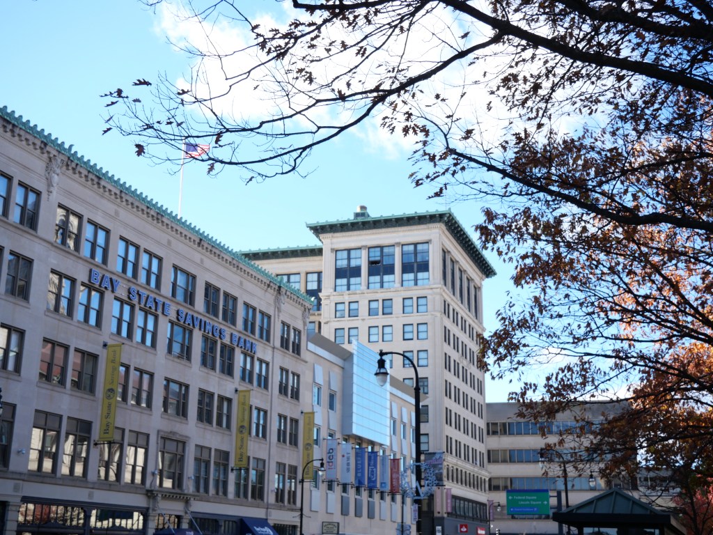
The South End has long been home to Springfield’s Italian community since the late 19th century and continues to hosts numerous Italian restaurants and pastry shops, most famously the La Fiorentina Pastry Shop. More recently it has become famous for housing the National Basketball Hall of Fame. From an urban perspective the South End is a solid neighborhood with a great sense of community, a fairly vibrant Main Street, and walkable access to the heart of Downtown Springfield. For this to become a top tier urban district it needs a lot of quality urban in-fill along Main Street and filling in vacant parcels along the eastern edge of the district, better schools and ideally the abandonment of I-91 so the neighborhood can connect much more seamlessly to the Connecticut River.
Walkable access to Dwtn and plenty of restaurants (esp Italian), bars, smaller ethnic groceries, boutiques located along Main Street.
generally a solid business district along Main St with pretty good urban form and a variety of businesses. Becomes more autocentric towards the southern end of the neighborhood.
Pretty affordable place to buy a home generally btwn 200K-350K. Decent # of rentals as well.
URBAN WEAKNESSES:
Other than the recreation trail running along the river, really not bike infrastructure.
The historic residential isn’t very attractive as its mostly turn of the century worker housing.
So so density for an urban neighborhood but a bit underwhelming for an inner City East Coast City. Same thing with public transit access.
Some walkable schools located here but generally not well rated.
Highway 91 unfortunately is a major barrier between the neighborhood and the Connecticut River.”
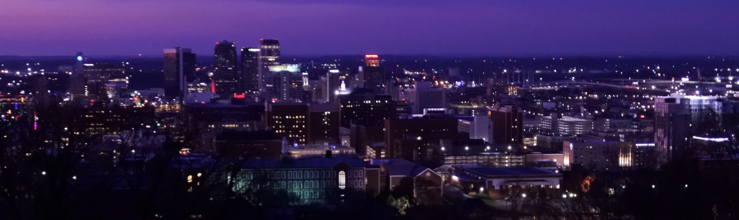
Main street is the heart of Dwtn running north to south throughout its entire duration. I consider where Main Street and Court House Place Square meet as the heart of Dwtn as this is the convergence of the Springfield Convention Center, several vibrant blocks of Main Street, the Civic Heart of Springfield with many historic Civic Buildings and the MGM Casino (technically in the South End). East of Dwight Street the urban form starts to break down with more parking lots, modern bldgs with poor urban form, and less vibrancy. A couple blocks just west of the Armory host the Armory Quadrangle Historic District a collection of attractive Boston looking apartment bldgs with bay turrets and other historic institutional buildings. Downtown connects most seamlessness with the South End neighborhood to the south especially via Main Street as quality urban cohesive blocks continue for several blocks south through the neighborhood. For Downtown Springfield to become a great Downtown it primarily needs much more population and density to help support more neighborhood retail amenities and much better vibrancy especially north of the railroad tracks and east of Dwight Street. Downtown has strong bones along Main Street and several surrounding blocks to build from and expand to the less developed parts of Downtown.
Click here to view my Downtown Springfield album on Flickr
URBAN STRENGTHS:
* Lovely set of intact historic commercial buildings from the 19th to early 20th century. * Really like the historic center of Dwtn at Court House Place with the City’s most prominent Civic and Historic Gov’t Bldgs surrounding it. * Main Street south of the Train Station is very in-tact with many mid to late 19th century commercial bldgs btwn 4-8 stories. Worthing St is also making a comeback with many revitalized historic bldgs, new pedestrian friendly streetscaping and light crossing over the Street. * Nicely renovated Historic Union Station which was restored in 2019 moving the Amtrack Station back to the station after many years of disrepair. * Excellent cultural amenities dwtn including tons of food & beverage businesses, plenty of theaters & live music venues, a cineplex and plenty of Museums and art galleries especially within or near the Springfield Museums Complex.
URBAN WEAKNESSES:
* North of the railroad tracks and east of Dwight Street has lost much of its urban form and lacks a sense of place and vibrancy. * So so density for an Dwtn area. * Not a ton of condo options but some options along Dwight Street and very affordable. Not a ton of rental options either dwtn. * Not a lot of solid urban infill in Downtown. This is largely due to Dwtn’s lacking of housing options. * Good smaller retail amenities like boutiques, clothing stores, and gift stores but Dwtn lacks a major supermarket and other important neighborhood retail amenities. * Other than a recreational trail only the river, bike infrastructure is limited. * Several small plazas and parks dwtn but the recreational trail along the river is really the only large park dwtn.
Piedmont is an inner city Worcester neighborhood that developed in the mid-late 19th century. Like Main-South the neighborhood began to decline in the post War Era but it has pockets of stability and investment that generally correspond to the several small historic districts located within Piedmont i.e. Oxford–Crown- The district contains Mid 19th Century Revival, Greek Revival, and Renaissance architecture; The Elm Street- Historic District encompasses a collection of high-style Queen Anne Victorian three-decker houses; Lincoln Estate-Elm Park- The District is a mix of large 19th century mansions of various styles.
For most of the 19th century, Piedmont and the larger west side of Worcester’s west side was the preferred neighborhood for the City’s fashionable and upper-class residents. With the development of the trolley network in the late 19th century working and middle class housing and often apartments came to the neighborhood leading to the departure of the upper classes but in my opinion becoming a more dynamic urban district. The Piedmont has several historic districts of various stability. Pleasant St and several blocks of Main St have the best cohesion and urban feel; Highland St isn’t bad but feels grittier and Chandler feels very autocentric. Piedmont doesn’t have the best retail & cultural amenities located within it, but makes up for this a bit with its convenient access to Dwtn (esp. cultural amenities). Rentals are plentiful but still pretty expensive and for-sale housing are reasonably priced but not plentiful. Piedmont also has solid park amenities, good tree canopy, and overall good urban bones and density. For Piedmont to become more of a top tier urban district it needs more income diversity which would fuel more retail & cultural amenities and urban in-fil especially along its business districts. There are still lingering crime issues here and school ratings are less than desirable.
* Solid urban density at just over 18K residents per Sq Mile * Good racial diversity with large White & Hispanic populations. Decent Black & Asian households as well. * Good sidewalk infrastructure with most intersections as modern ADA curb cuts. * A couple smaller parks mixed throughout Piedmont in addition to the historic Elm Park (one of the earliest public parks in the country), and Beaver Brook Park, Newton Hill Cemetery, and several ball fields on the wester edge of Piedmont. Also a YMCA branch complete with an indoor pool. * Decent Tree canopy. * Good concentrated are pretty and well maintained historic homes in the Lincoln Estate- Elm Historic District just south of Highland St. South of Pleasant St is more of a mixed-bag with plenty of shabby triple decker apts. * Decent urban form and street scaping along Pleasant and Highland. Chandler feels like the more autocentric stroad between the 3 business districts. Generally good urban form along the portion of Main St that forms Piedmonts south eastern border. * Good # of rentals but pricey. Plenty of studios that lease in the low to mid 1Ks, 1-beds lease in the 1Ks, 2-bed in the high 1Ks to low 2K, 1.5K-2.3K. Plenty of 3 bed options in the 2Ks generally. Lots of dedicated affordable rentals in Piedmont. * Decent for sale options and relatively affordable for the East coast. 1-bed condo options selling in the high 100Ks and low 200Ks, more 2-beds condos that sell btwn 150K-400K, 3 & 4 beds btwn 250K-500K. * Decent retail amenities including a couple grocerias & pharmacies, a full service supermarket, a couple boutiques, tons salons & barber shops, several banks, a couple gift stores & florists, several dessert joints & bakeries, several churches, a small hospital w/ several doctor’s offices, a couple dollar stores and convenient access to Dwtn retail amenities.
URBAN WEAKNESSES:
High rates of poverty and lower income households in Piedmont. Not a ton of economic diversity.
Really no good bike infrastructure.
Safety is a mixed bag in Piedmont as some residents feel its it’s a bit “”dicey”” due to the presence of people struggling with addiction or mental illness, and lots of shabby triple decker apartments esp. in the southern half of the district. But violent crime seems manageable here and residents don’t necessarily feel unsafe.
Modern infill is largely non-existent besides a handful of autocentric businesses.
Some walkable schools in Piedmont but a mix of poor and medium ratings.
Cultural amenities located in Piedmont itself are limited to a handful of bars, cafes, & restaurants but convenient access to the many cultural amenities dwtn and the Worcester Art Museum and several smaller museums located just north of Highland St.”
Development began in Main South in the mid 19th century and came to its full development in the late 1880s with the founding of Clark University in 1887 by industrialist Jonas Gilman Clark. The neighborhood was stable until the post War era with the collapse of manufacturing in New England. By the 70s Main South became an area with a reputation for prostitution and hard drugs. This impression has stuck with the area, despite the reduction in crime & drug activity in the neighborhood. There have also been several fairly successful urban renewal projects, largely lead by Clark University through their University Park Partnership Collaboration focused on Housing & Physical Revitalization, Education, Economic Development, and Social & recreational activities for residents. Clark University has largely helped the neighborhood stay afloat even as the neighborhood continues to struggle with low level drug activity and homelessness issues.
From an urban perspective South Main is a solid urban district with convenient access to Dwtn and decent walkability thanks to its density, good public transit access, and Main Street running through the heart of the community. But Main South seems to be stuck in a place of low public perception thanks to its persistent drug and homelessness issues concentrated along Main St. This has made it hard for Main street to attract quality businesses and the neighborhood as a whole to attract higher income residents. The neighborhood also lacks bike infrastructure and could use a lot more retail and cultural amenities. Not sure if Worcester’s economy is strong enough to see major revitalization efforts in the community but my hope is that Main South can slowly revitalize from largely grass roots initiatives and support from Clark University.
* Outstanding density esp. for a mid sized city urban district. * Very convenient access to Dwtn as the neighborhood is located just south of Dwtn. * Solid public transit access and overall a pretty walkable neighborhood with Main St running through the heart of the community. * Excellent racial diversity with a large Hispanic populating (around 40%) but good Black, White, and Asian household representation. * Decent park amenities including the medium sized University Park complete with a pond, a couple smaller parks with playgrounds, the Clark University Campus, and a couple medium sized parks just on the edge of the neighborhood including a public pool. * Clark is an excellent Historic Arts College with great architecture. Good amount of impressive historic homes and interesting commercial bldgs mixing in with the more working class housing. * Solid urban form along Main Street. Better closer to Dwtn. Not so much along Park Street a 4 lane through street with a good amount of crummy modern in-fill. * Decent # of walkable schools but of mixed ratings. * Good # of rentals but pricey. 1-beds lease btwn 1.5K-2K, 2-bed btwn 1.5K-2.3K. Plenty of 3 & 4 bed options in the 2Ks generally. * Decent for sale options and relatively affordable for the East coast. 1-bed condo options selling btwn 100K-225, 2-beds sell btwn 150K-300K, 3 & 4 beds btwn 250K-400K but not a ton of options. * Decent retail amenities including plenty of small & medium sized grocerias, a CVS, a hardware store, a couple banks., tons of salons & barber shops, a couple furniture stores, several dollar stores, several dessert joints & bakeries, a YMCA and the Clark University Recreation Center, a small hospital, several churches, and a local post office & public library.
URBAN WEAKNESSES:
* Good sidewalks infrastructure but ADA standard curb cuts are mostly concentrated along Main Street. * Bike infrastructure is basically non-existent. * A good amount of drugs and homeless concentrated along Main Street. Violence crime seems to be limited and blight isn’t too bad but many are willing to put up with “the scene” on Main Street. * Nothing particularly inspiring about the streetscaping. Its functional but dated and warn. * Cultural amenities are so so. Some restaurants, bars, & cafes and a brewery especially along Park Ave. a performing arts Theater at Clark University, a couple night clubs, and convenient access to all the cultural amenities dwtn.
Downtown Worcester likely began as a wholesaling district in the mid 19th century centered around Main Street and expanded eastwards, especially along Franklin St., until it hit the railroad tracks and Worcester’s Warehousing district. Like most American Dwtns, Downtown Worcester experienced profound changes and disinvestment in the post War era. A huge portion of downtown Worcester was demolished for new office towers and the Worcester Center Galleria shopping mall. This occurred in the eastern portion of Downtown between the railroad tracks and a block east of Main Street. The result was an environment filled with many parking garages and lots and a very dead and soulless environment. After only 30 years, the Galleria would be demolished and become a redeveloped City Square, an improved but still not spectacular new urbanist development in the early 2000s. This area also brought other major investments to Dwtn including a new Convention Center, the DCU Arena, Polar Park home to the AAA Woosoxs, the renovation of Worcester’s Union Station reopened and more recently the creation of the Worcester Public Market in 2020.
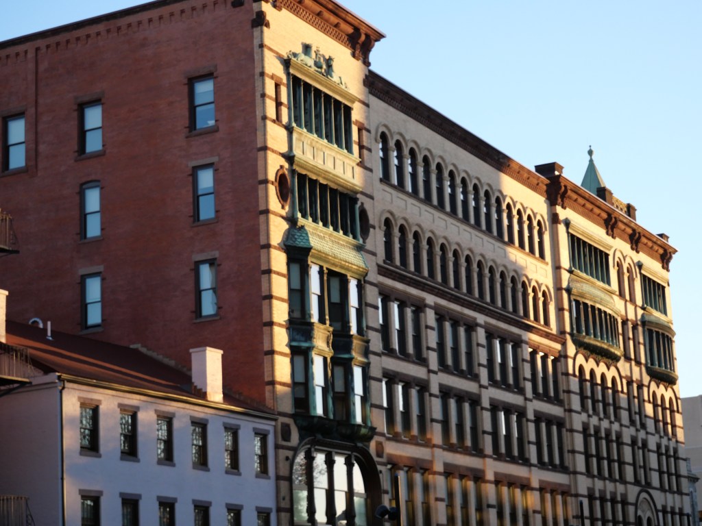
My favorite part of Downtown Worcester is the historic western edge centered along Main Street. The street is filled with gorgeous historic mid to late 19th century 5-15 story historic bldgs, many historic theaters, prominent civic buildings, the historic Worcester Commons, and a great pedestrian friendly streetscaping project along Main St. But along with the soulless urban renewal portion of Downtown, there are also some glaring deficiencies including a complete lack of bike infrastructure within Dwtn and throughout the City, limited park amenities, limited Dwtn workforce, limited K-12 schools, pricy rentals, and limited tree canopy. Dwtn Worcester has a decent population based and cultural & retail amenities. It just needs to better enliven its downtown and fix these key areas to become a thriving and competitive American Dwtn.
Click here to view my Downtown Worcester Album on Flickr
URBAN STRENGTHS:
* Excellent density esp. for a mid sized City * Most intersection are up to ADA standard and good investments in the Streetscaping, esp. Main St which is very friendly to pedestrians. * * Good public transit Dwtn and to the inner City neighborhood. So transit access outside of these inner city neighborhoods and very limited transit service to the suburbs unless you are along one of the Massachusetts transit stops. * Good racial & economic diversity living dwtn. * Good mix of students, young professionals and older adults. While unsurprisingly there are few family households here there are at least two sports venues for more family activities. * A good amount of homelessness exists dwtn but overall its pretty safe. * Excellent set of historic office buildings especially along or near Main Street and warehouses along and near Green Street. * Generally good form along Main St and Green St but lots of open space and urban infill with poor urban form in-between. * Good food & beverage businesses especially craft breweries. Also several museums and art galleries, several theaters including some really gorgeous historic ones that also double as live music venues. For regional amenities there is a minor league ballpark, arena, & convention center. * Pretty good retail amenities including a Supermarket located just south of Dwtn, the Worcester public market, a couple pharmacies, a decent # of clothing stores, several furniture & gift stores (concentrated in Green Island), a book store, several dessert joints, a couple gyms, a dtwn public library & post office, some banks, a couple major hospitals accompanied by several doctor’s offices, and several churches.
URBAN WEAKNESSES:
Weird mix of typical narrow chaotic New England street grid in the western half of Dwtn and wide Blvds in the eastern half.
Pretty terrible bike infrastructure with only a handful of short bike lanes segments in the City or region and not bike sharing system. The only bike path of note is the Black Stone Bike trail running along the southern portion of the City and just below it.
No K-12 schools within Dwtn although there are some decent options in nearby neighborhoods.
Worcester has a large college population but not right in dwtn. Only a small satellite campus dwtn. Worcester Polytechnic Institute is about 1/2 from Dwtn with an enrollment of 7K. Clark University, Worcester State, and Holy Cross are a couple miles away.
Good # of rentals but pricey. Studios lease btwn 1.3K-2K, 2-bed btwn 1.8K-3K but really no 3-bed options.
Condos are more reasonably priced but limited. 1 & 2 bedrooms range from 150K-300K.
Skyline doesn’t have any particularly tall or unique buildings but at least has a good concentration of bldgs with a similar 10-20 story range.
Only a couple parks in Dwtn but they are pretty solid Civic Spaces (Franklin Square), especially Worcester Common.
Not great tree canopy.
Some modern infill and mixed urban quality.
Only about 5K people work in Dwtn which is one of the lowest dwtn employment concentrations I’ve encountered esp. for a metro of 860K.”
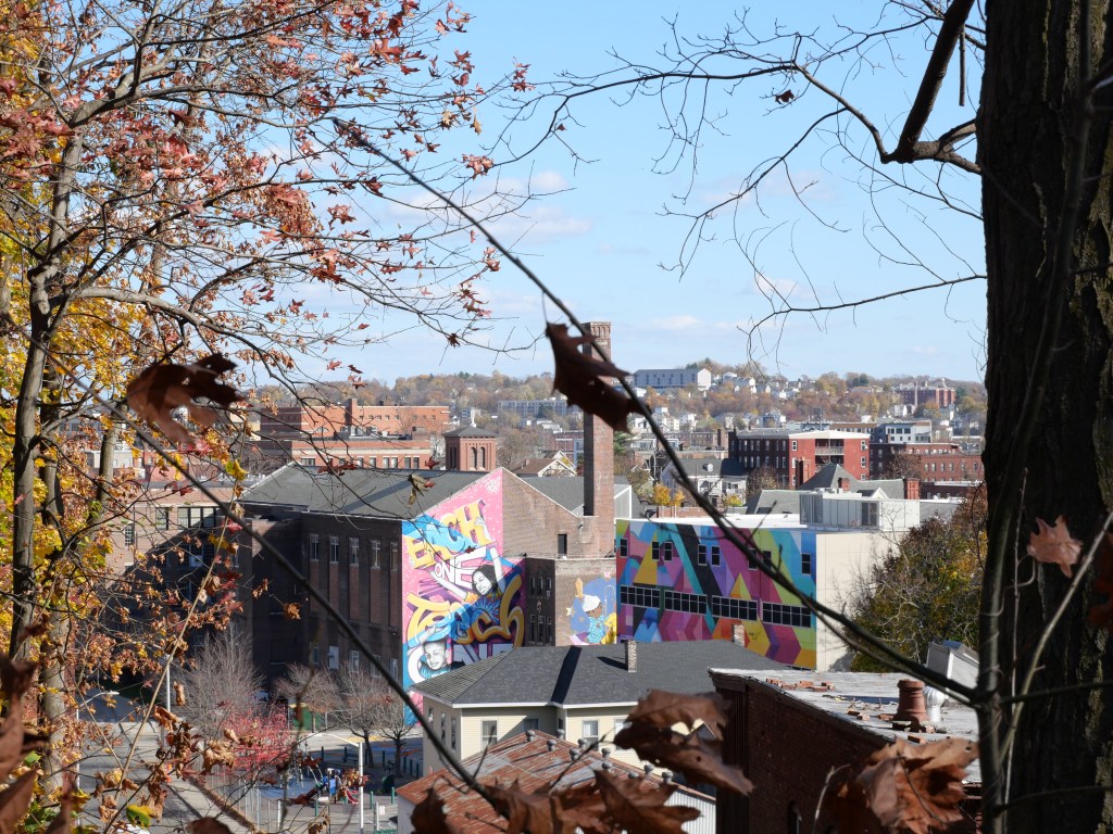
Settlement in Olneyville began at Olneyville Square in the early 18th century as a center of trade with a nearby Narragansett village. The settlement grew significantly around 1785, after Christopher Olney, an American Revolutionary War General, founded a grist mill and a paper mill. By the mid-19th century, Olneyville developed as a railroad junction and a mill district, and became a major employment hub in Providence attracting many immigrants. This all came to an end in the post War era as the mill industries decline and the construction of highways 6 & 10 separating Olneyville from other neighborhoods. This led to decades of decline for Olneyville and a substantial drop in its population. Yet Olneyville is mostly preserved and has become a major hub for 1st & 2nd generation Hispanic immigrants. Former warehouses and mill buildings have seen new life as artist collectives and loft spaces since the 1990s and trendy new businesses and some new construction apartments are trickling in. But I would not say that Olneyville is gentrifying yet as the neighborhood is very affordable comparted to neighboring as with a top for sale price at around 450K.
From an urban perspective Olneyville has a lot of good walkable attributes. Its dense, has solid public transit and bike access, has a nice neighborhood hub where Broadway, Manton, & Westminster St meet (historic Olneyville Square), convenient access to Dwtn, a good array of cultural and retail amenities and lots of mixed-use areas thanks to it historic industrial legacy. Olneyville also has decent parks thanks to the recreational trail and riverside parks along the Woonasquatucket River and decent walkable school options. But Olneyville still has a lot of blight and grit and plenty of strip malls & autocentric uses ( especially concentrated along Manton Avenue) limited tree canopy, and not enough housing options. But given its good urban bones, I think Olneyville will continue to get better and better and has one of Providence’s best potentials as an up and coming urban district.
* Solid density at nearly 15K per sq mile. * Good sidewalk infrastructure but only about half of all intersections have ADA curb cuts with much better coverage along the biz districts than residential streets. * Some attractive 19th century landmark bldgs and old warehouses but the residential arch is generally very working class and gritty. * Decent public transit access and very convenient access to Dwtn being only a 10 min drive and 20 min bus ride. Also a good # of dedicated bike lanes running along the streams & rivers and providing good access to Dwtn through Federal Hill. * Likely hosts the largest concentration of Hispanics in Providence at nearly 60%. Also sizable White & Black populations. A largely working class population with some income diversity. * Many larger families here with children. * Some bad stretches of strip malls along Manton Ave but generally urban form is pretty solid along Broadway and decent along Valley & Atwells. * Pretty good cultural amenities including tons of restaurants, a couple of bars & cafes, a couple art galleries, a small technology museum, several live music venues, a local performing arts theater. * Extensive riverside park including a rec trail in Olneyville running along Woonasquatucket River. Also convenient access to the large Merino Park just across the river, Donigian Park, and the Button Hole golf course. * Only one schools within Olneyville but several solid schools just across the river in Federal Hill. * Decent # of rental options including some 1-beds options that lease btwn 1.4K-2.5Kand some of 2 beds btwn 1.5K to 2.5K. Good amount of dedicated affordable housing. * Really solid retail in Olneyville which include several grocerias, a supermarket just on the edge of the neighborhood, a flee market, several clothing/boutique stores, a family dollar, a couple gift shops, several furniture stores, a hardware store, tons of salons, a couple banks, a couple book stores & bike shops, several bakeries, a local library and post office, several churches, and a couple of medical centers. * Thanks to the historic industrial district located on the southern edge of Olneyville and 4 biz districts, this is a very mixed-use area.
URBAN WEAKNESSES:
* Mix of autocentric strip malls and some quality urban infill. * Lots of grid due to the industrial and immigrant legacy of the neighborhood. Some crime and gang issues but not terrible. * Tree canopy is so so due to the large amounts of industry remaining in Olneyville. * For sale options are a bit limited. Really no 1-beds but for sale housing is pretty reasonable compared to more gentrified areas. 2-bed sell in the 200Ks, and some more 3 & 4 beds which sell btwn 175K-475K. * Some recent interest in the neighborhood judging by some recent loft conversions on creative stores locating in the old warehouses but judging by the relatively cheap housing prices, Olneyville is still not a cool and “in demand” area.
Mount Pleasant was one of the last sections of the City to be developed, and as a result, the houses have decent side yards and front lawns. Although some houses were constructed in the late 19th century thanks to the construction of the streetcar down Chalkstone, most homes were built in the early to mid 20th century. There are sections of Mt. Pleasant (esp. on the western edge and northeast corner) that weren’t built up until the 50s and are often missing sidewalks. Very similar to neighboring Elmhurst, the neighborhood saw an influx of 2nd & 3rd generation Irish and Italian immigrants into Mt. Pleasant in the first half of the 20th century with the Irish leaving behind Smith Hill and the Italians leaving Federal Hill. In the post War era, Mount Pleasant was one of Providence’s most stable neighborhoods with few homes being listed for sale. By the 2000s the demographics shifted to include large numbers of Hispanic and African American families. Mt. Pleasant, by all accounts, has made this transition graciously, and is still a very stable part of Providence.
From an urban perspective Mt. Pleasant contains many suburban amenities with enough urban amenities to be a solid urban district. It has good schools and high levels of safety but also high density levels, decent retail amenities, convenient access to Dwtn pretty good transit access and some 2 & 3 bedroom rentals. For Mt. Pleasant to become a top tier urban district it needs more accessible parks. Most parks space is dedicated to sport complexes attached to schools, the Triggs Memorial Golf Course, and Rhode Island College. The neighborhood could use better public transit and bike infrastructure and major mixed-use development built up along the business districts running along Chalkstone, Smith, and Atwells, which would foster more retail and cultural amenities in the community.
Click here to view my Mt. Pleasant Album on Flickr
URBAN STRENGTHS:
* Really good density esp. for this era of housing btwn WWI and WWII. * Decent public transit access and very convenient access to Dwtn being only a 13 min drive and 20 min bus ride. * About 60% of all curb cuts are up to ADA standards. Generally good sidewalk infrastructure but some sections with limited sidewalks especially in sections of the neighborhood with a lot of Post WWII housing (western edge and northeastern sections). * Solid tree canopy throughout. * Large Hispanic population here (about 50%). Also large White and Black populations as well. Also good economic diversity and a large number of college students and families here. * Overall a pretty safe community. * Good array of pretty well rated public grade schools in Mt. Pleasant. There are a couple private schools and a large public HS but poorly rated. * Really no 1-beds but for sale housing is pretty reasonable compared to more gentrified areas. 2-bed sell btwn 200K-500K, and 3 & 4 beds sell btwn 200K-700K.
URBAN WEAKNESSES:
Modern in-fill is limited but much of what does exist is auto centric junk.
Historic residential is generally pretty plain with a mix of working class duplex/triplexes and single family homes. Some nice homes mixed in throughout the neighborhood.
Urban form is mixed along the commercial corridors (Chalkstone, Academy, Smith, and Atwells) . Nothing special about the streetscaping.
Outside of the Triggs Memorial Golf Course, the Rec center at Rhode Island College, school sports fields, only a handful of parks within Mt. Pleasant.
Okay cultural amenities including plenty of Hispanic restaurants, a handful of bars & cafes, an art museum and performing arts theater at Providence College.
So so retail amenities including several smaller grocerias, a couple drug stores, a hardware store, a couple banks, tons of salons & barber shops, several bakeries, a couple churches, and a public library.
Limited 1-beds and some of 2 & 3 beds the lease btwn 1.8K-2.5K.”
The neighborhood remained sparsely settled for most of the nineteenth century. This began to change when a streetcar opened in 1882 connecting Elmhurst to Downtown. In 1909, the City acquired a piece of land on either side of a stream flowing parallel to Chalkstone, and created Pleasant Valley Parkway, a landscaped boulevard. The design was similar to Blackstone Boulevard over in East Providence but it never quiet attracted the more desirable upper middle class residents as in Blackstone Blvd. Regardless, the Parkway is still a major neighborhood amenity with attractive homes from the 1920s-1940s. In the early 1900s, Irish and Italian immigrants made their way out to Elmhurst leaving behind the more crowded inner City Providence neighborhoods. This really solidified Elmhurst as a solid middle and working class neighborhood. Elmhurst was also one of the few Providence neighborhoods with room to grow in the post War years concentrated in the northwestern part of the neighborhood.
From an urban perspective Elmhurst contains most suburban amenities with enough urban amenities to be a solid urban district. It has good parks, schools and high levels of safety but also high density levels, decent retail amenities, convenient access to Dwtn and lots of 2 & 3 bedroom rentals. For Elmhurst to become a top tier urban district it needs better public transit and bike infrastructure and major mixed-use development building up the business districts running along Chalkstone, Smith, and Admiral which would foster more retail and cultural amenities in the community.
Overall good sidewalk infrastructure. Most commercial intersections have modern curb cuts. Less than 50% of residential intersections have them.
Convenient access to Dwtn only 2-3 miles away. 10 min drive and 20 min transit or bike trip.
Nice array of home styles from the 1910s-1940s including a variety of single family styles with many duplexes and triplexes mixed-in.
Good diversity indicators especially economic. Slight majority white neighborhood with a large Hispanic population and decent Black and Asian #s.
Decent pretty well rated public schools but not a ton. Decent # of public & private schools in nearby Mt. Pleasant.
Overall a safe community with limited amounts of blight.
Limited 1-beds but plenty of 2 & 3 beds the lease btwn 2K-3K.
Really no 1-beds but for sale housing is pretty reasonable compared to more gentrified areas. 2-bed sell btwn 200K-450K, and 3 & 4 beds sell btwn 250K-650K.
Pretty good tree canopy.
Decent parks especially plentiful sport fields. Also a splash pad and the Providence College green space.
Solid density.
Decent retail amenities including an Aldi’s a couple Hispanic groceries, a drug store, a couple clothing/boutique stores, a florist, a couple banks, a hardware store, plenty of salons & barber shops, several bakeries & dessert joints, a university book store, several churches, two major hospitals with plenty of accompanying doctor’s offices, and a local public library.
URBAN WEAKNESSES:
* So so public transit access. * Bike infrastructure is limited. * Modern in-fill is limited but much of what does exist is auto centric junk. * Urban form is mixed along the commercial corridors. Nothing special about the streetscaping. * So so cultural amenities including some restaurants, a couple bars & cafes, a dinner theater and local art museum and Performing arts at Providence College. * Missing major brand name supermarkets, a local post office, and limited locally owned boutiques and creative stores.
Fox Point retains much of its historical character, with housing stock dating from the late 18th and 19th centuries. This includes vernacular of the Federal, Greek revival, and Italianate styles generally well represented West of Governor Street. East of Governor St the architecture is more working class from the late 19th century. Fox Point’s economy quickly became focused on the docks and trade with the creation of Providence’s first port at India Point in 1680, which sadly became major trading point in the Atlantic Triangle Slave Trade. By the mid 1800s Fox Point transitioned to move heavy industry with the completion of the Boston and Providence Rail Roads and regular steamship connections to ports along the East Coast. This attracted many immigrants starting with the Irish and then families from Portuguese and Cape Verdeans in the second half of the 19th century. Fox Point retained its working class ethnic vibe well into the 20th century but by the 1980s due to its proximity to Brown University working class families were replaced by students and upper middle class professionals looking for convenient access to College Hill in a walkable community.
Fox Point is a solid urban district with great access to both Dwtn and College Hill, decent public transit & bike connections, solid park amenities, and good retail amenities thanks to Wickenden & Ives Commercial Streets. It also is a great destination for night life, particularly bars & restaurants, and has a strong cafe cultural and college vibe. While housing types are diverse and rentals plentiful, its a pretty expensive neighborhood and lacks good neighborhood schools and families. Hopefully Fox Point can do a better job attracting families and empty nesters. I also would like to see continued dense urban infill along Main & Benefit Street near Providence River. My dream project would be the removal of I-195 which would eliminate the barrier to India Point Park and heal this incision through the neighborhood.
Click here to view my Fox Point Neighborhood on Flickr
URBAN STRENGTHS:
Good sidewalk infrastructure but ADA curb cuts are less than 1/2 of all intersections.
Good urban density.
Very convenient access to Dwtn being only 1.5 Miles from Dwtn across all modes of transport. Nice bike lanes along the river connecting to Dwtn.
Good street grid but 195 really separates the southern edge of the district from the waterfront.
Excellent economic diversity. Good racial but not as good as College Hill.
Good array of for-sale options but pretty expensive. Thankfully do to the diversity of housing options there are moderately price condos often in multi-family historic mansions. This includes plenty of 1-bed condos that sell btwn 200K-750K, 2-bed btwn 300K-850K, and 3 & 4 beds btwn 400K-1.5 M.
Lots of rental options with studios and 1-beds leasing btwn 1K-3K, tons of 2-beds which lease btwn 1.8K-3.3K, and plenty of 3 & 4 beds leasing btwn 2K-4K.
Solid tree canopy.
Overall a very safe community. Can be a bit noisy near the bars.
Nice array of small parks spread throughout Fox Points, the larger India Point Park and a Guys & Girls Club with an indoor pool.
Attractive historic 19th century architecture but not as consistent or old as Federal Hill. A lot more plainer working class homes mixed in, esp. the eastern half of Fox Point.
Good urban form throughout most of Fox Point. A couple spots with surface prkg near 195 but these areas seem to be redeveloping.
Good cultural amenities including many diverse restaurants, tons of bars & cafes, a couple art galleries, a brewery, a performing arts theater, and convenient access to all the cultural amenities of College Hill & Dwtn.
Good retail amenities a Trader Joes, a couple gourmet grocerias, a couple florist, good amount of boutiques & gift stores, several antiques & home good stores, a hardware store, a couple bike stores, a local public library, several dessert joint & bakeries, a couple gyms, and several of churches.
Very mixed use district with two main biz districts along Wickenden & Ives but also a local of commercial activity along Brook & Hope.
URBAN WEAKNESSES:
A handful of good schools in Fox Point but they are small. Several quality schools in neighboring College Hill and Wayland.
Streetscaping along Wickenden & Ives is pretty dated and narrow but better streetscaping along Main St.
Not much urban infill but more and more along or near Main St with pretty solid urban form.
Missing a post office, doctor’s office, pharmacy, etc.
Limited generational diversity as the district is largely college students and young professionals.
College Hill is the most affluent neighborhood in Providence, with a median family income of nearly three times that of the whole city. Next to Dwtn it is Providence’s oldest neighborhood and home to the City’s colonial core. By 1644, settlement had taken root in College Hill around a natural spring at the base of the neighborhood near the Providence River. College Hill has some of the City’s oldest and more prominent buildings (e.g. Old State House, Providence Atheneaeum, John Brown House, Providence County Courthouse, Providence County Courthouse, and many iconic bldgs at Brown University). It is also known for its gorgeous 18th and 19th century mansions. Prior to Brown University’s 1770 relocation to Providence, the area was known as Prospect Hill. By the time of the American Revolution, the foot of the College Hill was densely populated with wharves, warehouses, shops, public buildings, and residential houses.
By the 1900s the portion of College Hill near Providence River became working class leading to many subdivided larger homes. It appears the rest of College Hill remained middle-upper middle class. By the mid century there were several urban renewal efforts to clean up this perceived slums of Providence and to expand and modernize Brown University. Soon after a major preservation report was published in 1959 recommending the restoration of North Benefit and conversion to residential uses. While this was a major victory for historic preservation, it helped gentrify the area displacing the neighborhood’s working class African-American and Cape Verdean communities. Regardless, College Hill was destined to gentrify eventually given its proximity to Dwtn, Brown University, and incredible historic and architectural gems.
Not much to complain about with College Hill from an urban perspective but for it to become a top tier American urban district in line with the best neighborhoods of NYC, Boston, San Fran, DC, and Philly it needs more density, which would help drive more retail amenities like a neighborhood grocery store or urban target. College Hill also needs more affordable housing and better bike infrastructure.
Click here to view my College Hill Album on Flickr
URBAN STRENGTHS:
* Solid density but lower than I was expecting for Providence’s top tier urban district and home of Brown University. * Solid sidewalks and ADA Curb cuts that are up to standard in most intersections. * Good public transit access, especially the western half of the neighborhood. Very convenient access to Dwtn where residents living near the Providence River have a 5-10 walk to dwtn. * Excellent economic diversity and solid racial diversity. * A couple large and excellent private schools ranging from K-12 that are likely very expensive. A good public elementary schools but the public HS isn’t well rated. * Overall a very safe community with limited blight. Some theft but that’s pretty typical for a college campus. * Lots of for-sale options but pretty expensive. Thankfully do to the diversity of housing options there are moderately price condos often in multi-family historic mansions. This includes plenty of 1-bed condos that sell btwn 200K-600K, 2-bed btwn 200K-1M, and 3 & 4 beds btwn 400K-2 M. Some multi-million $ options for larger mansions. * Good parks but many of them are quads or sport complexes for Brown University. Other park amenities include the Providence River Greenway, the historic Memorial Park, Prospect Terrace w/ excellent views of Dwtn, all the parks space and ballfields around Hope HS, and a major pool and rec center at Brown University. * Great tree canopy throughout. * Very attractive Historic Architecture spanning the late 17th to early 20th century. Amazing historic mansions, ornate commercial bldgs, and excellent historic collegiate architecture at Brown University. * Numerous cultural amenities including a great diversity of ethnic restaurants, plenty of bars & cafes, several art galleries, a plentitude of historic sites, College and City Museums, several concert halls within Brown or nearby, several theaters at Brown, a couple local theaters, and an Indie Movie Theater. Also very convenient access to the Cultural Amenities Dwtn. * Solid urban form with few parking lots or strip malls. Urban in-fill while not ubiquitous is generally of good quality. * Good retail amenities but a bit underwhelming for a top tier urban college. Urban amenities include a Whole Food located just north of the district, a drug store, good amount of boutiques & gift stores, a university book store, a couple art supply stores, a hardware store, a couple antique/furniture stores, several banks, a local post office, several dessert joints, a couple gyms, and plenty of churches.
URBAN WEAKNESSES:
Not a ton of age diversity as many living here are of college age.
A nice north to south seperated bike lane running along the river, but not much else.
Good # of rentals but less than I would expect for a College District. Rentals are expensive for Providence. Some studios lease btwn 1K-1.5K, more 1-beds that rent btwn 1.8K-3K-, 2-beds 2K-4K, 3 & 4 beds btwn 2K-4.5K.
No public library nor a department store like Target but these things can be found Dwtn and Providence Place Mall.”