Old Fourth & Gill/Emory Place- Knoxville’s best Urban Neighborhood

This evaluation includes both the Fourth & Gill and Emory Place neighborhoods. I also expanded Emory Place to go north to Bernard and west to Cooper St.

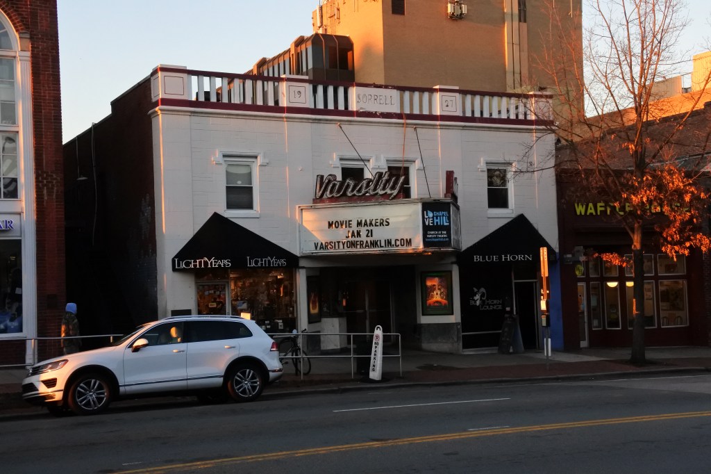
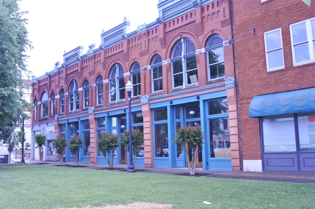
Fourth & Gill was Initially developed in the late nineteenth century as a residential area for Knoxville’s growing middle and professional classes. The neighborhood still contains most of its original Victorian-era houses, churches, and streetscapes. Similar to Old North Knoxville to the north the Post WWII era brough suburban sprawl  and the neighborhood began to decline. Many of the neighborhood’s houses were converted into low-rent apartments. During the late 1970s Fourth and Gill launched a major preservation effort and thankfully the district still contains most of its original houses. Closer to Downtown ,Emory Place is a district that developed due to the construction of the Old Grey Cemetery  and the Southern Railroad in the 1850s. By the  late 19th century a farmers’ market and several small industrial and commercial companies grew up adjacent to the train station to take advantage of its convenient location. By the early 20th century Emory Place had transitioned into a mostly residential neighborhood but its history helped it become arguably Knoxville’s most mixed-use districts outside of Dwtn.  Thanks to the dismantling of the trolley system and construction of I-40, Emory Place began to decline. A small Historic District saved some of the neighborhood’s historic buildings but much of Emory Place’s fabric was erased and the neighborhood still lacks good urban cohesion.

Because of its age and adjacent location to Downtown Fourth & Gill/Emory Place have the best urban form and cohesion of any urban neighborhood in Knoxville. Much of Center Ave is intact and Broadway is a semi-urban corridor. Many late 19th/ Early 20th century homes in Fourth & Gill remain and Emory Place has several gorgeous mid-late 19th century bldgs. The district also has consistant sidewalk & ADA infrastructure, solid public transit and bike infrastructure, a strong housing market, and good cultural amenities. To become a great urban district the neighborhood needs more people, a lot more rental options, mixed-use infill in many parts of Emory Place and along Broadway, better parks, and more retail amenities to increase walkability.

Click here to view my Emory Place Album on Flickr. And here for Fourth & Gill

URBAN STRENGTHS:

* ADA and sidewalk infrastructure is pretty high quality through the neighborhood.
* Solid public transit access and bike infrastructure.
* Great access to dwtn being only 0.5-1.5 miles from the neighborhood.
* Pretty good diversity all around especially economic.
* Pretty good diversity of for sale hsg prices but more expensive than other adjacent neighborhoods. 1-bed condos selling in the 200Ks, 2-bed 300K-500K, 3 & 4 beds btwn 300K-650K.
* The district is generally safe but Emory Place can get pretty sketchy with its large homeless population.
* Lots of attractive historic homes and a decent amount of attractive historic commercial bldgs.
* Tree canopy is good in Fourth & Gill but pretty sparse in Emory Place.
* There is certainly a good amount of buzz in Fourth & Gill but Emory Place is still a bit dodgy.
* Plenty of autocentric holes on Center and Broadly but better urban form that surrounding neighborhoods esp. along Central.
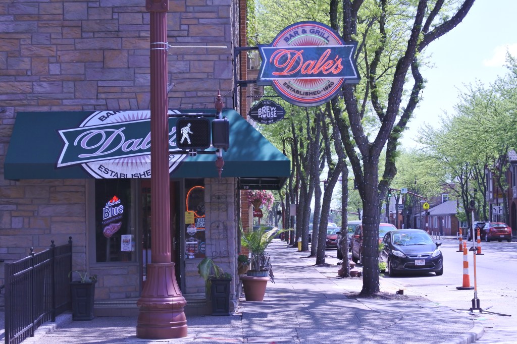
* Decent cultural amenities including several restaurants & cafes, a couple bars, several breweries, a couple art galleries & live music venues, a community theater, and very convenient access to the many cultural amenities of Dwtn.

URBAN WEAKNESSES:

* A couple smaller or specialty schools with in the neighborhood and some in the adjacent districts.
* Rentals are very hard to come by. 1-beds lease in the low 1Ks, 2-beds in the mid 1Ks-2K. and 3 beds around 2K.
* Pedestrian activity isn’t great but better than most Knoxville urban districts.
* Poor density for an urban neighborhood.
* Parks are limited to the small Fourth and Gill and the Old Grey Cemetery. A couple walks nearby in adjacent districts.
* Okay retail amenities including a couple supermarkets& drug stores just outside the neighborhood district, a couple boutiques, home good, & antique stores, a hardware store, several dessert joints, and several churches.
* Not much infill but what does exist is mediocre.

Old North Knoxville- One of Knoxville’s better urban districts

For this evaluation I included all of North Old Knoxville but extended the boundaries to Broadway and Central. This evaluation also includes the Old Holler Historic District along Central Avenue.

The housing boom reached what is now Old North Knoxville in the late 1880s. The area quickly became a prominent suburb for Knoxville’s upper middle and professional classes until the 1950s. During the 50s many of the neighborhood’s larger homes were converted into low rent apartments, leading to a decline in the area. Fortunately this lasted for only a couple decades and by the 70s/80s there was a strong preservation movement in place to renovate and stabilize the historic homes. In 1992, over 400 houses were added to the National Register of Historic Places.

On the positive side, Old North Knoxville is a generally a safe area, with good park amenities, decent bike infrastructure and public transit. It also is one of the more sought after urban districts in Knoxville due to its central location, historic housing stock, a decent walkable retail and cultural amenities. While this is one of the City’s better urban neighborhoods I just barely consider it to be a quality urban area. The main reason for this is the neighborhood’s low density, lack of pedestrian activity, hit or miss ADA infrastructure, often auto centric commercial district massing, limited walkable schools, few rental properties, and many missing retail amenities. The revitalization of Centre Avenue and Broadway as dense, mixed-use corridors would go a long ways to making this a better urban district.

Click here to view my Old North Knoxville Album on my Flickr Page

URBAN STRENGTHS:

* Decent ADA infrastructure and sidewalks. Some areas missing sidewalks and plenty of ADA curbs missing.
* Great access to Dwtn Knoxville which is only 1-2 miles away and a 5 minute drive.
* Decent bike infrastructure with several bike lanes running through the district.
* Solid diversity across the board. Only concern is that poverty is pretty widespread here.
* Lots of attractive historic homes here.
* Urban massing along Central is decent. High quality for the 2 blocks of the Old Holler Historic District. Broadway is more hit or miss.
* Generally a pretty safe neighborhood.
* Pretty good buzz. Old North Knoxville is considered urban for Knoxville and sought out by those desiring an urban life.
* Good tree canopy but below average of southern neighborhoods.
* Good diversity of for sale hsg prices.. Some small 1-beds selling in the mid to high 100Ks, 2-bed 175K-400K, 3 & 4 beds btwn 225K-600K.
* Decent cultural amenities includes several restaurants, bars, and cafes, a couple art galleries, a couple night clubs, several breweries, a historic movie house, a community theater, and convenient access to the cultural amenities of Dwtn.
* Decent retail amenities including 3 supermarkets, several drug stores, several antique and consignment stores, a record store, a couple gift stores, several e dessert stores, a several churches, and a post office.

URBAN WEAKNESSES:

* Pretty poor density for an urban district.
* Pedestrian activity not great, but better than other inner city Knoxville neighborhoods.
* Decent # of schools but mixed ratings.
* Smaller rentals are very hard to come by. 1-beds lease in the low 1Ks, 2-beds in the mid 1Ks. and 3 beds (which seem most common) around 2K.
* Parks are limited to a couple small-medium sized parks and the First Creek Greenway along the eastern edge of the neighborhood.
* Neighborhood needs more retail amenities especially banks more boutiques and antique stores, etc.

Oakwood- a Streetcar Neighborhood in North Knoxville, TN

For the evaluation I used the commonly excepted boundaries of Oakwood and extended it west to include Central Avenue and areas west to the train tracks.

Oakwood was developed starting in the early 20th century and started as a quiet streetcar community with easy access to Dwtn. The neighborhood was annexed into the City of Knoxville in 1917. The Community filled out by around WWII but the commercial districts along Central, Woodland, and Broadway were slow to development and unfortunately turned out pretty autocentric.

The district is characterized by pretty 1910s-1930s homes set on mostly sidewalk lined streets with decent bike and public transit access, and a convenient 5 minute drive to Downtown Knoxville. But I wouldn’t characterize Oakwood as necessarily walkable as the density is low, business and cultural amenities are limited, and the commercial districts are not very urban. Oakwood does have a good array of affordable/moderately priced homes, but few rentals. Overall the community is safe and there are a decent number of park amenities. What Oakwood mostly needs is a population boom and creation of mixed-use urban corridors along Central, Woodland, and Broadway. That would good a long way towards creating a quality urban district here.

Click here to view my Oakwood album on Flickr

URBAN STRENGTHS:

* Very convenient access to Dwtn. Only a 5 minute drive. Bus ride is 30-40 minutes.
* Decent bike lane infrastructure but no dedicated bike stations in Oakwood.
* Solid connectivity here.
* Excellent economic and generational diversity. Ok racial diversity.
* For sale hsg is pretty moderately priced. Some small 1-beds selling in the 100Ks, 2-bed 150K-300K, 3 & 4 beds btwn 175K-375K.
* Decent park amenities with the medium size Christen berry Ballfields and Fulton Bicentennial Park. A couple other pocket parks.
* Good tree canopy but not as full as most southern neighborhoods.
* Overall a pretty safe community.

URBAN WEAKNESSES:

* ADA infrastructure and sidewalks are very hit or miss. About 1/2 of the residential streets have sidewalks and ADA curbs are often missing from the arterial roads.
* So  public transit.
* Decent # of schools but mixed ratings.
* Smaller rentals are very hard to come by. 1-beds lease in the low 1Ks, 2-beds in the mid 1Ks. and 3 beds (which seem most common) around 2K.
* Urban form and streetscaping is pretty poor. While there are sidewalks few buildings are up to the street.
* Pedestrian activity is pretty limited.
* Fair cultural amenities including a decent mix of American & Mexican restaurants, a cafe, a couple breweries, and the Knoxville Children’s Theater. Convenient access to the cultural amenities of adjacent urban neighborhoods and certainly Dwtn.
* Slightly more retail amenities although generally set in an autocentric setting… Supermarket, a bakery, a couple drug stores, a couple boutiques/consignment stores, an ice cream store, a  post office, and a couple churches.

Chapel Hill, NC- Home to the University of North Carolina

Similar to Carrboro, its difficult to tease out what is urban and what is suburban In Chapel Hill. For this evaluation I used Carrboro as a western boundary, Umstead and Mill Race as the northern, the eastern edge of the Franklin-Rosemary Historic District, UNC to the south, and a pocket of pre-WWII development south of Franklin and west of UNC.

Chapel Hill is named after the hill it developed along and the site of a small Anglican church called the New Hope Chapel. The town was found in 1819 to serve the University of North Carolina . The community slowly grew and reached critical mass in 1880 with just over 800 people. By 1920 there were 1,500 residents and 3,650 by 1940. Growth exploded after WWII due to suburban sprawl and the growth of the university. Chapel Hill had 9,000 residents by 1950, 26K by 1970, and now hosts 64K souls thanks also to its location within the Raleigh-Durham metro and the job access propelled by I-40.

For southern standards this is a good urban environment. The university helps foster good density, ad a quality main street (Franklin St) which host good urban form, many quality mixed-use infill bldgs, many shops and cultural amenities. The City also has good public transit and bike access, decent schools and park amenities, and is generally pretty safe. Overall the core of Chapel Hill is a very comfortable environment for bikers and walkers. When one leaves the main street and enters the more residential areas, the urban form is hit or miss often missing ADA curbs and sidewalks. The density also drops in the Single family areas. Chapel Hill could also use more affordable for-sale and rental housing, a dwtn public library, and better access to non-UNC gyms.

Click here to view my Chapel Hill Album on Flickr. Here is for my UNC Album.

URBAN STRENGTHS:

* Very convenient access to the major economic powerhouse of UNC, which includes 30K students and 12k jobs. But not great access to Dwtn Raleigh or Durham.
* Overall good public transit access.
* Decent bike infrastructure with several bike lanes and plenty of dedicated bike stations.
* Great economic and racial diversity.
* Generally very good urban in-fill mainly along Franklin, Chapel Hill’s main street. Some areas of parking lots and auto centric development, but most wholes have been filled in.
* Good amount of historic architecture in the residentials streets. Some of it is good others is pretty bland. Some historic remaining along Franklin St.
* High level of pedestrian activity esp. along Franklin.
* Like most college towns a good abound of thefts but violent crime is low.
* Great tree canopy here.
* A couple well rated schools within or near this evaluation area. Plenty are located in the fringes of Chapel Hill. School ratings always high.
* Chapel hills has their own Community Land Trust to offer affordable for-sale hsg.
* Good but not great park amenities including a rec center, pool & tennis courts, a couple playgrounds & basket ball courts, and the wooded Battle Park. Lots of green spaces at UNC but not necessarily open to the general public.
* Great cultural amenities including many restaurants, bars, breweries, cafes, live music/night clubs along Franklin St. There is also a historic theater, several performing arts theaters and museums at UNC, and a decent # of art galleries.
* Excellent retail amenities as well including a supermarket, several ethnic grocerias, an urban target, several drug stores, several boutiques, banks, and gift stores, a couple book stores, a hardware store, plenty of dessert stores, a dwtn post office, a decent # of churches, and great access to the UNC medical facilities.

URBAN WEAKNESSES:

* Decent density, esp. for a southern neighborhood.
* ADA infrastructure and sidewalks is quite good along the main street and core of Chapel Hill. Very spotty in the residential areas, even in pre-WWII fabric.
* Mixed connectivity. Good in the core of Dwtn. Lots of disconnected and curvilinear streets.
* Generational diversity pretty limited.
* Rental product is much more limited than I would expect in the City core given this is a college town. 1-beds lease anywhere in the1Ks, 2-beds generally around 2K, 3-beds around 3K.
* For sale is generally expensive but some moderate options available. 1-bed condos sell btwn 250-500K, 2-beds anywhere from 300K-850K depending on size & condition, 3 & 4 beds btwn 350- the low Ms.
* No dwtn public library and gyms are limited in central Chapel Hill.

Carrboro, NC- A Progressive Community Located on the doorstep of Chapel Hill

Hard to nail down exactly what is urban Carrboro and what’s suburban. I did my best using Davie Rd as a western border, Main/Shelton as the northern, the Chapel Hill as the eastern and Jones Ferry/Carrboro as the southern.

The history of Carrboro is similar to the history of many North Carolina mill towns and largely parallels the histories of the University of North Carolina. Located just west of Chapel Hill, Carrboro was originally known as West End. It was settled in 1882 near the terminus of the railway because the state had a law that railroads had to be at least 1 mile from a university campus “to guard against possible damage to student morals and habits of study,” Most, however, viewed this as an attempt to keep students from leaving for weekend excursions. The town remained small until a 1920s building boom grew it to 1,500 residents in 1940. With the combined forces of suburban sprawl and student population growth Carrboro exploded after WWI reaching over 5K residents in 1970 and now has just over 21K souls. Current day Carrboro has a reputation as one of the most progressive communities in the Southeastern United States.

Like must successful southern urban environments Carrboro excels at retail and cultural amenities and is filled with many shops, food & beverage businesses, and live music. But the urban form is lacking largely due to its small pre-WW II population. There are still lots of surface parking lots and businesses set back from the street in the core dwtn area. Density is also low and ADA and sidewalk infrastructure is hit or miss. But there have been efforts to create a better urban environment with the creation of bike lanes and stations and quality urban mixed-use in-fill. Hopefully this trend can continue.

Click here to view my Carrboro Album on Flickr

URBAN STRENGTHS:

* Decent access to Downtown Durham via car and worse access to Downtown Raleigh. Carrboro, however, is only 1.5 miles from the University of NC with its 30K students and 12 k jobs.
* Good bike infrastructure with a solid bike lane system and bike stations in the works.
* Great economic diversity and good racial.
* Great tree canopy.
* Generally a pretty safe community but some crime likely due to the large student population here.
* Overall good historic architecture especially in the core of Dwtn. Fair amount of good urban in-fill but plenty of autocentric infill too.
* Pretty good vibrancy and def. plenty of local buzz.
* Walkable access to several quality public elementary schools. Middle and high schools are just outside of walkable access.
* Rentals are pretty moderately priced with a decent amount of product.. 1-beds lease in the low-mid 1Ks, 2-beds in the low-mid 1Ks,m 3-beds mid 1Ks-2K.
* Carrboro and Chapel Hill have a Community Land Trust, model for aff for-sale hsg.
* Great cultural amenities including many bars, restaurants, & cafes, several live music venues and night clubs, a performing arts center, and lots of art galleries. Decent access to cultural amenities in neighboring Chapel Hill.
* Quality retail amenities as well including a supermarket, several ethnic grocerias, a butcher shop, a couple drug stores, a hardware store, several boutiques & consignment stores, several antique and home good stores, plenty of banks, a toy store. lots of gift stores, several gyms, plenty of dessert shops, a dwtn public library, several churches, and good access to the UNC hospitals 1-2 miles aways.

URBAN WEAKNESSES:

* Density is pretty poor for an urban district.
* ADA Infrastructure and sidewalks are pretty hit or miss outside of the main Dwtn area.
* Public transit access is so  .
* Street connectivity is hit or miss. A decent grid in the core of Dwtn but plenty of disconnected and curvilinear streets.
* Being a college town, not a ton of households w/ families and def a younger crowd.
* Park amenities are pretty limited including a couple small parks and short bike greenway segment in the core of Carrboro. But there is a large recreation center in the center of town.
* Urban form and streetscape is also a pretty mix bag. The form of Dwtn is mostly good but plenty of surface lots and set back bldgs mixed in. Streetscape is similar.
* For sale hsg is on the expensive side but not terrible. 2-beds generally sell btwn 250K-650K, 3 & 4 beds btwn 350K-850K. 1-bed options are very limited.
* Lots of more affordable rental product seems to be on the outskirts of town unfortunately.

Canonsburg- One of Pittsburgh’s oldest Suburbs

I included most of Canonsburg in this evaluation but excluded the less than urban edges with limited sidewalks south of I-79, west of Oak Spring Rd, and north of North and Gladden Roads.

Canonsburg was laid out by Colonel John Canon in 1789 and incorporated in 1802. It quickly grew to 500 residents in 1820 and 650 by the Civil War. Canonsburg hosted the first institution of higher learning west of the Allegheny Mountains, Jefferson College, founded in 1802. The school would go on to become Washington & Jefferson College in nearby Washington in 1868 leaving Canonsburg is severe economic straights. Fortunately the railroads and industrialization came to the Borough leading to a second population boom. By 1900 the borough reached 3,000 residents and 12,500 by 1930 but fell  to 8,600 residents by 2000 following the trends of most historic Western PA towns. Surprisingly the Borough’s population has begun to raise and as of 2020 9,744 residents called Canonsburg home.

From an urban perspective Canonsburg has a solid historic main street along Pike St., and hit or miss residential streets. The Borough has solid economic & generational diversity, great public schools, quality parks & recreation, affordable housing, and solid retail amenities. To become a quality urban district the Borough needs better density, bike infrastructure, and connections to Dwtn Pittsburgh via transit, more consistant ADA infrastructure, better cultural amenities, and just more vibrancy and activity. There is also lots of blight still to clean up in the Borough.

Click here to view my Canonsburg Album on Flickr

URBAN STRENGTHS:

* Economic and generational diversity.
* Several excellent public schools within Canonsburg and an excellent public high school in the adjacent Strabane that should be in the same school district.
* Canonsburg Town Park is expansive with diverse amenities including a pool tennis court hiking trails, playground and ball fields. The borough also the Falconi Fields and couple other smaller parks.
* Some interesting historic architecture along the main street but generally pretty plain in the residential areas.
* A decent # of rentals and generally affordable. 1-beds lease btwn $600-1K, 2-beds in the 1Ks, and 3-bed houses in the high 1Ks and low 2Ks.
* For-sale is also pretty affordable. 1-beds (not many) sell in the low 100Ks, 2-beds btwn 10K-300K, 3 & 4 beds 150K- ~ 400K.
* Seems to be several afford. hsg projects in Canonsburg.
* Pretty good retail amenities including a Shop n Save, Rite Aid, several boutiques & consignment stores, a toy store, antique & home good stores, several banks, a post office, plenty of dessert shops and bakeries, several gyms, and a Public Library. There is also the Canonsburg hospital and tons of churches.
 While Canonsburg has some blight and grit it is actually a very safe place to live.
* Good urban form in the core 4-5 blocks Canonsburg. Pretty autocentric outside of this core area.

URBAN WEAKNESSES:

* Pretty poor density for an urban area.
* So  access to Dwtn. About a 25-30 drive but 50 min public transit ride.
* Transit service is limited to several trips to Dwtn per day on week days and only a couple on the weekend.
* Bike infrastructure is non-existent.
* Poor racial diversity.
* Tree canopy is hit or miss in the residential areas, poor in the biz district, but good along hillsides and valleys.
* Ok cultural amenities including several American restaurants & bars, a couple cafes, a couple breweries. Missing any art galleries, live music venues, theaters/cinemas, or museums.
* ADA infrastructure is pretty decent along the Biz Corridor but very hit or miss along the residential streets. Plenty of missing ADA curbs and often missing segments of sidewalk.
* Not great pedestrian activity.
* Not much in-fill and what does exist is generally pretty bad.

Bridgeville- Western PA’s Borough named after a Bridge

I included the portion of Bridgeville that at least had some semblance of sidewalk connectivity. Areas of Bridgeville I excluded from the evaluation where areas east of New York Rd. and north of McLaughlin Run.

The village that eventually became Bridgeville gained its name after the first bridge built at the crossing of Chartiers Creek at the south end of what is now Washington Avenue. For nearly 100 years, Bridgeville was a village within Upper St. Clair Township, known for its one bridge over Chartiers Creek where people would meet to trade goods. This evolved into an informal name of the village that sprung up north of the bridge starting in the 1830s. As mining operations began in the 1880s  Bridgeville grew to around 1,000 residents in 1900 and shortly after was incorporated as a Borough. Its population quickly grew in the early 20th century to 4,450 residents in 1940 and maxed out in 1960 at just over 7K residents. Like many Western PA communities Bridgeville has seen a steady population decline but not as severe as other communities. Bridgeville now has just under 5K residents.

Bridgeville’s evaluation score was 90, the minimum level I consider to be an urban community. That’s because Bridgeville has a mix of positive and negative attributes from an urban perspective. On the positive side Bridgeville has a decent Dwtn area, with plenty of retail, many restaurants and bars, good mix of affordable for-sale housing, quality historic architecture, decent urban massing, and some walkability. However, it lacks good density, quality transit and bike infrastructure, has fair ADA and sidewalk infrastructure, only one walkable school, limited cultural amenities, and has a rather tired and dated looking streetscape. Obviously there are many areas for urban improvement in Bridgeville but the Borough has the urban bones and a strong enough housing market to become a solid urban community.

Click here to view my Bridgeville Album on Flickr

URBAN STRENGTHS:

* Decent access to Dwtn. 20 min drive and 40 min bus ride.
* Great economic and generational diversity.
* Decent medium sized parks (McLaughlin and Chartiers Park).  Bridgeville Historic Society Park is centrally located but small. No swimming pools.
* Bridgeville is overall a safe community. Still a fair amount of grit and some vacancy, especially with commercial bldgs.
* Good mix affordable and moderately priced for sale housing. 1 & 2-bed condos sell btwn 60K-125K, 2-beds sell anywhere btwn 100K-250K, 3&4-beds generally btwn 150K-400K.
* Several affordable housing towers in town.
* Okay cultural amenities include several American restaurants & bars, a good # of cafes, the Bridgeville Historic Society, there is a cineplex just north of the Borough in Collier Township.
* Good retail amenities include a supermarket, a drug store, several boutiques, a couple antiques, a couple hardware stores, a  couple of banks, gyms, and bookstores, a bookstore, a public library, local post office. A major shopping plaza is just north of Bridgeport with a home depot, supermarket TJ MAX and lots of other stores but access is dicey for pedestrians.
* Good historic architecture.
* Mix of good and fair urban massing.
* Good tree canopy in the residential areas but pretty limited in the main St.

URBAN WEAKNESSES:

* Density is pretty poor.
* ADA infrastructure is pretty decent along the Biz Corridor but very hit or miss along the residential streets. Plenty of missing ADA curbs and often missing segments of sidewalk.
* Overall transit access is so .
* Connectivity is fair.
* No bike infrastructure here.
* With 90% of the population as White, racial diversity is limited here.
* Bridgeville is in a good school district, Chartiers School district, but only a small elementary school is walkable and located within the borough.
* Some rental product but generally affordable. 1-beds lease btwn 700 & the low 1Ks, 2-beds around 1K but not many of them.
* Culturally Bridgeville is missing any art galleries, there are few museums, limited live music venues.
* Limited modern in-fill
* Streetscaping is ok but pretty tired.

Maumee, OH- Historic Toledo suburb near the Battle of Fallen Timbers

In general I included in this evaluation the pre-WWII fabric between Anthony Wayne Trail and the Maumee River.

Maumee is the site of Gen. “Mad” Anthony Wayne’s final fort, Fort Deposit, built in Aug. 1794 on his way to the battle of Fallen Timbers. Shortly after the war of 1812 a town plat was laid out at the begin of the Maumee River rapids and within a decade, the Maumee was gaining recognition as a major trans-shipment point connecting Lake Erie and lands to the west. The town quickly reached 840 residents by 1840. Yet dreams of greatness began to fade in the 1850s, when ships too large to navigate the river were introduced for use and railroads began to replace water transport. The town stagnated and only grew to 1,856 residents by 1900. The City did start to see steady growth in the early 20th century growing to 3,100 by 1920 and 4,600 in 1940. But it took its integration into Toledo’s outer belt system to really propel its growth. Maumee reached 15,747 in 1970 and  has slowly lost residents since then.

Similar to Perrysburg, Maumee has a compact main street running along a couple blocks Conant St. surrounded by several blocks of 19th century historic home. Its pre-WII fabric then sprawls out to the east more or less following the Maumee River. Central Maumee’s greatest assets are its park amenities, quality walkable schools, compact & attractive main street, tree canopy, and affordable for-sale housing. It lacks quality public transit and bike infrastructure, a central supermarket, racial diversity, and could use significantly more rental options and housing in general as Maumee’s density is very low.

Click here to view my Maumee album on Flickr

URBAN STRENGTHS:

* ADA Curbs- Generally good but some spots without ADA current curbs and a couple spots without sidewalks.
* Generally good connectivity but plenty of dead ends and disconnected blocks.
* This is a very safe City and consistantly on the top of most safe cities in Ohio.
* Excellent generational diversity with a high % of households with kids. Decent economic diversity.
* Very attractive historic architecture in Dwtn and in the core residential areas.
* Overall very good tree canopy.
* Cultural amenities are modest including a couple restaurants & bars, several cafes & art galleries, the Historic Maumee Theater, and the Wolcott House musem.
* Also modest retail amenities including a drug store, a dollar store, a couple of boutiques, a couple home good stores, several banks, a florist, several dessert joints and gyms,  and a dwtn public library.
* Great park access including several small parks, the mediun size Tow Path Park and River walk, and the expansive Side Cut Metropark.
* Good walkable schools options including quality k-12 public school options and a Catholic grade school.
* Lots of affordable & modest for-sale hsg option including some 1-bed homes selling in the low 100ks, 2-bed selling anywhere btwn 100K- the low 300Ks, 3 & 4 beds btwn 150K-400K.

URBAN WEAKNESSES:

* Pretty poor transit access.
* Poor density. More in-line with a suburb.
* While there are limited transit options to Dwtn it is only a 18 minutes drive. One can bike it along River Road in about 50 mins.
* Some bike lanes connecting Dwtn to the metro parks but really nothing else bike infrastructurewise.
* Poor racial diversity.
* Some half decent urban infill along Conant St but plenty of crummy auto centric bldgs along Anthony Wayne Trail.
* No supermarket nor post office Dwtn.
* Rental hsg is modestly priced but very limited.

Perrysburg, OH- Historic Toledo suburb and home to Fort Meigs

The evaluation area includes Boundary Streets to the west and east, 7th St to the south and the Maumee River to the north.

By the War of 1812 Perrysburg was a settlement of 67 families. The town quickly grew to 1,000 in 1840 and served as the county seat from 1822 to 1868. Things remained pretty unchanged in the 19th century with the population only reaching 1,766 by 1900. The town’s population steadily grew in the early 20th century reaching 2,400 by 1920 and 3,457 in 1940. Perrysburg’s population really took off after 1960 with suburban sprawl and its connection highway connection to I-75. At this points Perrysburg became integrated into the Toledo metro and the City now has 25K souls.

Fortunately historic Perrsyburg has retained its charm and is in-tact. This includes an attractive several block main street along Louisiana Ave, the Perrysburg Historic District along the Maumee River including lots of great 19th century housing, and many blocks of attractive early 20th century housing. Perrysburg also has excellent schools, quality ADA infrastructure, lots of moderately priced housing, and decent cultural, retail, and park amenities. For Perrysburg to become a great urban environment it needs more density and housing. I sense a fair amount of exclusivity here as there are few residents living in poverty and very limited rental options. Perrysburg also needs better public transit and bike connections.

Click here to view my Perrysburg, OH album on Flickr

URBAN STRENGTHS:

* Generally very good ADA and sidewalk infrastructure.
* Quality tree canopy.

* Connectivity is good an even includes a couple diagonal roads.
* High number of households with families.
* Lots of quality walkable schools in the core of Perrysburg, both private and public options. High schools is unfortunately located on the edge of town.
* Good range of for-sale housing. A handful of 1-bed options selling in the low-mid 100Ks, 2-beds btwn 150K-250K, 3 & 4 beds 175K-500K with some of the mansion selling in 600 & 700Ks.
* This is a very safe community.
* Decent # of bars & restaurants along Louisiana Ave (Main St), a local brewery, and a couple of cafes. Also a couple of art galleries. The Fort Meigs Historic Site is located just outside the historic core.
* Decent park amenities with a couple nice riverfront parks and the expansive Woodland Park on the Eastern Edge.
*  Good retail amenities including a grocery store, lots of boutiques, a couple of consignment stores, home good stores, banks, gyms & floral shops, several dessert joints, a dwtn public library, and several churches.
* Pretty good urban massing in the biz district and quality streetscaping overall.

URBAN WEAKNESSES:

* While there are limited transit options to Dwtn it is only a 15 minutes drive. One can bike it along River Road in about 50 mins.
* Very low density of an urban area.
* Public transit access is very limited.
* Bike infrastructure is very limited.
* Racial and economic diversity is so .
* Rental hsg is very limited. Really no studio and 1-bed options. Some 2-beds leasing in the low to mid $1,000s.
* Affordable hsg exists in Perrysburg but is relegated to the outskirts of town.
* Missing retail amenities include a drugstore, a bookstore, and hospital is about 1 mile outside of town.
* Urban in-fill is a half-hearted attempt for urbanity as buildings are generally historic looking but still often pretty autocentric. Not terrible though.

Downtown West Palm Beach, FL

For the borders of Dwtn West Palm Beach I use Royal Palm Way as the southern boundary, Sapodilla Ave to the west, Banyan Blvd and Quadrille Blvd to the north and the bay to the east.

I divide Downtown West Palm Beach into three districts: City Place- the new urbanist/town center development west of Quadrille Blvd; Clematis St- the historic main street which dead ends into a great urban park; and everything north and south of Clematis St which is pretty dead and half developed.

Downtown West Palm Beach fell on pretty hard times in the 70s/80s due to crime and suburban sprawl issues. But like most American downtowns it saw re-birth in the 90s thanks to the preservation and renovation of the Clematis main street and the construction of City Place. Since those major improvements there has been a consistant trickle of new apartment buildings Downtown, slowly improving the viability of Dwtn as an urban neighborhood.

But to become a great urban district West Palm Beach needs significantly more mixed-use urban in-fill in the portions of Dwtn north and south of Clematis St, better bike infrastructure, more affordable rental options, and more retail options outside of Clematis and City Place.

Click here to view my Downtown West Palm Beach Album on Flickr

URBAN STRENGTHS:

* Great density for a Downtown.
* Excellent ADA infrastructure and streetscaping along Clementis (historic main street) and the City Place Development. More hit or miss in other parts of dwtn with current ADA curbs often missing.
* Connectivity is generally good Dwtn but there are several wide, fast moving boulevards here.
* Generally a pretty high median income but also 25% of Dwtn residents are in poverty. Pretty good generational diversity and decent racial diversity.
* Decent amount of affordable housing options Dwtn.
* Good tree canopy throughout most of Dwtn, especially at City Place.
* Good park amenities overall with the riverfront running down the entire length of the bay attached is several larger parks. Centennial Park is the best park Dwtn with an amphitheater, fountains, large lawn, and space for farmer’s markets. City Plaza also has some attractive plazas spaces but small.
* Centennial Park functions as a quality civic space given its location at the end of Dwtn’s historic main street.
* Cultural amenities include a good array of restaurants, bars & cafes esp. concentrated at City Place & along Clematis; several art galleries (City Place), a cineplex, a couple performing arts center, and a comedy club, a couple music themed bars, several night clubs, and a couple of local museums. The convention center is located on the southern edge of Dwtn.
* Retail amenities include a Publixs and Gourmet Grocery store, several drug stores, many retail stores, boutiques and shops in the Square Shopping Mall; several boutiques/vintage stores on Clematis, several home good stores, plenty of banks, a couple of bookstores, tons of dessert shops & bakeries, lots of gyms, the main public library, and plenty of churches, and a major hospital is only 1/2 north of Dwtn.
* Overall this is a very safe dwtn.
* Decent college population of about 4-5K btwn PM Atlantic University & PM State College.
* Wonderful urban in-fill at City Centre. The rest Dwtn is a mix of bland 60-20s office bldgs and better modern high-rises.

URBAN WEAKNESSES:

* Public transit is only decent Dwtn and in a handful of districts surrounding it. Most the City of West Palm Beach of fair-poor public transit access. Transit access to surrounding suburbs is similar.
* Dedicated bike lanes within Downtown and the City of West Palm Beach are limited to mostly waterfront trails. Some good connections to the suburbs. Dwtn also just rolled out dedicated bike stations in only Dwtn.
* Decent access to schools including a really great Arts High School and a couple Christian elementary schools.
* For sale housing is generally pretty expensive but smaller condos are moderately priced. Studios sell around 200K, lots of 1-bed condos selling btwn 200K-500K, most 2-beds sell btwn 300K-700K but some in the Ms, 3-beds generally 500k- the low Ms.
* Rentals are more expensive with studios leasing in the 2Ks, 1-beds generally in the 2-3Ks, 2-beds generally 3-4Ks, and 3-beds around 5K.
* No sports arenas dwtn.
* Dwtn hosts around 30K employees. Less than Ft. Lauderdale but not terrible considering the City’s size.
* Retail amenities are highly concentrated at City Place and along Clematis. The rest of Dwtn isn’t terrible mixed-use.
* Skyline is pretty bland.
* Historic architecture is pretty much limited to Clematis with a scattering through the rest of Dwtn (not including City Place).
* Dwtn is pretty dead along its southern and northern edges. Lots of surface parking and vacant lots here. Great urban massing at City Centre and Clematis.