Tarentum, PA- A well built but blighted rivertown 20 miles from Downtown Pittsburgh

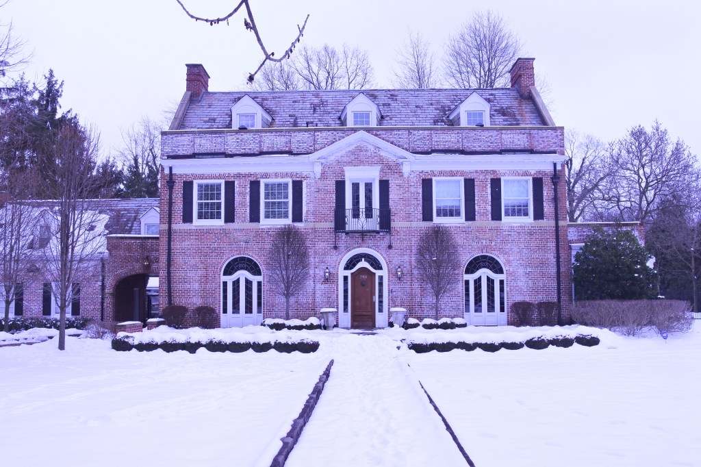
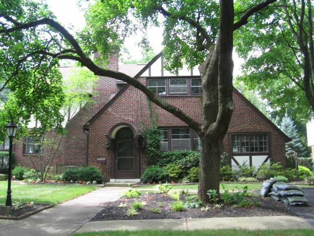
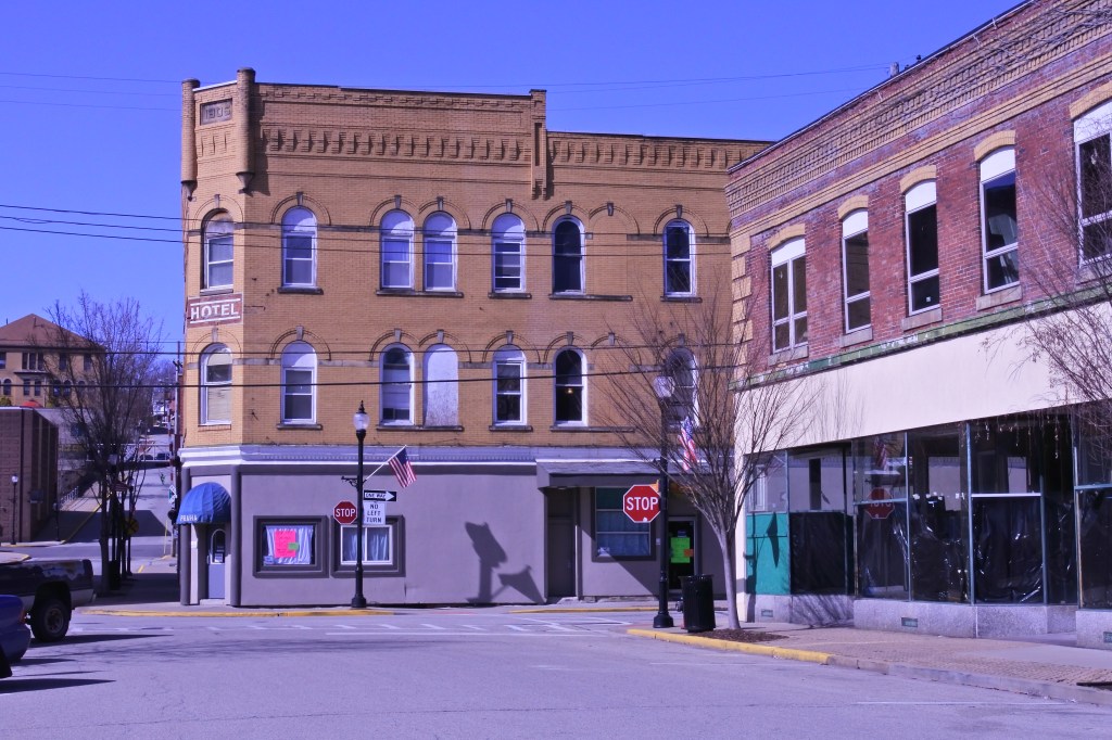
Tarentum is located about 20 miles up the Allegheny River from Dwtn Pittsburgh. This rivertown developed after the Civil War, rapidly expanding in the late 19th century and reaching 5,400 residents in 1900. The borough peaked at nearly 10K souls in 1940. But like most Western PA river towns it has been on a steady population decline since WWII and now Tarentum has just over 4K residents.

Tarentum was a well built city and hosts a fairly expansive Dwtn with main street like buildings across several streets and several bulky historic mixed-use buildings (including a large abandonded Opera House). There is also a historic main street along Freeport in Western Tarentum that is largely in-tact but very blighted. Nice homes climb the hill north of Dwtn but most housing is historic worker housing. The oldest homes in Tarentum are near the Allegheny River, which also hosts a really nice riverfront park.

There is some hope for a revitalization of Tarentum. There is a small but dedicated group of local businesses downtown, many well built historic commercial buildings ripe for renovation and most of the housing stock is still in tact. It will be interesting to see if the slow drive of revitalization along 28 reaches Tarentum some day. 
Click here to view my Tarentum album on Flickr

URBAN STRENGTHS:

* Consistent sidewalks infrastructure, but modern ADA curbs are hit or miss. More within the biz districts.
* Some nice Dwtn Historic architecture. Mix of nice residential buildings (north of Dwtn) and gritty worker housing (West Tarentum).
* Lots of family households and decent economic diversity.
* Culturally Tarentum has a decent set of restaurants and bars, some live music venues,  a handful of cafes, a nice art gallery, a local museum.
* Crime is very low here but plenty of blight and abandonment. 
* Pretty good urban form remains in Dwtn Tarentum and even along Freeport in West Tarentum (although its a very gritty and underutilized biz district).

URBAN WEAKNESSES:

* No bike infrastructure.
* Transit access is so  but decent in the Dwtn Tarentum.
* Modern in-fill is limited. What does exist is mostly crummy autocentric uses.
* Rentals are very limited.
* For sale housing is inexpensive. Most product sells between 50K and low 100Ks. Some homes selling in the 100Ks but plenty below 50K.
* Tarentum has a very nice riverside park with multiple amenities but nothing else, meaning park space is not convenient to many of its residents.
* Some nice retail amenities downtown including a local pharmacy, family dollar, post office, a florist, a couple banks, jeweler, and several boutiques.
* Walkable schools limited to one public school.

Springdale, PA- Childhood home of Rachal Carson located only 25 mins from Downtown Pittsburgh

Springdale’s claim to fame is that it is the childhood home of marine biologist and author of Silent Spring, Rachael Carson. Perfect setting as Rachael Carson witnessed first hand the environmental destruction that modern industry can create on the environment and liked in the shadow of a very distinctive power generation plan with massive twin smokestacks. Other than this claim to fame, Springdale is yet another rivertown built on industry during the turn of the 20th century. Its population peaked in 1960 at 5,600 and has been in a steady decline ever since now hosting just over 3,000 residents.

Springdale is a relatively stable post-industrial town with a medium income near the Allegheny Co. average, limited poverty, and some blight (concentrated along its main street and near the Allegheny River). The main street hosts several nice in-tact blocks with a decent array of local businesses,. Beyond this Pittsburgh Street becomes pretty drab and semi-autocentric. It would be nice to see more businesses and in-fill along Pittsburgh St. and a renewed interest in Springdale. This might happen as some river towns along route 28 closer to Dwtn Pittsburgh have started to witness revitalization. If not, Springdale will likely continue on without much change.
Click here to view my Springdale Album on Flickr

URBAN STRENGTHS:

* Some nice historic architecture.
* While transit access isn’t great, only a 23 minute drive to Dwtn.
* Economically this is a very middle class community.
* High percentage of family households (56%)
* Crime below the national average, although there is some grit and vacancy especially Btwn Pittsburgh St and the River.
* Good tree canopy.
* Some local retail along Pittsburgh St but not a ton (i.e. dollar general, ice cream, a bookstore, jeweler, florist, post office, public library, and a couple banks and salons).
* The junior high and high school are walkable and located within Springdale Borough limits. A Christian school located in the adjacent Cheswick community.

URBAN WEAKNESSES:

* Sidewalks are consistent but really no ADA standard curb cuts.
* Modern in-fill is very limited.
* Transit access is so .
* No bike infrastructure.
* Pretty low density for an urbanized area.
* Relatively stable housing market, but not much variety in price point. For-sale generally ranges from 60K-180K depending on size and condition.
* Rental options are very limited.
* Park amenities limited to Veterans Memorial Field (home to several sports fields) and couple other greenspaces
* Cultural amenities limited to a handful of Americana restaurants, some bars, a local brewery, and the Rachael Carson Homestead Museum.
* Good urban form for several blocks along Pittsburgh St. but beyond this it becomes pretty semi-autocentric. Same idea follows for the streetscape.

Irwin, PA- Historic Town 30 miles east of Downtown Pittsburgh

I only included a small portion of Irwin in this evaluation. It’s the portion north of Penn Highway and west of Locust St. This is the older most walkable portion of Irwin where sidewalks are consistent.

Irwin was a very small community through most of the 1800s.  It began to take off in the late 1800s with the discovery of extensive  bituminous coal deposits and by 1900 had reached around 2,500 residents. Its population maxed out in 1980 with around 5,000 (thanks to some suburban annexation). Unfortunately Irwin has lost just over 1,000 residents since then. Fortunately Irwin is still pretty healthy, especially for Western PA standards. It has a vibrant main street with lots of shops and restaurants open and its residential fabric is mostly in-tact with a stable housing market.

My hope is that Irwin can stabilize its population decline soon, allowing it to grow more neighborhood serving retail and start to fill-in underutilized buildings and spaces. Other urban improvements include more walkable schools, better bike infrastructure, and public transit access. Irwin could also use some immigration not only to help stabilize its population but to add diversity to a place where Whites make 95% of the population. 
Click here to view my Irwin album on Flickr

Urban Strengths:

* Pretty good density.
* Nicely connected street grid, convenient for pedestrians.
* Stable housing market with most product selling in the 100Ks. Some lower end product btwn 50-100K. Some higher end product selling in the 200Ks.
* Consistant sidewalks in Irwin. Current ADA ramps typical in the downtown area but rare in the residential streets.
* Irwin Park is a very nice one with lots of amenities. But its the only park in Dwtn Irwin.
* Some nice cultural amenities including a  nice array of restaurants, bars & cafes, a community theater, a couple historic sites, and an art center.
* Good array of neighborhood amenities as well including a post office, lots of boutiques and locally owned stores, antique stores, a toy store, many churches, and other neighborhood retail.
* Very nice urban form in the Dwtn Irwin. Some surface parking lots but generally off the main street. Streetscaping is also pretty good. 

Urban Weaknesses:

* Pretty poor public transit access, although downtown Pittsburgh is only a 30-35 min drive.
* No bike infrastructure.
* Rentals are very limited.
* No walkable supermarkets or larger retailers.
* Only the Catholic grade school and music school are located within Dwtn Irwin. All other schools are located on the outskirts of Irwin and not walkable.
* Modern in-fill is very limited. 

Jeannette, PA- Once the Glass Capital of the World

Jeannette was first incorporated as a borough in 1889 and quickly grew to 3,000 residents by 1890. Jeannette earned the nickname “the glass city” as it became a major glass producing center for the US. Some estimates indicate the borough produced 70-85% of the world’s glass at one point. Jeannette was also Westmoreland County’s first truly industrial town and rapidly grew to 8,000 residents by 1910. At times, there were as many as 7 significant factories operating in the borough. Jeanette reached its height at 16,000 residents in 1950 but the post WWII decades were not kind to the City as only 9,000 residents now reside in the borough.

What remains of Jeanne is an impressive historic main street, but with many vacancies and vacant lots. Still some shops remain, but nothing like its heyday. Residential areas immediately surrounding downtown and in the industrial flats have been hardest hit with the hillside neighborhoods mostly in tact. Sadly Jeannette is likely to continue its slow decline without drastic changes like an influx of immigration, or major reinvestment effort into its downtown and neighborhoods. Towns like this make me wish the US has an immigration policy incentivizing resettlement of rust belt cities. That seems to be its only hope of coming back. 
Click here to view my Jeannette Album on Flickr

URBAN STRENGTHS:

* Decent economic diversity but also high poverty here (22%).
* While there is lots of blight and vacancy here, very low crime rate.
* High pct of family households (58%)
* While dwtn Jeannette is certainly very blighted there is still a decent amount of walkable retail remaining including a drug store, library, post office, a couple banks, a dollar general, florist. a liquor store, jeweler and several other general retail options. Some retail on mixed-use streets throughout Jeannette.
* Some nice historic buildings Dwtn. Nothing extraordinary about the housing stock generally.
* The massing of the main street is actually pretty good even though there is significant blight Dwtn. Outside of dwtn commercial is generally mixed-use with decent urban form.

URBAN WEAKNESSES:

* Limited current ADA curb ramps and plenty of areas missing sidewalks and curb cuts.
* Very low density for an urban area.
* Poor public transit and therefore multi-model access to Dwtn.
* No bike infrastructure in Jeannette.
* Housing is very inexpensive. Large amount of product below 100K and much of it below 50K. The most stable product is generally further from Dwtn and selling in the low to mid 100Ks.
* Rentals are pretty limited and very inexpensive.
* Parks a limited to a couple playgrounds and ball fields.
* Cultural amenities limited to a handful of restaurants (many of them Italian) and bars along with the Italian cultural center.
* Several decent walkable schools including a public elementary, middle, and high school and Catholic Grade school.
* No recent investment in streetscaping. Looks very tired.

Greensburg, PA- County seat of Westmoreland Co. 30 miles outside of Pittsburgh

In the early 19th century, Greensburg had very little growth in population.  After 1850, Greensburg became a growing county seat with inns and small businesses. By 1870 it had 1,600 residents. The railroad and discovery of large areas coal reserves nearby added commerce and residents during the turn of the 20th century. Its population reached 6,500 in 1900 and doubled a decade later. Like most western PA towns Greensburg entered into decline after WWII but much less severe than other comparable cities due to its location as County seat and annexing a significant amount of its suburban growth. By the mid-1990s, city officials shifted revitalization plans to the cultural aspects of Downtown leading to projects like the Palace Theater and historic Train Station, as well the new Seton Hill performing arts. New businesses are filling many historic storefronts in Downtown Greensburg (especially along Main and Pennsylvania Avenues).

There area certainly plenty of areas Greensburg can improve from an urban perspective. First of all it has a very low population density making vibrancy and walkability more challenging. Its commercial district become mostly auto centric outside 1/2 mile of Dwtn, even if the surrounding neighborhoods were built before WWII. ADA and Bike infrastructure is certainly wanting and racial diversity is limited. Similar to Latrobe, an increase in immigration would provide many urban benefits to Greensburg.
Click here to view my album on Flickr

URBAN STRENGTHS:

* Good economic, and generational diversity.
* Generally a pretty same community although certainly a fair amount of blight, but not widespread vacancy in Greensburg.
* Nice amount of rental product that is generally affordable.
* Some excellent historic architecture, especially Downtown and in the more affluent north and east side neighborhoods.
* Solid tree cover.
* Several nice parks including St. Clair Park, the County Courthouse Plaza, Coulter Playground, Grove St. Park, and expensive grounds at Seton Hill, and Lynch Park (located just outside the city but close to Dwtn).
* Some nice cultural amenities here including: the Palace Theater, Greenfield Civic Theater, A Performing Arts Center, an Art Museum, decent amount of restaurants, bars, and cafes, several art galleries, and cultural offerings of Seton Hill.
* Decent neighborhood amenities including several supermarkets & Pharmacies, a Dwtn library and post office, Ollies bargain store, a hardware store, and plenty of boutiques, local clothing stores, antiques, banks, & jewelers in the Dwtn area. A full service hospital is located on the Westside of town.
* Good array of walkable schools including a Catholic elementary and high school along with a several public grade schools and a middle school. The Public high School is on the outskirts of town. 

URBAN WEAKNESSES:

* Decent ADA and sidewalk infrastructure. Some areas with missing or crummy sidewalks and modern ADA curb cuts is about 50% of all intersections.
* Decent public transit access in Dwtn and surrounding streets, but this drops off pretty quickly as one moves away from Dwtn.
* Nice recreational trail on the eastern side of Dwtn connecting to Youngwood. Other than this, bike infrastructure is limited.
* For sale housing is plentiful but generally pretty affordable. Also generally just SF options. Housing prices range from 50K-250K with more stable housing in the north and east sides of town.
* Solid walkability and urban form in the Dwtn area and on commercial streets extending about 1/2 out. Beyond this, the biz district become very autocentric and run down. 

Latrobe, PA- Childhood home of Mr. Rogers and Historic producer of Rolling Rock Beer.

Latrobe was founded in 1854 and quickly became a significant industrial hub due to its location along the Pennsylvania Railroad. Along with being the childhood of Mr. Rogers, Latrobe is famous for housing one of the largest breweries in the United States and the maker of Rolling Rock beer. Latrobe hit its population maximum in 1960 at 12K but is now down to just under 8K. This is actually a pretty manageable amount of decline for an old Pittsburgh steel town. Many are much worse off.

Latrobe has several nice blocks of in tact historic main street fabric along both Main St and Ligonier Ave. Certainly plenty of historic commercial buildings outside of this core area, but not great main street cohesion. Occupancy is spotty with some nice store fronts but plenty of vacancies or occupied 1st floor and vacant floors above.  Latrobe’s most stable housing market is east of Lincoln Ave where most homes sell well into the 100ks. The rest of Latrobe is mostly working housing selling between 50K and the low 100Ks.

To become a quality urban area again Latrobe should start with a Main St. revitalization focus reoccupying its storefronts and upper floors. This would certainly foster vibrancy and interest in the city. Other improvements include more walkable schools, better bike infrastructure, consistant ADA infrastructure, more rental options, and a hub for immigrants. Latrobe needs to more population and lacks diversity. With cheap housing, it is well poised to attract immigrants.
Click here to view my Latrobe album on Flickr

URBAN STRENGTHS:

* While there is certainly some blight in Latrobe crime is low.
* Very healthy medium income and a low poverty rate. High percentage of family households as well (nearly 60%).
* Solid park recreations well distributed throughout the borough.
* Decent walkable retail/neighborhood amenities including a Shop’n’Save, drug store, a library, post office, bakery, a dollar general, several boutiques, toystore, and a hospital.
* Some very nice historic architecture along Main St. and larger early 20th century historic homes on the east side of town.
* Decent urban form along Main St. for a couple blocks but it quickly breaks down to a semi-autocentric form. Ligonier also has a couple good blocks but then transitions into a gritty mixed-use street.

URBAN WEAKNESSES:

* Pretty poor density for an urban area.
* Generally consistent sidewalks and curb cuts but few ADA standard infrastructure.
* Limited bike infrastructure but a very nice recreational trail along the Lincoln and short path along the river.
* This a very white community (~96%) with limited racial diversity.
* Homes are very affordable but a stable market. Most homes sell between 50-200K. Some large mansions selling between 200K-300K.
* Rentals are very affordable but also limited.
* Cultural amenities limited to a handful of restaurants, bars, cafes, the Latrobe historic society, the Latrobe Art Center, and a couple other small art galleries.
* Walkable schools are limited to a public elementary, Catholic school and community college. The middle and high school are located out on the edges of Latrobe.

Bexley, OH Columbus’ most exclusive historic suburb

Founded as a village over a hundred years ago, Bexley is an old, tree-lined suburb of Columbus. By 1928 Bexley achieved a population of 5,000 and thus officially became a city in Ohio. By 1950 the City’s population reached 12K and has been mostly flat ever since. Thanks to is older fabric, Bexley scores pretty well from an urban and walkability perspective.

The historic suburb is also known for its large houses and estates and hosts the famous Jeffrey Mansion,  the home of the president of The Ohio State University, and the Ohio Governor’s Mansion. This certainly adds a layer of exclusivity and explains why Bexley scores low in diversity and affordability. Other urban areas for improvement include more density and better urban in-fill along its commercial district on Main St. Both of these improvements would also improve Bexley’s vibrancy and make it more inclusive.

Click here to view my Bexley album on Flickr
URBAN STRENGTHS

* Solid ADA infrastructure and generally sidewalks exist.
* Transit access is decent but only a 5-10 drive to Downtown.
* Several dedicated bike stations especially around Main St., and a nice dedicated north-south bike lane along Alum Creek but not convenient connections to Dwtn.
* Overall this is a very safe community, but not surprisingly pretty high number of burglaries.
* Great generational diversity with 71% family households and a large amount of college students as well.
* Several nice parks and recreational amenities including the Alum Creek Rec trail, Jeffrey Park, Nelson Park, and Walk Park. The Franklin Park Conservatory is also just across the river. These are also concentrated along the western edge of Bexley, so many portion of the neighborhood don’t have walking access to a park.
* Cultural amenities include a good array of restaurants, bars, and cafes along Main St., The Schumacker Gallery & Bexley Historic Society, the historic Drexel Theater, and an array of cultural offerings from Capitol University.
* Quality historic housing throughout, especially the mansions. Infill is a mixed bag depending on its urban orientation. City certainly has designs standards helping to avoid the worse modern architecture.
* Great tree canopy.
* Good retail amenities, although a mixed bag regarding orientation. 3 full service grocery stores, several pharmacies, bookstore, bike store, several boutiques, and plenty of banks.
* Good array of high quality public schools and several private schools as well. Families of means certainly move here for the schools.

URBAN WEAKNESSES:

* Not great density.
* Pretty limited racial and economic diversity.
* Rentals are very limited and what product does exist is primarily SF homes.
* For sale product is also expensive but some price diversity. South of Main St. is the most “affordable” portion of Bexley with plenty of modest SF homes selling in the 200Ks and low 300Ks.  Area around Broad has a decent amount of product selling btwn 350K-500K. Plenty of larger homes selling between 500K-1.5 Million north of Main St.
* Urban form of biz districts is a mixed bag. The western half of Main is good. The eastern half is pretty auto centric, although city appears to be requiring new construction to be oriented up to the street and there are sidewalks the entire length. The small stretch of urban comm along Broad is very auto centric. 

West Boulevard- A solid early 20th century district on Cleveland’s Westside ready to be noticed

West Boulevard developed around the turn of the 20th century as Cleveland’s streetcar system extended outwards, primarily along Lorain. W 105, Memphis, and Dennison were also built as mixed-use streets although they have experienced a good amount of blight and auto centric development. Large homes were built on set back lawns along the curvilinear West Blvd. This homes demand the highest prices in the neighborhood generally btwn 150K-200K.

West Boulevard started declining probably in the 70s but has retained most of its housing stock. (The portion of the district east of Dennison is the most blighted abutting Stockyards). Like Jefferson to the west it has remained static for decades, but households are less wealthy. This is also one of Cleveland’s most diverse districts hosting large Hispanic, Middle Eastern, Black, and Asian Populations. My hope is that the general revitalization of nearby Cleveland westside districts (Lakewood, Kamm’s Corner, and Detroit Shoreway) will arrive to West Boulevard. I’d love to see the Lorain Station commercial district (btwn West Boulevard and W. 90th) revitalize as it contains most of its attractive early 20th century 2 story fabric.

Click here to view my West Boulevard album on Flickr

URBAN STRENGTHS:

* Better urban form along Lorain between W 117th W 92nd especially in Lorain Station section.
 Many large stately homes from the early 20th century with massive years along West Boulevard.
* Excellent racial diversity and decent economic and generational diversity.
* Convenient access to Dwtn with solid public transit service.
* Good array of parks west od Dennison Street. Really no recreational spaces east of Dennison St.
* Indoor mountain bike park within an old industrial site.
* Very good ADA and sidewalks infrastructure.
* Some very nice homes especially the quasi-mansions along West Blvd. Also some crummy woodframe worker housing not maintained well, especially east of Dennison St.
* A good amount of school options K-8 mixing private, public, and charter options. Mixed however in terms of quality education. No walkable High Schools.
* Decent urban commercial massing especially along Lorain street where much of the historic commercial is still in-tact even with high vacancies. Recent streetscaping project along Lorain as well.
* Decent amount of retail amenities including a discount supermarket, many ethnic grocerias & markets, a drug store, public library, Shoppers World (like k-mart), Rainbows, a fabrics store, good array of banks, and several discount boutiques. 

URBAN WEAKNESSES:

* Moderate level of vacancies in commercial district and residential especially east of Denison.
* Limited bike infrastructure.
* Rentals are kinda limited but generally very reasonably priced.
* For Sale product is a mix of stable and standing but blighted. Majority of housing sells between 50K-100K. But some below 50K. Larger well maintained homes will sell between 100K-150. Some of the larger homes along West Blvd are pushing 200K. Sale prices are too low for any quality new in-fill. In-fill is generally crummy auto centric stuff.
* Good amount of rental product but all pretty inexpensive. Mix of decent and poorly maintained rentals.
* Cultural amenities are pretty limited but include a decent array of ethnic restaurants, lots of dive bars, and several cafes.

Jefferson- A stable working class neighborhood on Cleveland’s Westside

Jefferson is a staple middle/working class district on Cleveland’s Westside with relatively good occupancy and in tact urban form. It is also a very affordable neighborhood  attractive to immigrant groups and one of Cleveland’s most diverse areas. About 14% of the population is foreign born and over half of the population is a minority. One can find an array of ethnic restaurants, bakeries, markets, along Lorain and West 105th Street.

The district also excels at great transit access and park recreation. It has decent walkable schools. ADA infrastructure, historic homes, and connectivity. My hope is that the general revitalization of nearby Cleveland westside districts (Lakewood, Kamm’s Corner, and Detroit Shoreway) will arrive in Jefferson. The neighborhood has good urban form but has remained in a similar place for many decades leading to a static maintenance of existing homes and commercial fabric with very little new urban infill. The biggest urban areas to improve include: urban infill long Jefferson’s commercial districts and more cultural and neighborhood amenities.
 
Click here to view my Jefferson Album on Flickr

URBAN STRENGTHS:

* Highly diverse neighborhood including sizable Middle eastern and Hispanic community. Considered the center of Middle Eastern community at Lorain and West 117th in Cleveland. Also great economic and generation diversity. Lots of families here.
* Excellent public transportation access especially along Lorain and near the Red Line Transit Stations.
* Many attractive brick and wooded streets with solid owner occupancy.
* Recent streetscape investments on Lorain west of W. 117th including mid-block pedestrian crossing.
* Several great park assets pretty well distributed throughout the neighborhood including Gunning Park Recreation Center, Jefferson Park, Halloran Park (includes an indoor ice rink), Mohican, and Worthington Park.
* Pretty good pre WWII architecture mixing in brick and woodframe styles. Historic commercial is mostly 2 story brick structures.
* Good Tree canopy.
* While not all the schools are highly rated, good mix of walkable schools including several grade schools and the John Marshall High School focusing on engineering.
* Culturally a wonderful array of ethnic restaurants, several diverse bars, and some cafes. Not much else culturally.
* Good array of retail amenities although much of them are auto centric. This includes a target, office max, tons of ethnic grocerias, a couple supermarkets, several drug stores, post office,  a hardware store, and other typical neighborhood retail.

URBAN WEAKNESSES:

* Rentals are kinda limited but generally very reasonably priced.
* For Sale product is stable but pretty inexpensive. Most homes sell between 75K-150 and are 3 & 4 bedrooms with decent sized yards. Great neighborhood for a starter home. Some nicer product between 150-200K. But sale prices are too low for any quality new in-fill. In-fill is generally crummy auto centric stuff.
* Some blight in the neighborhood especially along the commercial districts where there is a fair amount of unoccupied store fronts
* Limited bike infrastructure.
* Urban form of commercial district is a mixed bag. Decent stretch along Lorain between W 136 and 117. The W 117 & Lorain node has the best form. Some very auto centric areas near Lorain and W 140th. parts of W 117th, Puritas, and W 150th. 

North Clintonville- A Columbus neighborhood that bridges the gap between American’s streetcar and autocentric eras

North Clintonville is the northern half of Clintonville north of Henderson/Cooke. It includes the sub-district of Old Beechwold, East Beechwold, and Sharon Heights. Old Beechwold is a historic development from the pre-WWII era that was developed after the failure of an early Columbus Zoo. Here, single family homes using stone, brick, and stucco are set on well canopied curvilinear streets. East Beechwold is a bit newer mixing homes from the 1920s-1950s. Sidewalks in both neighborhoods are hit or miss. Sharon Heights is consistently the most suburban of the sub-districts with housing squarely between the 1940s-1960s and limited sidewalks.

The Beechwold business district along High Street between Henderson and Morse Road is the most urban in North Clintonville. It has clusters of businesses with urban orientation and walkability but lacks consistently. Remaining commercial districts are pretty auto centric across the district.

North Clintonville excels in providing quality amenities such as good parks, quality housing, low crime, and good retail amenities, although often oriented towards cars. Because the neighborhood bridges the early 20th century streetcar era and the full auto centric era, it has a lot of suburban tendencies that prevent it from being a viable urban district. But with some intentional urban commercial overlays and densifications, North Clintonville could become a viable urban district. It certainly has the enough quality public transit access and connectivity to pull it off. 
Click here to view my Beechwold album on Flick

URBAN STRENGTHS:

* Some very nice stretches of historic homes old Beechwold and East Beechwold sub-districts. Nice 1920s-1940s brick housing with some older woodframe. Plenty of blah 1950s-1960s housing as well.
* Good access to Dwtn and surprisingly good transit access.
* A pair of north-south bike paths running along the western and  eastern edges of the district.
* Plenty of housing product selling between 200K-500K depending on condition and size. Vast majority of this are SF homes but some condos mixed in as well. Top of the market is larger SF homes selling btwn 500K-700K. The majority of these are in the Old Beechwold subdistrict.
* Several nice park and recreational amenities including the Olentangy River Trail, Beechwold Ravine, Overbrook Ravine, Kennedy Park, Broadmeadows Parks, Rush Run Park, and Sharon Meadows Park.
* Very safe neighborhood. Limited blight.
* Cultural amenities include a good array of restaurants (although many are fast food joints), bars, and some cafes.
* Good neighborhood amenities but most of them are auto centric. A couple supermarkets & drugstores, a post office, a couple bookstores, several boutiques, plenty of banks, a hardware store, a target, and other general retail especially in the Graceland Shopping center.
* Other than the Graceland Shopping Center and some WWII developments, great tree canopy in North Clintonville. 

URBAN WEAKNESSES:

* Poor Density. More similar to a suburb.
* Commercial districts are mostly auto centric but some climbs of good urban form along High Street between Cook and Morse Road.
* Some ADA infrastructure and sidewalks south of Morse but its really hit or miss. Sidewalks are mostly non-existent north of Morse in the Sharon Heights sub-district.
* No dedicated bike stations though in this portion of Clintonville.
* Some rentals but almost all of them are 2 & 3 bedrooms. s generally at moderate rents. Mix of moderate and more expensive rentals.
* Pedestrian traffic is pretty limited.
* Really no museums here although there are several old historic sites just north in Worthington. No theaters and limited live music and art galleries.
* Hospitals and library are located in adjacent districts, but one most drive there.
* Lots of quality schools south of Morse Street. Only one in North Clintonville.
* Some decent commercial infill built to the street but also lots of unattractive auto centric buildings.