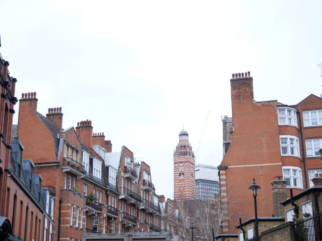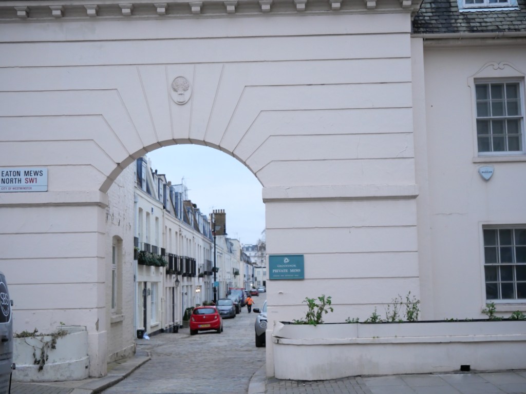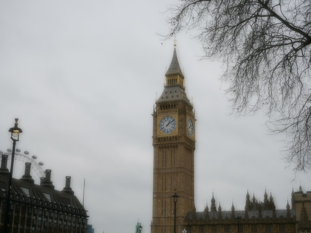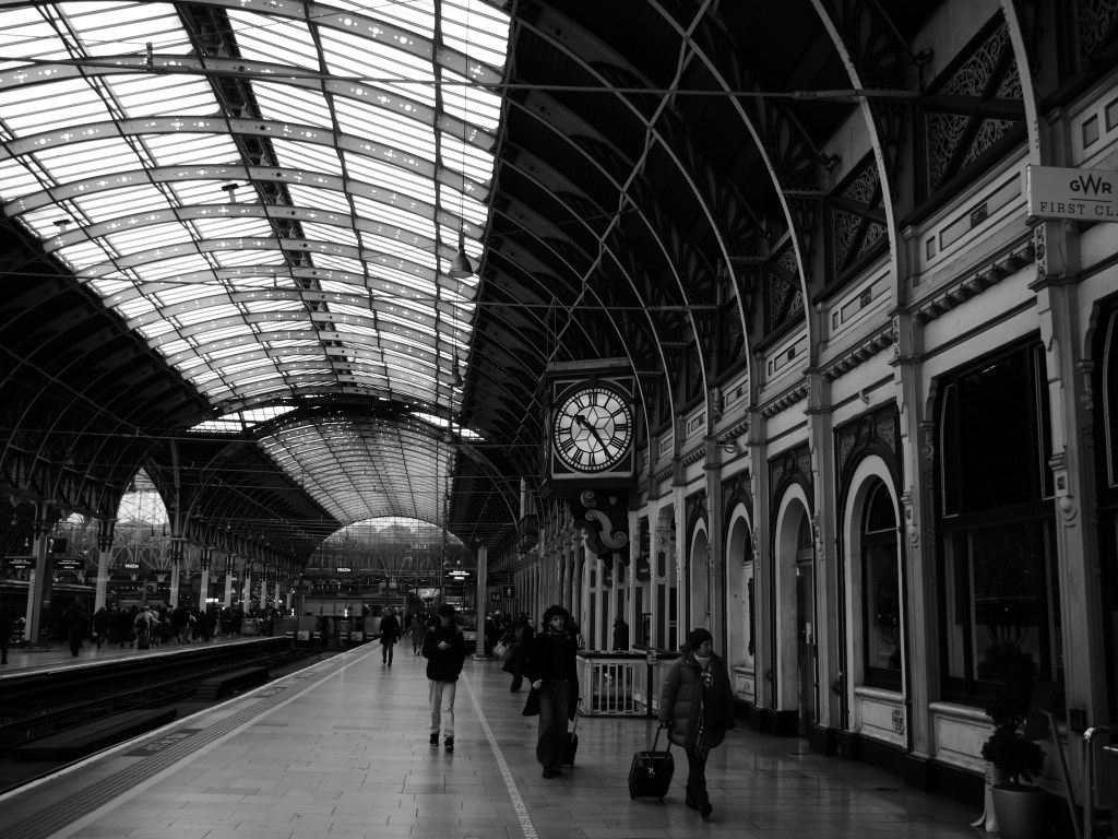
Richmond- Home of the Historic Richmond Palace turned Fashionable London Commuter 19th Century Suburb

Richmond was founded following the completion of Richmond Palace in the early 16th century. Richmond remained mostly agricultural until the 18th century when several large mansions were constructed and the district began to become fashionable. Development expanded with the late 18th century with the construction of the Richmond Bridge connecting the two banks of the Thames, adding many Georgian terraces to the neighborhood, particularly around Richmond Green and on Richmond Hill. By the mid 19th century Richmond was connected to Central London via the Richmond Railway, leading to further densification and development, especially along Kew/George St, Richmond Green, and Hill St.  Richmond continued to fill in throughout the late 19th and early 20th centuries leading to several additional business districts and nodes (Sheed Rd, Friar Stile, Sandy Combe/Kew Gardens). Southern Richmond is the newest part of the district and was mostly built post-war and has a distinctively suburban character compared to the rest of Richmond.

From an urban perspective, Central Richmond is the most urban and mixed-use. Richmond Square is actually where many scenes from Ted Lasso were filmed and has a couple quaint pedestrian commercial streets feeding into it along with convenient access to the main George/Kew Rd biz district and several other commercial streets. This is also where the Richmond Station is located and many 18th century mansions. The district around Kew Gardens is a comfortable late 19th century London district but nothing particularly unique about it other than its proximity to Kew Gardens, arguably the best Botanical Garden complex in the World. Richmond excels with a high concentration of Museums, historic homes, theaters, restaurants & bars and excellent retail amenities. The district also hosts a solid bike network, great tree canopy, and excellent parks. The biggest downsides of Richmond includes its distances from Central London (50 min-60 mins via the tube), several highly tracked roads, and lower density in pockets creating some parts of the neighborhood that are particularly walkable. 

Click here to view my Richmond Album on Flickr

URBAN STRENGTHS:

  • George/Kew Rd is the most extensive biz district running north-south in Central Richmond. Sheen Rd, Friar Stile, Hill Street, King St are solid secondary biz district in Central Richmond. Paved Ct and Brewers Ln are lovely alleyway biz districts that feed into Richmond Green featured in the Ted Lasso series.
  • Sandycombe and the node around Kew Gardens station comprise the main biz districts of northern Richmond.
  • Several iconic landmarks and destinations fill Richmond including: Kew Gardens, Richmond Green, Ham House and Garden, Richmond Palace, Trumpeter’s House, Museum of Richmond, the National Archives, the King’s Observatory, and Richmond Theatre.
  • Solid cultural amenities especially in Central Richmond including Kew Gardens, several museums (including many historic mansions), several theatres and cinemas, plenty of bars, restaurants, and cafes, a handful of art galleries.
  • Great retail amenities especially concentrated in Central Richmond including tons of clothing stores/boutiques, dessert joins, plenty of supermarkets & drug stores, plenty of bookstores and floral shops. Also larger big box stores in the suburban style Kew Retail Park along the northern edge of Richmond
  • Great park access in Richmond including several large parks: North Sheen Cemetery, Richmond Park, Hams Land, Beaufort Court, Ham Common, Richmond Cemetery and several other small-medium park spaces.
  • Good bike & recreational lane infrastructure especially along the Thames River.
  • Lovely array of late 19th-early 20th century architecture styles (duplexes, rowhouses, townhouses, apts, and single family homes detached esp. in the northern and southern Richmond subdistricts. Also some post War housing mixed in (esp. in Southern Richmond) and a major redevelopment site along the northern edge of Richmond running along the Thames.
  • Great tree canopy.

URBAN WEAKNESSES:

  • Good transit access in the northern half of Richmond include two tube stations and two regional rail stations. The southern half of Richmond however has no train access and it shows with the neighborhood’s more suburban character.
  • Southern Richmond is newer with lower density than the rest of Richmond and really no well defined biz nodes nor corridors. Some walkable retail in Northern Richmond but much more limited than Central Richmond.
  • Lower Richmond Rd is basically a stroad and very car friendly.
  • So so population density at just over 10K residents per square mile.
  • About a 1 hour train ride to get to the City of London. A bit closer to the West End.”

Southwark- the Original South London Neighborhood

The district, which is the oldest part of South London, developed due to its position at the southern end of the early versions of London Bridge, for centuries the only dry crossing on the river. Around 43 AD, the Romans found the geographic features of the south bank in Southwark suitable for the City’s first bridge. By the 12th century Southwark had been incorporated as an ancient borough. West of the Bridge was the Liberty of Clink manor, which was never controlled by the city, but was held under the Bishop of Winchester’s authority. This lack of oversight helped the area become the entertainment district for London with the Globe Theatre being one such venue.

Other than a handful of buildings (prisons, board houses, fishing sheds, and Bothels), Southwark did not become a proper district until the 16th century. Same incremental expansions occurred in Southwark thru the early 19th century with a much larger expansion of the district in the 1820s and 1830s thanks to the railroads and industrialization of London. By 1840 Southwark was filled in down to New Kent Rd. Southwark was heavily bombed during WWII thanks to its port and industrial nature. Much of the district, especially the western and southern edges, was rebuilt. The heart of Southwark around Borough Market thankfully retains its layered history and character and hosts buildings from all eras. The look and feel and street grid of Southwark share many similarities to the City of London given its medieval roots, helping make it one of London’s most interesting districts. While the population density is only about 17K souls per square mile, Southwark is an incredibly vibrant district thanks to a very mixed-use character housing Borough Market and all its interesting shops, restaurants, and bars, several museums and theaters near the Thames River, modern office buildings running along Southwark Ave and Blackfriars Rd and the vibrant biz districts along Borough High and Tower Bridge Rd. South of Borough Station the district becomes more residential and quieter. Southwark, while well connected to the Tube system and a convenient walk to the City of London across the River, is also just a 10 min walk to Waterloo, an important Regional Train Station. It also hosts a respectable bike system network and a good system of smaller public parks. Given its convenient location and great mixed-use fabric, I would like to see its population at least double. 

Click here to view my Album on Flickr

URBAN STRENGTHS:

  • Southwark is the great main street cutting west to east through the district. Other decent biz districts include Borough High St, Union Street (which includes a nice small pedestrian segment), several segments of Tower Bridge Rd.
  • Layers and layers of history in Southwark with an incredible mix of architectural styles and eras. The overhead railroad viaducts also create a distinctiveness to the district where it feels its operating on multiple levels.
  • Several major landmarks here including: the Globe Theater, Southwark Cathedral, the Borough Market, the Shard, London Bridge Station, the Tate Modern, the London & Tower Bridge, Bermondsey St.,
  • Culturally the district has a great array of museums, performing art theaters, cinemas, live music venues, bars & restaurants (especially near the Borough Market) and a good number of cafes and art galleries.
  • Good tree canopy in the southern half of the district (where all the post War housing projects are located) but not the older parts of Southwark near the Thames.
  • Surprisingly much better dedicated bike lanes than the City of London and most inner city London districts. Safe seperated lanes run along Blackfriars and Southwark Bridge.
  • Good subway access including 4 stations and 4 metro lines. Waterloo is also a 10 min walk west of Southwark.
  • Solid retail amenities but mostly concentrated in Borough market, the main arteries and the northern edge along the Thames river. No real department stores in Southwark like in Central or West London.
  • Lots of nice smaller parks but no larger parks like Hyde or Regent’s Parks.

URBAN WEAKNESSES:

* Large post war housing complexes build here that don’t have the best urban form and mixed-use fabric especially in the western and southern edges of the district.
* Parts of the district especially along the river and Borough Market can get very touristy.
* At about 17K residents per square mile, this really isn’t a very dense neighborhood. But Southwark still feels busy due to all the tourists and workers here.
* Parts of New Kent feel like a minor highway especially at the intersection with Tower Bridge Rd. 

Kensington- West London District where Queen Victoria Grew up and an Upscale District Emerged during Her Reign

It was during the late 17th century when Kensington began rising to prominence, with William III and Mary II transforming the modest Nottingham House, into Kensington Palace. This was also where Queen Victoria was born, the last sovereign who lived here before the royal court moved to Buckingham Palace. Thanks to the location of Kensington Palace, the neighborhood saw sporadic suburban style development spring up housing the British nobility during the Georgian Era mostly in the 18th century. This consisted of the standard housing of the time for the nobility (Georgian terraced houses built around squares and gardens). Kensington Square and Campden Hill Square are good examples of this. Most of Kensington was built up during the Victorian period with the neighborhood filling in pretty quickly during the 1860s & 1870s. This rapid development was permitted of course by London’s rapidly expanding rail system populated by the City’s growing upper middle class hoping to exit London’s crowded central city. In addition to typical terrace housing from 1860s-1870s, Kensington also saw a good amount of late 19th Century Edwardian housing built characterized by more duplexes, mansion homes, and smaller scale rowhouses. This is most common along the western edges of Kensington.

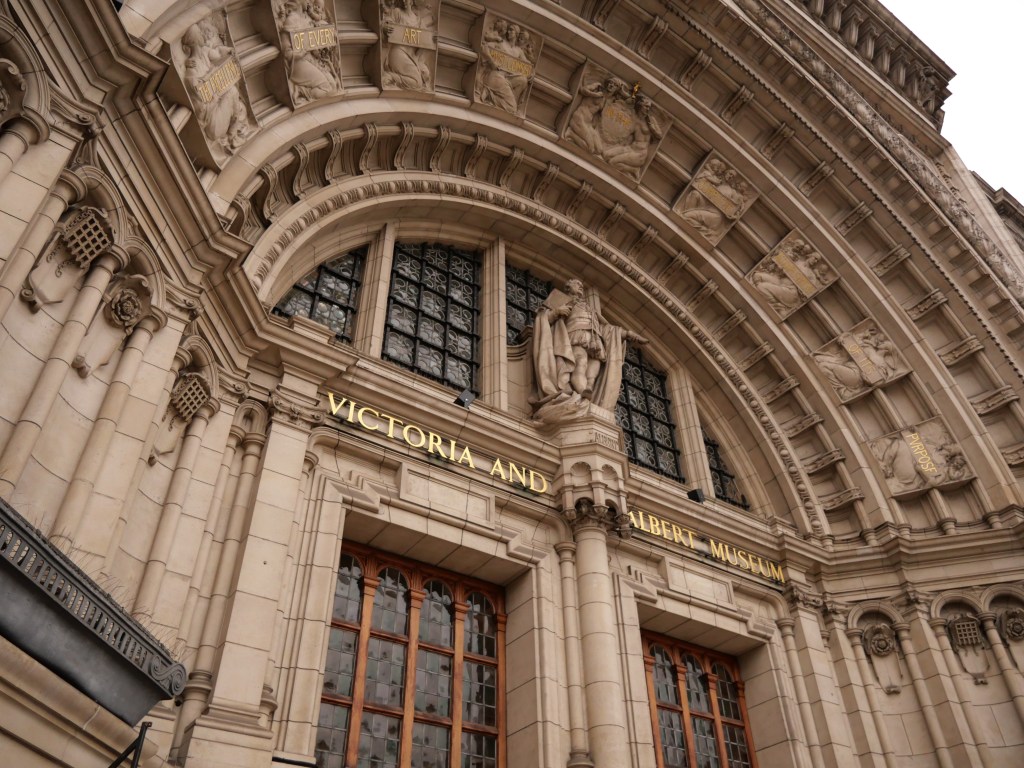
Kensington really has never lost its luster and remains an extremely affluent area. The area has some of London’s most expensive streets and garden squares. The district’s commercial heart is Kensington High Street, running on an east–west axis. Several other impressive commercial districts crisscross their way across Kensington including (Gloucester, Old Brompton,  Fulham,  Kensington Church, and Notting Hill Gate) leaving few Kensington residents further than a 5 minutes walk from a solid biz district. The area around the South Kensington Station is a wonderful commercial node with a small pedestrian block on Thurloe. Just north of here is one of London’s best museum/university districts housing Imperial College London, the Royal College of Music, the Royal Albert Hall, Natural History Museum, Victoria & Albert Museum, and Science Museum. The area is also home to many embassies and consulates. From an urban perspective Kensington is a better district thanks to better access to subway lines and stations, better access to large park spaces (Hyde Park and Holland Park) incredible concentration of museums clustered around South Kensington Station and Kensington Garden. But Kensington does have some areas where it should improve. I’d like to see the neighborhood double its density from 20K to 40K residents given how in demand the neighborhood is and how expensive housing in general is in London. Kensington also deserves better bike infrastructure and access to more of the smaller squares and gardens that are reserved for the wealthy. 

Click here to view my Kensington Album on Flickr

URBAN STRENGTHS:

* Several solid urban biz districts (i.e.  Gloucester, Old Brompton,  Fulham, Kensington High, Kensington Church, and Notting Hill Gate).
* South Kensington is a great TOD nod with a plaza space at Exhibition Rd and a pedestrian block on Thurloe.
* Major landmarks include: Royal Albert Hall, Kensington Palace, Royal College of Music,  and Nat. History Museum,
* Several great park spaces including Kensington Gardens & Hyde Park, Hollard Gardens, the expansive Brompton Cemetery,
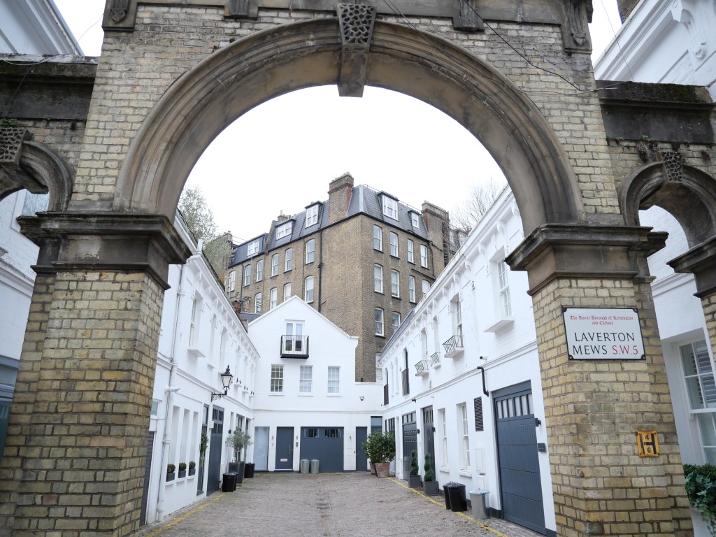
* Solid mid-19th West London architecture. Nice mix of earlier brick Georgian styles, more ornate terraced housing, and cute mew style housing. Also some nice late 19th century Victorian style brick apartments and a good amount of smaller scaled rowhouses and attached townhomes.
* Pretty good tree canopy. Much better than neighboring Chelsea and older West London Districts.
* Decent density at around 22K residents per square mile but lower than older West London and Central London neighborhoods.
* Good metro coverage with 9 stations and 7/8 subway lines but there are still parts of Kensington (around Holland and Fulham rd. that are a pretty long walk from a station).
* Solid recent amenities with the best concentration of clothing, department stores & boutiques along Kensington Rd & Kensington Church St. Also a couple of shopping malls.
* Cultural amenities include numerous museums (including several world renowned ones), several performing arts & live music venues and plenty of food and beverage locals.
* Even with his high concentration of high-end housing about 20% of Kensington’s units are reserved as Social Housing. 

URBAN WEAKNESSES:

* A couple of pretty wide arterials that are borderline stroads (Notting Hill Gate, Kensington High, Holland Rd, and Cromwell Road).
* Not that much mixed-use development outside of the commercial corridors.
* Plenty of intimate gardens and squares but sadly almost all of them are private reserved for the terraced housing that surrounds them.
* Dedicated bike lanes are pretty fragmented.
* Given how in demand this neighborhood is, it should be a lot denser. 

Earl’s Court- Buzzing West London District Developed in the late 19th century enabled by London’s Commuter Rail Expansion

Earl’s Court is an iconic late 19th century London district made possible by the rapid expansion of the Tube system, in particular the Metropolitan District Railway and Piccadilly line in 1860. The neighborhood is bordered by the rail tracks of the West London line and District line separating it from the ancient borough of Fulham to the west. Earl’s Court gets its name from the now defunct pleasure grounds and the Earls Court Exhibition Centre, which served as one of England largest indoor arenas and concert venues. The Exhibition Centre is currently being redeveloped as a major mixed-use entertainment district which should tie in well to the Earl Court and West Brompton metro station.

The Earl’s Court neighborhood was built a bit latter than Kensington with all development coming in the 1870s & 1880s rapidly transforming the neighborhood from a loosely populated suburb to a dense London urban district. In its early years, Earl’s Court was a solid middle class neighborhood but with some poor pockets. After World War II, the area lost its luster hosting a large number of transient residents. By the late 20th century, Earl’s Court transitioned into a large immigrant community with nearly half of its residents being born outside of the Country. However, in the first couple of decades of 2000s Earl’s Court has risen in value, like the rest of West London, and become a major district for hotels and hostels given its convenient location to several tube lines.

From an urban perspective Earl’s Court thrives as one of London’s densest district’s, well connected to the tube system and buzzing with life thanks to a mix of fulltime and large tourist population.  Earl’s Court Rd and Hogarth are the primary commercial districts providing excellent retail amenities esp. for a less affluent working class population. The redeveloped Exhibition Centre should further improve the district’s retail amenities. Earl Court lacks serious cultural amenities beyond restaurants, bars and cafes. It also lacks park space open to the public, has a limited bike infrastructure system, and has the autocentric Cromwell Road as its northern border.

Click here to view my Earl’s Court Album on Flickr

URBAN STREGNTHS:

* Nice biz district and pedestrian lane along Hogarth. Earls Ct Rd is also a great urban commercial district than runs the entire north to south length of Earl’s Court.
* Good tree canopy similar to Kensington.
* Great subway access including 4 stations and lines either within or nearby Earl’s Court.
* One of London’s most dense communities at just under 50K residents per square mile.
* Great food & beverage businesses. Also a couple live music venues & art galleries.
* Solid retail amenities concentrated mostly along Earl’s Court Rd & Hogarth. More retail amenities accessible to working class households than most Westend Districts.
* Attractive mix of late 19th century architecture styles including Regency, Gothic brick revival, and mew rowhouse architecture. 

URBAN WEAKNESSES:

  • Not that much mixed-use development outside of the commercial corridors.
  • Plenty of intimate gardens and squares but sadly almost all of them are private reserved for the terraced housing that surrounds them.
  • Dedicated bike lanes are pretty fragmented.
  • A couple pretty wide arterials that are borderline stroads (Notting Hill Gate, Kensington High, Holland Rd, and Cromwell Road).

Chelsea- One of London’s Most Posh Districts and Home of the Pre-Raphaelite Movement & Swing 60s

In the centuries before Chelsea was built out in the 1600s and 1700s, Chelsea was a popular location for the wealthy and a market garden, described as “a village of palaces”. By 1700 it had a population of 3,000. The 19th-century development boom caused Chelsea’s final absorption as an urban district into the London metropolis. Development occurred in stages generally from east to west starting in the 1830s and wrapping up by the 1890s. King’s Road, named after Charles II, was historically used as the King’s private road from St James’s Palace to Fulham, which was maintained until the reign of George IV. During the 19th century Chelsea’s gained a reputation as a centre of innovation and influence when the area became a more upscale Victorian artists’ colony (especially for the Pre-Raphaelite movement). Artists were concentrated in the area around Cheyne Walk & Cheyne Row. Chelsea’s was also one of the centers of the “Swinging London” along King’s Road of the 1960s, when prices were reasonable. The district was once home to the Beatles and several Rolling Stones members. By the 1980s Chelsea was in demand again and prices and continued to rise making the district one of London’s most in demand neighborhoods.

Chelsea is certainly a solid urban district but  I would not count it as a top tier London district due to its modest density, somewhat limited metro  access, and limited bike infrastructure. Chelsea’s best asset is King street which cuts the length neighborhood from east to west, one of London’ best urban business districts. Chelsea also has great historic 19th century rowhouse/terrace house architecture, several small commercial nodes and mixed-use areas, great park access, solid tree canopy, and many iconic landmarks. The lengthy King Street also provides excellent retail and cultural amenities especially high end stores, restaurants, bars, and art galleries. And while housing prices are very high there are a good percentage of social housing units coming in at around 20% of all districts units.

Click here to view my Chelsea Album on Flickr

URBAN STRENGTHS:

* King’s Road is a great biz district and one of the most expansive in London. Fulham Rd  is also a lengthy biz district but not quite as commercial as King St. Some great biz nodes at Sloane Square, Chelsea Common, and a block of Beauchamp.
* Nice ped only street on Pavilion.
* Great historic terraces.
*Landmarks: Royal Hospital Chelsea, Chelsea Old Town Hall, Saatchi Gallery, Chelsea Old Church, Chelsea Bridge,
* Parks: Chelsea Embankments, Cremorne Gardens, Westfield Park, Coleridge Square, Dovehouse Square, St. Luke’s Gardens and Sloan Square. Also decent access to Hyde Park/Kensington Gardens about a mile to the north.
* Excellent cultural amenities including tons of restaurants, bars, & cafes, a ton of art galleries, a handful of museums, plenty of historic sites, and a handful of live music venues, theaters, and indie movie theaters.
* Great retail amenities especially high end boutiques and clothing stores.
* While the mid-late 19th century architecture in Chelsea is not as ornate or posh as other West London Districts its still very charming.
* Pretty decent tree canopy. While the many parks and gardens certainly contribute to this, more interior courtyards areas dedicated to green space than West/Central London districts which is prob why the density is below 20K residents per square mile in Chelsea.
* About 20% of housing units are social housing. 

URBAN WEAKNESSES:

* One of the larger neighborhoods in London but population density is only around 17K people per square mile.
* Limited bike lane infrastructure and what does exist is smaller segments.
* Only the northeast corner is covered by the London Tube which includes 2 metro stations and 2 subway lines. One subway station about 1/4 west of Chelsea. 

Notting Hill- Historic Home of London’s Carribean Population, now an Affluent West London District featured in the 1999 Julia Roberts Film

Notting Hill remained rural until London’s westward expansion reached Bayswater by the early 19th century. The first major development started in the 1820s by the Ladbroke family who created the Ladbroke Estate. The estate was a unique creation of large private communal gardens enclosed by terraces and/or crescents of houses. What made the Ladbroke Estates unique was that residents had direct access to communal garden squares from the back of their homes instead of needing to cross the street from the front of their house to enter a square garden. This created a much more hidden and secluded green space which only the terrace home owners could enjoy. This is a whole other level of exclusion than the West End squared gardens.

The Ladbroke estate were not an immediate success for the richest Londoners given their relative distance from Central London. The aristocracy still remained in neighborhoods like Mayfair/Belgravia by and large. Instead, the upper middle class choose to move in which is well covered in the John Galsworthy’s Forsyte Saga novels. Most of Notting Hill was developed by the mid-19th century but a sliver along the northern edge was developed a couple decades later. The reputation of the district waned in the 20th century as the upper middle-class households ceased to employ servants devaluing the large Notting Hill homes. This led to the grand houses being increasingly broken up into small apartments. During the Blitz a number of buildings were damaged or destroyed by the Luftwaffe and much of the western edge of was rebuilt. Post War Notting Hill became a major hub for London’s immigrant community especially from the Caribbean and Ireland. Unfortunately many of these immigrants were squeezed into slumlord run housing and racial tensions flared culminating in 1958 with the Notting Hill race riots. Eventually the community organized to improve the neighborhood’s substandard housing conditions creating the Notting Hill Housing Trust in 1963. Gradually Notting Hill stabilized and by the 1980s many terraced housing units were converted back to single-family. By the early 21st century Notting Hill was squarely an affluent and fashionable area similar to London’s West End Communities. Sadly this created major demographic changes in the neighborhood. From just 2000 to 2010 Notting Hill’s Black or Irish population decreased from 46 to 28 percent of the district’s population. Thankfully about 20% of all housing units are Social Housing, so even with the district’s gentrification, it will always have a working class, diverse presence.

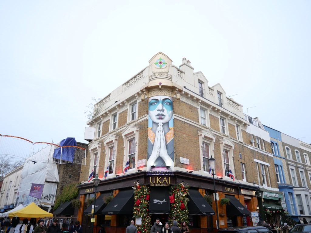
Notting Hill has some of London’s best urban business districts (Portobello Rd and Westbourne Grove). Portobello road hosts a local street market that closes down the street 6 days a week. Westbourne Grove is a colorful vibrant district with an amazing number of retail and clothing stores. Notting Hill also has great public transit access, attractive 19th century architecture styles, excellent retail and cultural amenities, and well shaded streets. The biggest downside is access. You are 30 mins and 50 mins from the West End and City of London, respectively via the Tube. This is better than most districts in the London metro but not great compared to other inner city London Neighborhoods. While there are several small-medium sized parks in the western third of Notting Hill, many park spaces are privately held and inaccessible. 

Click here to view my Notting Hill Album on Flickr

URBAN STRENGTHS:

  • The center of Notting Hill is filled with gorgeous historic terraces with generous private parks. The western third of Notting Hill is an eclectic mix of mid-late 19th century styles and a decent amount of post War housing. The eastern third of Notting Hill has a nice of mix of mid-19th century styles including Georgian & Regency Terraced rowhouses, side by side grand duplexes.
  • Several great biz districts across Notting Hill including: parts of Pembridge Rd, All Saints Rd, with Westbourne Grove and Portobello as the most extensive biz districts (Portobello Rd hosts the Portobello Street Market, a plethora of street vendors, giving the street an outdoor market feel). While the western half of Notting Hill does not have any extensive commercial streets, there are a lot of great small mixed-use nodes.
  • Great access to the London Tube including 6 stations and 6 metro lines.
  • Good tree canopy even including street trees, which is rare in Central London and some districts in the West End.
  • Excellent cultural amenities, especially restaurants, bars, theaters, live music venues and night clubs.
  • Great retail amenities especially higher end stores, clothing stores, and plenty of grocery options.

URBAN WEAKNESSES:

  • Good array of smaller parks in the western half Notting Hill but all the greenspace in central Notting Hill coming off of Ladbroke Grove is a sunken private park space. Very limited greenspaces in eastern Notting Hill”* Nice north to south bike lane cutting through the heart of Notting Hill but not much else in the biking network..
  • Not great density for an inner city neighborhood in London at just around 10K people pers square mile.
  • Lacks the museums of Central and West End London. Also limited art galleries here.”

Pimlico- Excellent West London District just south of Westminster & Belgravia running along the Thames

Pimlico is known for its garden squares and distinctive Regency architecture (a subset of Georgian architecture most popular in the first half of the 19th centry). At its heart is a grid of residential streets laid down by the planner Thomas Cubitt (a highly influential West London builder) beginning in 1825 and now protected as the Pimlico Conservation Area. By the 19th century as a result of an increase in demand for property, Pimlico become ripe for development. In order to be able to build in Pimlico excavated land from the St. Katharine’s Docks had to fill in the naturally marshy land running along the Thames. The largest and most opulent houses in the White Stucco Terrace style were built along St George’s Drive and Belgrave Road. Pilmico became a fashionable district in the 19th century yet by the late 19th century pockets of slums popped up. This led to the construction of the urban renewal project of  Dolphin Square in the 1930s. Fortunately Pimlico survived the war mostly intact, although parts were bombed (especially near the river) had to be rebuilt (i.e. Churchill Gardens, Lillington and Longmoore Gardens estates). Most of the larger Victorian houses were converted to hotels and other uses in the Post War era as well as Pimlico decline a bit. However the district’s decline was brief thanks to Pimlico’s connection to the London Underground in 1972 and the creation of a large conservation district in the neighborhood in 1968. Since this era, Pimlico has steadily improved, but fortunately due to its large number of post War Housing the area has a decent social mix. 

From an urban perspective this is a solid, walkable district. While not the most convenient to West and Central London, Pimlico still posts attractive mixed-use districts just east of Victoria Station along Upper Tachbrook, Warwick Way, Churton, and Wilton Streets. Pimlico also has attractive, mostly 19th century terrace/rowhouse styles, better bike lane infrastructure and tree canopy than most Central/West London districts, pretty economically diverse population for West London and very high density at around 45K residents per square mile. This biggest area for improvement is creating more accessible park space, as most of them are private. 

Click here to view my Pimlico Album on Flickr

URBAN STRENGTHS:

  • Several nice pedestrian/narrow road biz districts including Upper Tachbrook, Warwick Way, Churton, Wilton (which connects with the busy Victoria Station node). Also wider streets with a decent amount of mixed-use fabric including Vauxhall Bridge and Lupus.
  • Incredible 19th century terrace homes. Brick or white rowhouses.
  • Decent bike lane system (at least for London) including two east to west dedicated lanes.
  • Pretty good public transit access including 2 subway station connected to 3 subway lines.
  • Tree Canopy throughout Pimlico is decent thanks to all the greens, squares, and public housing sites spreadsheet throughout Pimlico.
  • Good cultural amenities but concentrated close to Victoria Station along Churton, Wilton, & Warwick. This includes plenty of restaurants, bars & cafes. Across the district there are a handful of smaller art galleries, and a handful of performing arts theaters.
  • Pretty good array of retail amenities as well with the more creative boutiques, clothing stores, and gift stores concentrated near Victoria Station.
  • Very dense population for London standards at around 45K residents per square mile.
  • For West London standards Pimlico is a pretty economically diverse district thanks to several large multi-block apartment buildings built in the mid 20th century.

URBAN STRENGTHS:

* Major post WWII/urban renewal sub district in Church Hill Gardens done in the Garden City style with tall towers sticking up as islands in a park space and parking lot. But could be a lot worse esp. considering how these look in the US.
* Plenty of quality squares and gardens throughout Pimlico but sadly most of them of private spaces along available to adjacent residents. Nice park space along the river however. 

Belgravia- One of London’s most Exclusive Neighborhoods centered on Belgrave Square

Belgravia was developed in the first half of the 19th century largely by London’s well known developer Richard Grosvenor. He built in the popular West London style of surrounding small parks (aka Squares) by creamed color stucco grand terraced housing. But the district retains a nice mixture of 19th century styles including the colorful and cozy Mew houses, stunning neo Gothic Architecture and a good mix of several other late 19th century styles. Much of Belgravia to this day is owned by the Grosvenor Estate and other than its border with Victoria Station to the east and Knightsbridge road to the north, the neighborhood has preserved its historic architecture. After World War II many of the larger homes in Belgravia transitioned from townhouses for the aristocracy, to embassies, charity headquarters, professional institutions and other businesses. But Belgravia never lost its luster and more recently has regained its status for hosting a large number of London’s super rich.

Modern day Belgravia has become a relatively quiet and lower density district in the heart of London yet with solid urban walkable amenities. The district hosts several excellent public park spaces (along with convenient access to Hyde Park) has several attractive pedestrian scale commercial districts, excellent access to several metro lines, solid cultural amenities and great shopping access including a handful of medium sized malls. I would love to see this exclusive Belgravia neighborhood densify given its increasable walkable infrastructure and preferably with more affordable  housing options. But that would require aa loosening of the district’s tightly controlled historic preservation districts. One can dream!

Click here to view my Belgravia Album on Flickr

URBAN STRENGTHS:

* Several great green spaces including convenient access to the expansive Hyde Park and several smaller plazas including (Hyde Park Corner, Sloan Square,  Ebury Square, and Grosvenor Gardens).
* Great White Stucco and red bricked terraces along with more modern in-fill especially surrounding Victorian Station. Also a fair number of more intimate rowhouses along several mews.
* Attractive pedestrian scaled commercial districts along Elizabeth St., Eccleston St & Pl., Motcomb St, and Sloan Square. Other solid commercial districts but wider and less pedestrian arterials (i.e. Sloan St., Knightsbridge.) Decent # of mixed-use street but not on the scale of Central London neighborhoods.
* Excellent metro access including 4 stations and 3 metro lines.
* Great cultural amenities including tons of restaurants, bars, & cafes, several ornate theaters, a couple live music venues, and several art galleries.
* Solid retail amenities as well including several shopping malls (Victoria Place, Fountain Square, Eccleston Yards), plenty of high end clothing stores, and much more.

URBAN WEAKNESSES:

  • Bike lanes are pretty limited and what do existin are in small segments.
  • Better tree canopy that most Central London Districts.
  • Missing any major museums.
  • Very affluent district with limited income diversity.
  • Low density for such a centrally located neighborhood of only around 10K per square mile.
  • Many attractive green spaces are privatized (i.e. Buckingham Palace Garden, Belgrave Square Garden, Easton Sq Garden, Chester Square, Cadogan Place South Garden, Wilton Crescent Park and Lowndes Square Garden).
  • Many attractive green spaces are privatized (i.e. Buckingham Palace Garden, Belgrave Square Garden, Easton Sq Garden, Chester Square, Cadogan Place South Garden, Wilton Crescent Park and Lowndes Square Garden).

Westminster- Home to Several World Famous Landmarks but also a solid London District

This evaluation includes the much smaller Westminster neighborhood which is part of the larger Westminster Borough. The neighborhood runs along the southern end of St. James Park from Trafalgar Square to Vauxhall Bridge. Development of the area began with the establishment of Westminster Abbey in 1066. The abbey became the traditional venue of the coronations of the kings and queens of England since its beginning. Starting in 1200 the Palace of Westminster, next to the abbey, became the principal royal residence. Gradually the neighborhood started to fill in with the servants of the palace and abbey and homes from the Aristocracy popped up from their desire to be close to the Palace. Development of Westminster really started to pick up after the Great Fire of 1666 connecting to London City via the urban ribbon development running along the Strand. By the mid-18th century the neighborhood was built out. A wide array of architectural styles, however, are present in Westminster, even those built after the mid-18th century. This is due to several small urban renewal/slum clearance projects of the late 19th century (i.e. Devil Acre) and many areas rebuilt in the post War Period due to the destruction of the Blitz. The medieval Westminster Palace was rebuilt in the mid 19th century after a devastation fire leaving us with the gorgeous Neo-Gothic structure which houses the British Parliament to this today.

I would divide the Westminster neighborhood into 3 parts. There is the very tourist sector filled with monumental and government building stretching from Trafalgar Square to Westminster Abbey. The CBD section running along Victoria Avenue from Westminster Abbey to Victoria Station. And finally the mostly residential section comprising about the southern half of the neighborhood with an eclectic mix of housing from the 1800s to the present day. From an urban perspective Westminster is a solid neighborhood from all measures but not one of my favorite London Districts due to a lack of exciting commercial districts, over tourism in certain sectors, and a bit lackluster architecture stock, including a significant amount of rather bland modern and post WWII housing. All that said the neighborhood still boasts excellent subway access, lies on the southern end of one of London’s best parks (St. James) and includes some vibrant urban nodes (i.e. Victoria Station, and Strutton Ground) and hosts several great museums, theaters, and historic sites.

Click here to view my Westminster Album on Flickr

URBAN STRENGTHS:

  • Several quality green spaces (i.e. Green Smith Square, Victoria Tower Gardens South, Victorian Embankment Ecclestone Square Park, Warwick Square, St. George’s Square, Parliament Square Garden, St, John’s Garden, Grosvenor Garden).
  • Great historic sites: Big Ben, Westminster, Westminster (Catholic) Cathedral, Admiralty House, Royal Horse Guards, Sinfonia Smith Square, Admiralty Arch, Downing Street, Banqueting House, Scotland Yard (historic and new), Tate Britain, The Royal Mews, Buckingham Palace, Victoria Palace Theater
  • Strutton Ground hosts an attractive pedestrian only block.
  • Mix of excellent historic architecture and some good urban in-fill.
  • Major modern Office corridor along Victoria St culminating at the Victoria St Subway node.
  • Solid cultural amenities including plenty of food & beverage venues, several theaters, performing arts & event venues, several museums. Good retail amenities as well.
  • Great metro access including 6 metro stations and 5 lines.

URBAN WEAKNESSES:

* Very touristy district.
* Really no consistent business corridor and premiere shopping street in Westminster. But there is decent Mixed-use development throughout and a couple of solid nodes (i.e. Strutton Ground and Victoria Station which includes a shopping mall (Cardinal Place).
* Bike lanes are pretty limited and what do existin are in small segments.
* Better tree canopy that most Central London Districts.
* Outside of the major landmarks architecture is a bit lackluster with a lot of bland post War buildings mixed into more ornate late 19th century terraces and flats. 

London’s Paddington Station Neighborhood

From the tenth century, Paddington was owned by Westminster Abbey and functioned as an ancient village for many years. Starting in 1801, Paddington began to transition to a bustling London district blustered by England’s industrialization. It was at this time that the local Anglican Bishop leased the land to the Grand Junction Canal, which formed a direct trade link between London and the Midlands. This led to the major industrialization of the neighborhood. Construction and building projects took place across the parish throughout the 19th century rapidly increasing its population. The neighborhood’s population increased from 1,881 to 46,305 between 1801 and 1851 with development concentrated on the eastern half of the neighborhood surrounding Paddington Basin and Paddington station. The architectural style of this era is mostly Georgian Brick rowhouses housing mostly the working and middle class. Paddington station first opened in 1838 connecting to London’s first underground line in 1863 (the Metropolitan). Paddington was one of the few districts in London that had a migrant majority population with a thriving Greek and Jewish community in the mid-19th century. Paddington continued to fill in the second half of the 19th century adding 10,000 new inhabitants every decade thereafter. Development in the second half of the 19th century was focused in the western half of the district with mostly regal Terrace Housing and a development style more in character with Notting Hill. Sadly by the late 19th century the immigrant community surrounding Paddington Station became overcrowded and one of London’s most notorious slums. In response, the City embarked on a massive rebuilding campaign starting in the 1930s with select redevelopment continuing in the 1960s. By the 1980s the majority of the Paddington neighborhood was stabilized and once more a desirable community. Yet the Paddington Basin remained dilapidated through the 90s resulting from the de-industrialization of the area. In response, the City passed an ambitious redevelopment plan for Paddington Basin leading to the creation of a dynamic mixed-use center with improved connectivity, excellent park space along the waterfront (including a Floating Pocket Park), a major hub for office space, and a couple thousand units of residential.

This is a dynamic urban district that feels more like the heart of Central London with street vibrancy generated from Paddington station and the major mixed-use developments. Paddington also boasts excellent subway and regional train connections thanks to Paddington station, several attractive smaller park and plaza spaces. The district also hosts a great array of restaurants, bars and retail amenities (including a modest shopping mall) and interesting mix of architectural styles: both new and old. For Paddington to be an even better district it first and foremost needs better bike lane infrastructure and could use more cultural amenities (music venues, theaters, etc.) that are very common in surrounding West End districts. I also would like to see the population density increase to more like 50K-100K residents per square mile. An urban density of 35K residents isn’t bad but a bit low for a major European district surrounding a major train station. 

Click here to view my Album on Flickr

URBAN STRENGTHS:

* Craven/Praed Rd is the main Biz District
* Westbourne Terrace, Talbot Square, Norfolk Square, and Sussex Gardens all have gorgeous historic terraces and gardens. Several interesting Mews in the Paddington District.
* Paddington Station is massive and interesting. Major modern mixed-use and office development surrounding Paddington Station and Paddington Basin.
* Some attractive publicly accessible greenspaces (i.e. Paddington Basin, Talbot, and Norfolk Square Garden).
* Large number of office jobs surrounding Paddington Station making this a very vibrant district even with a population density of btwn 25-30K residents per square mile.
* While there are only 2 metro stations serving the district Paddington Station connects with 5 metro lines providing excellent access across London.
* Tons of food & beverage businesses but limited number of live music venues, museums, and art galleries. Solid retail amenities as well including a modest shopping mall located in Paddington Station.
* Good diversity of architecture including more modest Georgian Brick rowhouses, Regal Terrace Housing, modest mew rowhouses, and modern office and mixed-use buildings. 

URBAN WEAKNESSES:

  • Tree Canopy is pretty limited.
  • Bike lanes are pretty limited and what do existin are in small segments.
  • Green space are pretty limited although residents can walk to Hyde Park pretty easily and Regent Park is about a 1 mile walk.
  • Hyde Park lacks the theaters, live music venues, and museums of the Westend of London.